Menu
- Countries
 Apr 3, 2025
11+ Austrian towns to rival Hallstatt
 Jun 19, 2019
Feel the Bern
 Jun 12, 2019
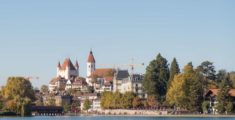
Fun in Thun: A pit stop on the way to Bern
 Jun 3, 2019
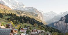
Wild and without money: Hiking Kleine Scheidegg
 Jan 13, 2020
Nine wild rides to the Pyrenees
 Oct 17, 2019
Wild and without the Alps: Camargue
 Jan 12, 2022
The wonders of Ronda: A bridge between the eras
 Feb 17, 2020
Wild and without enough time: Catalonia to Portugal
 Nov 6, 2021
City to sea: A day trip to Sintra
 Oct 18, 2021
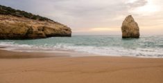
Benagil to Faro: All along the Algarve
 Aug 16, 2021
Wild and without a campground: Lisbon to Benagil
 Sep 7, 2024
The top three destinations in Adjara, Georgia
 Jan 14, 2023
Mestia to Koruldi Lakes: Camping at 2700 meters
 Nov 17, 2022
Ushguli: 4 day hike from Mestia via Tsvirmi
 Oct 31, 2021
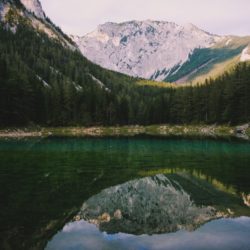
Black Rock Lake: 3 Day hike from Lagodekhi
 Aug 14, 2022
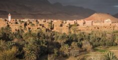
Madness in Marrakesh: The final leg
 Jun 25, 2022
Merzouga: The Gateway to the Sahara Desert
- Categories
 May 11, 2022
17 locations for vintage Wes Anderson vibes
 May 9, 2022
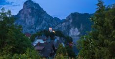
14 Gorgeous Churches in the Austrian Alps
Oct 18, 2021Benagil to Faro: All along the Algarve
Aug 16, 2021Wild and without a campground: Lisbon to Benagil
Feb 17, 2020Wild and without enough time: Catalonia to Portugal
Sep 7, 2024The top three destinations in Adjara, Georgia
Jan 14, 2023Mestia to Koruldi Lakes: Camping at 2700 meters


Black Rock Lake: 3 Day hike from Lagodekhi

Our time in Georgia is coming to an end and while we’re sad, we’ve got big plans for the summer. We are going to drive through Central Asia on the Silk Road with a final destination of Kyrgyzstan. A country not many people have ever heard of. When the summer is over we will head back to Austria to figure out what the future holds (Spoiler: Corona Virus). But first: Black Rock Lake!
We’ve been in Georgia for almost 6 months now, we’ve seen a lot of stuff and had a blast. We’ve hiked the popular Mestia-Ushguli trail, we drove in to Khevsureti & Shatili and got stuck there, we visited countless waterfalls & canyons and had no end of adventures in Adjara, Kvemo Kartli and Samtskhe-Javakheti. Not to forget a whole host of other expeditions we are yet to write about.
Before we leave Georgia we want to have one last mountain adventure, because it might be a while before we see rugged alpine landscapes again as we head to the Steppe of Central Asia, where harsh unrelenting desert rules the day. We are going to hike in Georgia’s oldest nature reserve, Lagodekhi Protected Areas (or Lagodekhi National Park) to a high alpine lake called Black Rock Lake, which is situated smack bang on the Georgian-Russian border.
Black Rock lake is situated at a staggering 2800 metres high and requires an elevation gain of 2500 metres over two days, including a whopping 1500 metres on the first day. The trail is a loop and takes 3 days. Apparently it’s possible to complete it in two if you are crazy but we’re not even going to entertain that thought.
Training for Black Rock Lake
I’ve wanted to visit Lagodekhi ever since entering Georgia – however, it’s always been a bit out of the way, close to the border with Azerbaijan, and well, it was also winter for the first months we were here. Our time in Georgia is coming to an end and we plan to head direction Azerbaijan. It makes perfect sense to tackle it now.
We’ve gathered our strength, practising on various hikes, short and long distance. Caroline suffered an extreme burst appendix while in Georgia and lost a lot of strength and weight as she was recovering. We’ve been taking it easy but now she feels strong and ready to tackle the challenge.
The planning stage is not as simple as other well documented hikes in Georgia, it seems Lagodekhi is not as popular as the Mestia-Ushguli crossing. We take in all the information from the trusty Jozef over at Caucasus Trekking.
Preparation
Our plan is to drive to Lagodekhi, check out the visitor centre and book stays in the huts. We will then sleep in our car in the car park of the visitor centre, do some shopping and start the hike. We’ve booked a room in Lagodekhi for when we return, to rest and wash and dry our stuff, before we head on to Azerbaijan. The room looks incredible and we are quite excited to return, but of course more excited about the hike.
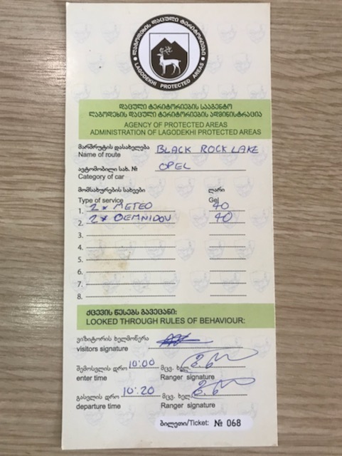
We visit the National Park centre, location here, where we chat in very good English with a friendly park ranger. He informs us about the trail, the timelines, the distances and elevation. He then books us in to the huts and we pay for it. Finally, he shows us maps and informs us of the trail rules, and notes that before we depart tomorrow morning we should come to the visitor centre and sign in.
The visitor centre is apparently open 9:00 – 18:00 every day of the year. We’re not too trusting of that information so better double check it’s open before you visit. The opening times are listed here on the Visit Lagodekhi website.
Trekking Adventures
Wild and without signal: Dachstein mountain nightmare
Fasten yourself in for a ride – this is a good one. The events of this post take place over one year ago. The 14th September 2017 to be precise. We had planned to take a cable car to the top of Dachstein (the second highest mountain in the Northern Limestone Alps) and maybe hike […]
Wild and without beer at Grüner See
Grüner See (Green lake, I’ll let you guess why) is a karst lake in Styria, Austria. No one knew it even existed until Ashton Kutcher posted about it on Facebook a few years back. After that, the council had to impose a swimming and diving ban to protect the environment due to the tourist masses. […]
Wild and without: Aigüestortes i Estany of Saint Maurici National Park
In the heart of the Pyrenees, we wake up from a cosy nights sleep in our tent, it was cold but not excruciatingly so. Wide awake, freshened and energetic to explore. We came to Espot to experience the mighty Pyrenees mountains. We decided randomly on the national park Aigüestortes i Estany of Saint Maurici. Well […]
Wild and without: 3 day trek in Karwendel Alps – Part 2
The bear categorically does not step in the mountain lodge. So I guess you are wondering what these stepping bears are all about? Well, it’s an Austrian countryside expression for something happening, like to find out where it’s cracking. Wo steppt der Bär?! Where is the bear stepping?! It’s perfect and the idea of bear […]
Day One – Lagodekhi Visitors Centre to Meteo Shelter
Before we start the hike to Black Rock Lake we’ve got a little last minute preparation to do, the shops were closed the previous evening so we’ve got to run around now and collect some food bits. Luckily for us we’ve got a car so we drive to the centre of town and visit a few little stores. We buy, nuts, fruits, chocolate, noodles, shoti (traditional Georgian fire baked bread) and various other food bits.
After the shopping is done we head back to the visitor centre where we receive, and sign, a check in form which details our bookings and other information.
Time to start hiking to Black Rock Lake
It’s now around 10:20AM, and we’re ready to go!
We are a little wary about the first part of the trail because we have to cross a river. We’ve already experienced a river crossing on the Mestia-Ushguli hike and despite what others say, it is quite terrifying. One wrong movement and you can easily be swept away down stream across various treacherous rocks, waterfalls and canyons. And you know what the worst bit is? That no one speaks about? THE COLD. My god is it cold. The coldest water I’ve ever felt on my legs and feet. Numbing – even in the height of summer. Trekking poles are a must for any river crossing in Georgia and don’t let anyone tell you different. We get it, we’re also not massive fans of trekking poles, but for situations like this, they are indispensable.
The first part of the trail is flat and wide. There are lots of picnic areas and to the south, by the river, locals bathe and swim in the cold waters and bask in the summer sun. We actually joined them for a little the previous evening. The trail is shared with a more leisurely hike to the Black Grouse waterfall, but after a while our trail splits off to the right. Look for a sign which points right with a destination of “Black Rock Lake/Meteo Shelter”. Meteo Shelter is our destination for the day. There’s a long way to go yet.
The river crossing
From here, the trail hugs a river and we are aiming to cross it. This is the part we are slightly worried about, but so far the river does not look anywhere near as fierce as the one in Svaneti, draining straight from the Adishi glacier. As we emerge from the forest to the river basin, the sun beams down us. Kakheti is extremely hot during the summer months. A few days ago our car displayed an outside temperatures of 42 degrees celsius, not something we expected in Georgia. Today it feels just as hot, though realistically it cannot be. No doubt the weight of a 65 litre rucksack containing clothes, supplies and camera equipment adds to the strain of the sun. We relish in the fact that the majority of the hiking today will be in the forest.
We follow the river bank and thankfully find a bridge. It was quite possible that it would be washed away but we’re happy to find it intact. Once we’ve crossed the river, the trail backtracks south a little until finally correcting itself northwards.
Now begins the relentless uphill march. The trail is very simple to follow and we make no mistakes. However, it is not easy. It goes up, up and up for 1300 metres until you make it to the Meteo Shelter at 1950 meters elevation. There’s not much else to report here, it’s just forest and not really any views. Just up.
It takes us many hours and quite a few people pass us. We take our time with various breaks and enjoy being deep in nature. At one point we find masses of the plumpest blackberries we’ve ever seen. We spend about an hour picking and gorging on those delicious berries.
Meteo Shelter impressions
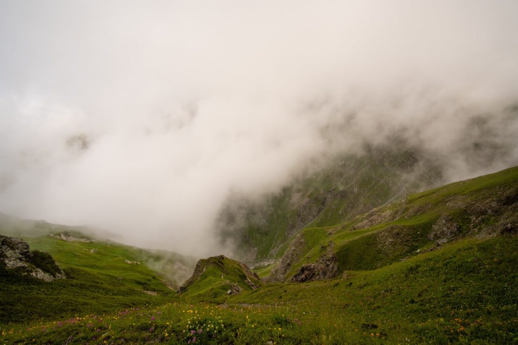
The closer we get to the hut, the more the clouds begin to brew. What others have described as wonderful views are not existent to us.
As we approach the clearing where the shelter is located we are met with a big group of hikers. They are mostly foreigners with a few Georgians. Some nice people from Vienna, Austria (our home!), the UK (my birth country!) as well as Ukraine and some other countries. The Georgians with them are filming some promotional material for the National Park.
The shelter is not the most well equipped, especially if you’re used to huts in the Alps. Don’t expect anything other than the bare essentials. E.g. a bed, and almost not even that. The group has booked up almost the entire shelter and it seems there is not space for us. A few awkward conversations later and we find space, in and amongst the others. We’re not together, not even in the same room which is a bit annoying, but it is what it is.
The hut is freezing and all the doors are open. The park ranger is grunting and smoking throughout the hut. The beds are squeaky bunks with relatively comfy mattresses. There are no blankets. The toilet is a smelly compost dump conveniently located near the drinking water source.
A few more people join, pitching tents outside. It is permitted to camp here and you pay less if you do so. The tents don’t look the best quality and based on the approaching dark clouds I wouldn’t want to be in them tonight. The ranger lights a fire outside and we all sit around enjoying the warming embers, relaxing our muscles from a tough day of hiking.
It’s getting late, so we retreat to bed. Our heads hit the sack and despite the noise we drift off in to a deep sleep. Well, at least Aydin is. There’s a mouse in Caroline’s dorm whose cute little tapping on the floor makes everyone in the room scramble to hang their rucksacks up high. Apparently mice can climb up walls though but we’d like to not get into that now. Today’s hike has been the most elevation we’ve ever covered in a single day. We’re drained, but proud.
Day Two – Meteo Shelter – Black Rock Lake – Demidov’s hut
We awake to the sound of raindrops pattering on the makeshift tin roof. The windows are steamed up and the weather that awaits us is unknown. It’s not sunshine that much is for sure. The hut is busy with people running to and fro so we keep a low profile and let them pack and leave before we make any attempt to piece together our belongings and pluck up the courage to look outside.
Breakfast is cereal bars, the kind full of sugar and chocolate for energy. To recuperate from yesterdays onslaught as well as fuel for the day ahead. I step outside onto the hut’s veranda, leaning on the railing as I chew the cereal bar that I really don’t want to eat. The view is nowhere to be seen, thick fog obscures whatever view might have existed in better weather. The drizzle continues and it’s clear that it’s not going to stop any time soon so we take a hint and set out on to the trail.
We head for the water source to refill our bottles and already make the first mistake of the day. Instead of walking the few hundred metres back to where the trail branches off to the hut we decide to head straight up and bushwhack to where the path crosses above us, hoping to shave off some metres. This proves to be a terribly silly idea and with almost zero visibility we climb a steep slope through extremely thick wet vegetation. We scramble and use trees to pull ourselves upwards. When we finally find the trail again we are completely drenched. Including our shoes and socks. We’re not even thirty minutes in to the 13 kilometre hike to Black Rock Lake.
Pushing through the weather
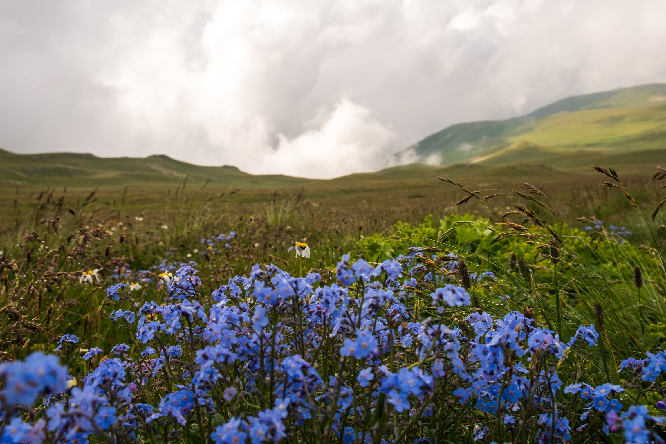
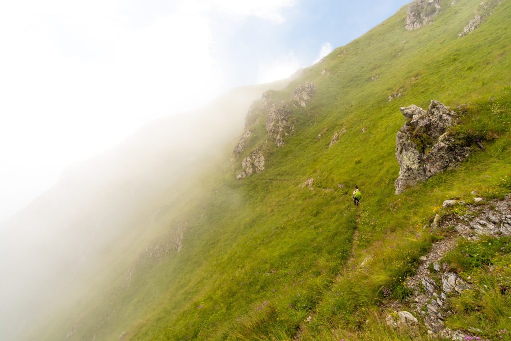
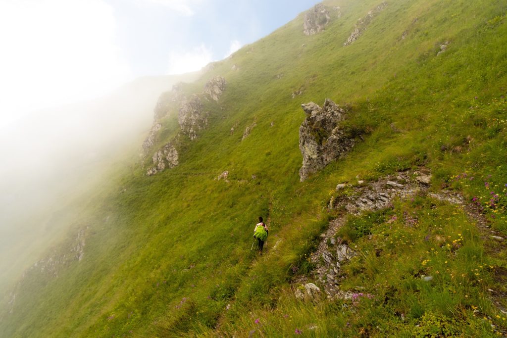
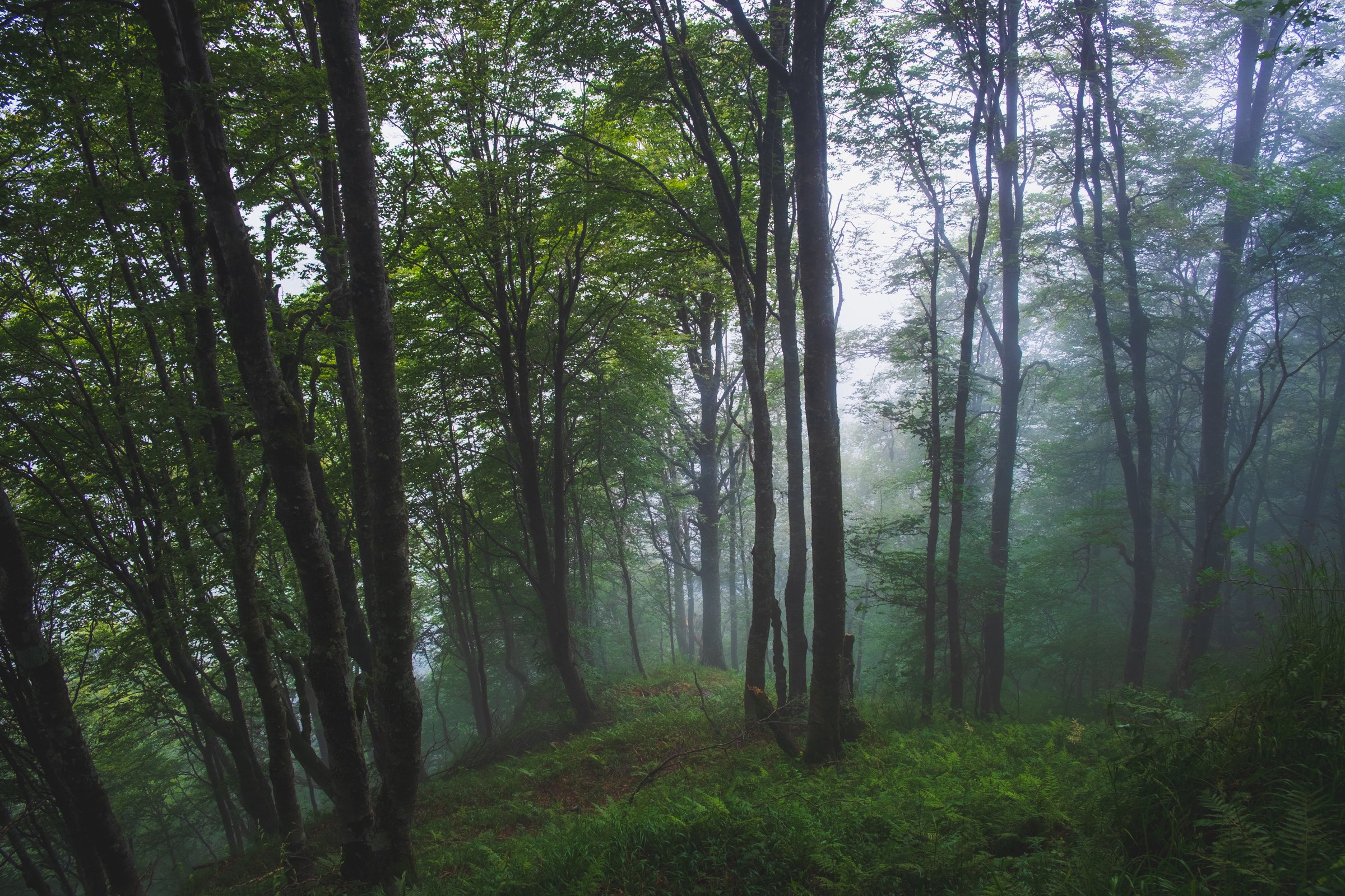
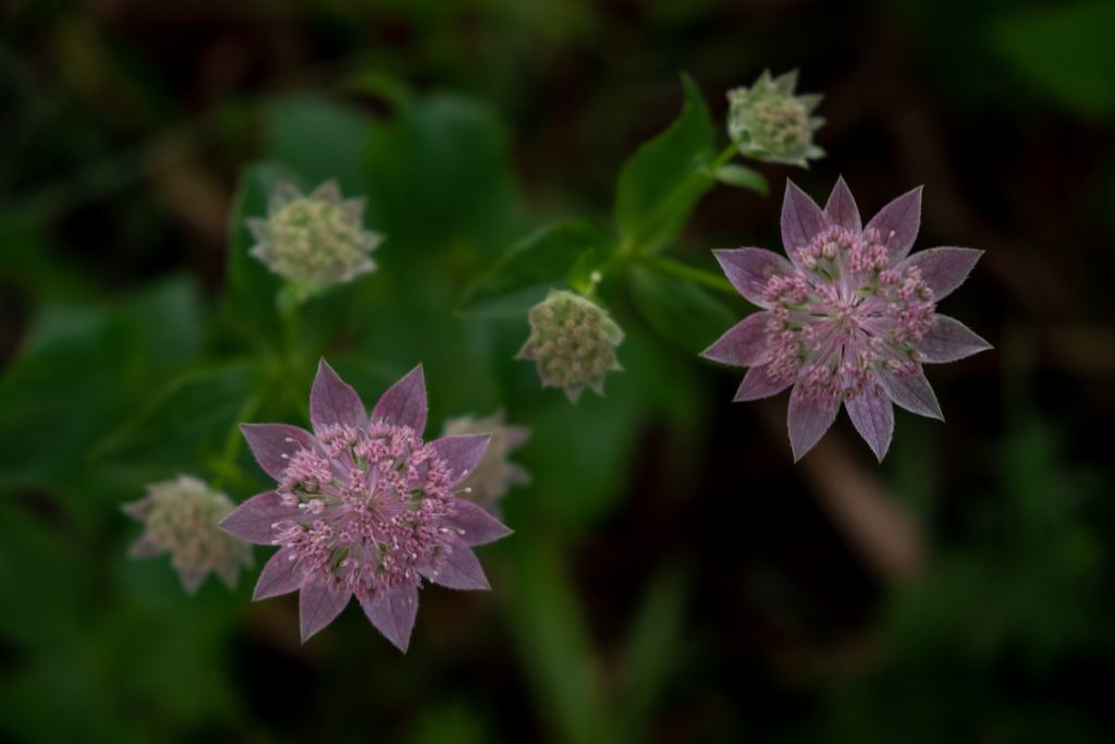
For the next hour we climb steadily, criss-crossing slopes and ducking through thick wet meadows and lush overgrown shrubbery. The grass in the meadows is long and wild, flowers glistening in the rain drops. Despite the lack of views, it’s beautiful, in its own enchanting way.
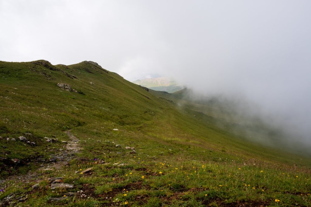
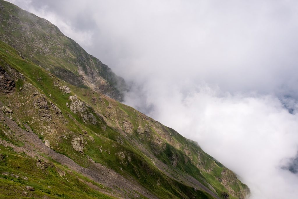
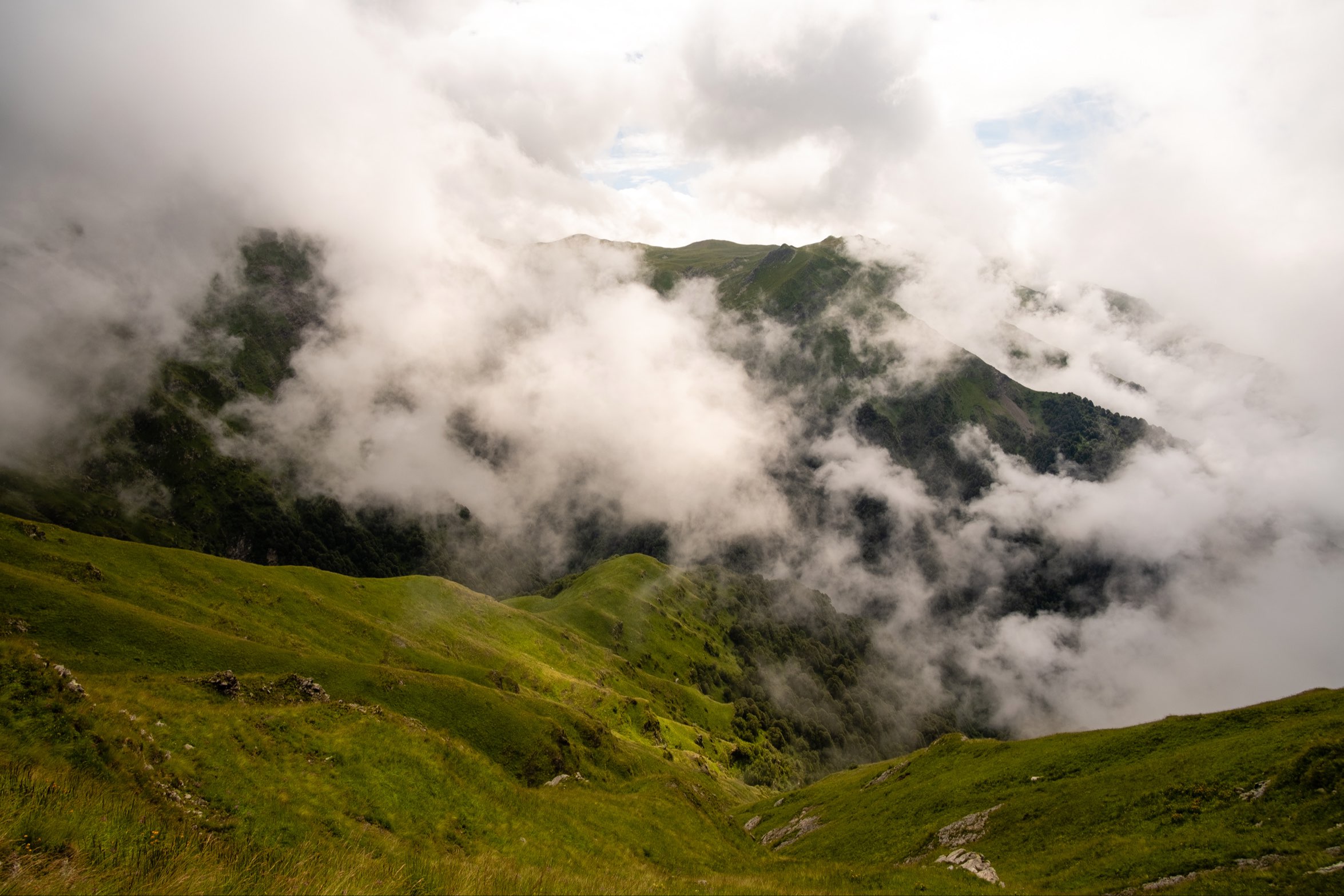
As the day progresses the rain begins to relent, we stop for a break at a point which in nice weather appears to be a viewing location. We watch the clouds twist and unwind. Every now and then a blue patch of sky breaks free from the clutches of the weather, only to be sucked away, engulfed again in a sea of white. We take bets on when the sky will clear. It feels like it’s inevitable. We yearn to experience the landscape we are fighting through to amass its majestic views.
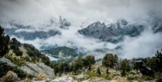
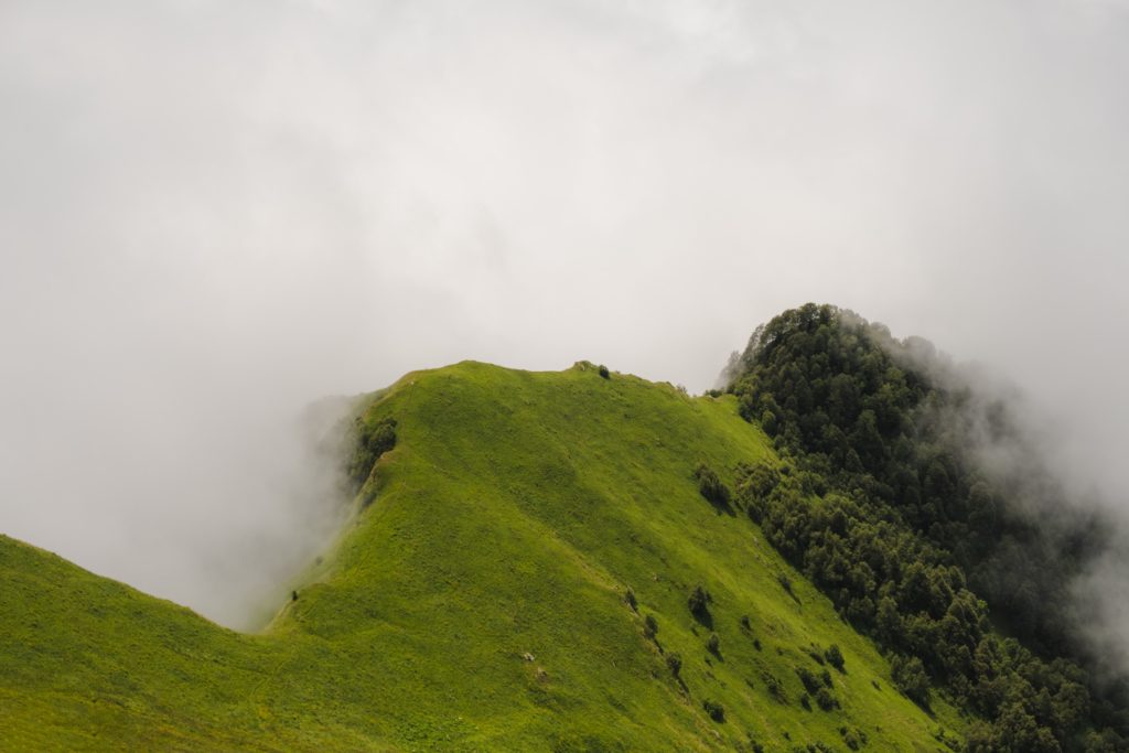
A few hundred more metres up and the clouds begin to melt away, vast landscapes behold us. In an instance the fog is back and then a second later we get a glimpse of craggy mountain walls through gaps in the clouds. It appears we have made it to a ridge, a sea of clouds below. It feels incredible when the sun shines, we bask in it, futilely attempting to dry our clothes and belongings.
As the light transforms the landscape we gain a scale of our accomplishments. We have come so incredibly high, amongst the peaks of the mighty Caucasus, on the way to Black Rock Lake.
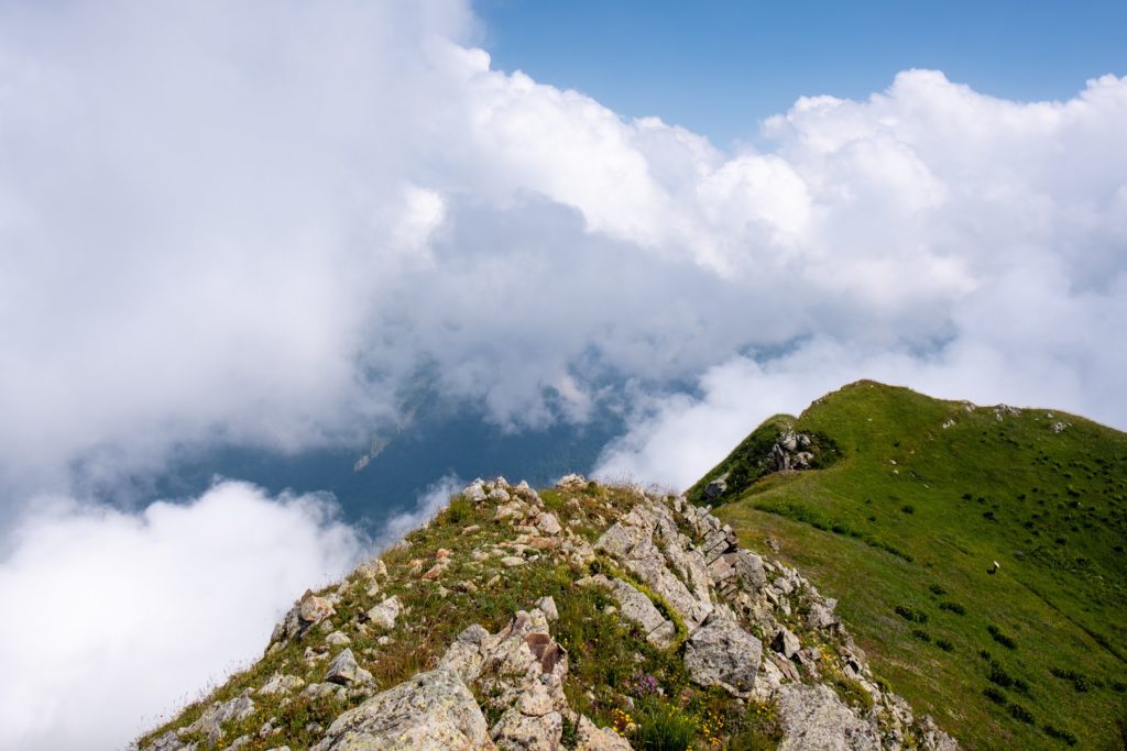
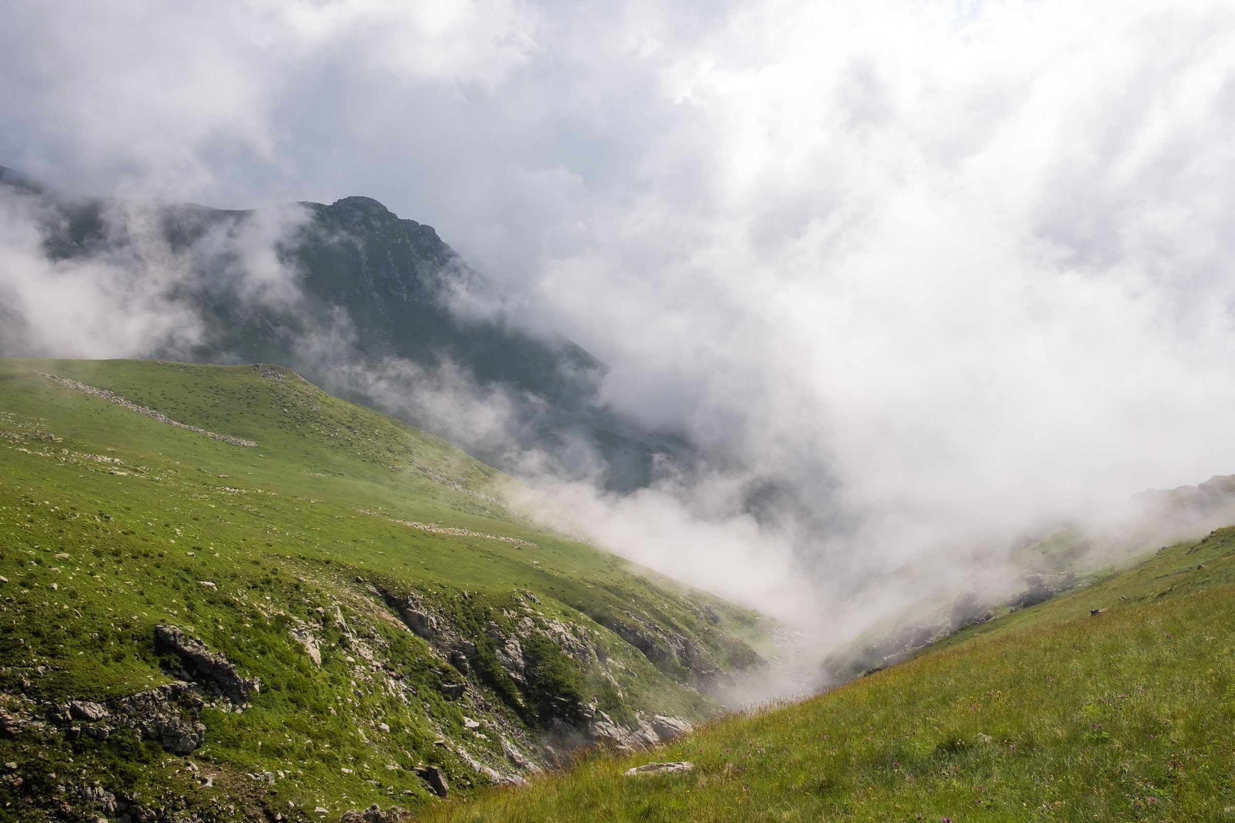
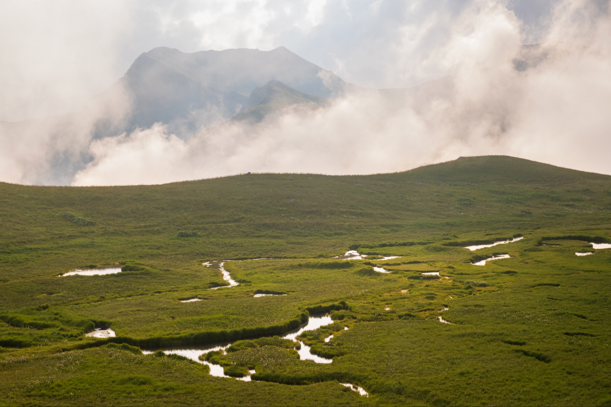
On the Black Rock Lake plateau
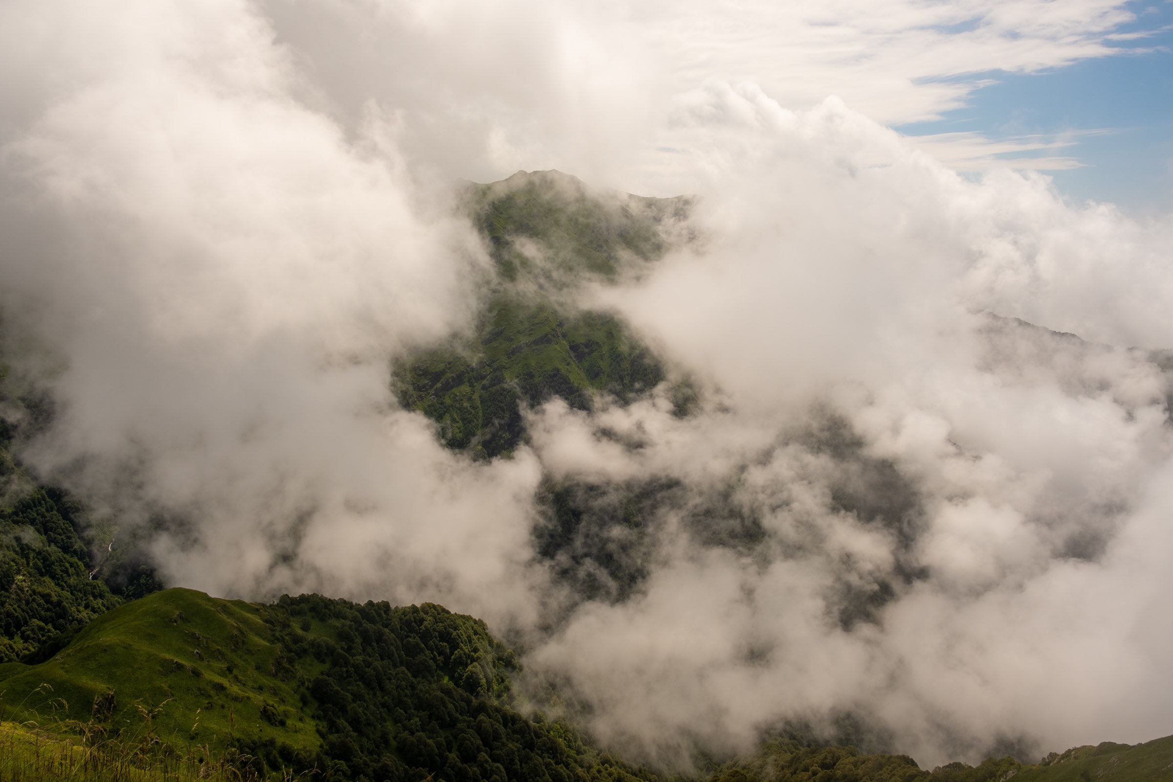
With the tough ascent out of the way, we enjoy the next few steady kilometres along the high plateau. With a spring in our step and a renewed sense of excitement we finally shoot some photos. The landscape is gorgeous and who knew such lush vegetation existed just shy of 3000 metres elevation. Although the sun fights a fierce battle with the fog and clouds, ultimately it never proclaims victory. It makes for some stunning scenes; for what it’s worth bad weather quite often makes for much more interesting photos. Drama is the key, and there is plenty of it here in Lagodekhi National Park.
Pristine streams, glistening in the diffused light carve fresh ravines with peaks towering above. Fog dances and swirls across the landscape like tumbleweed through the desert. Raindrops drip from vibrant alpine wild flowers. Marshlands glimmer in warm light as escaping sun rays push through the thick cloud, and then the ground abruptly disappears, descending into steep mountain slopes.
More of Georgia
Wild, dramatic, mystical: A trip to age-old Khevsureti
We’ve seen the pictures, we’ve heard the stories. Now we want to go to Khevsureti. Does our car want to though? Sometimes I’m glad I can’t personally ask Vlad, our trusty Opel Astra. Khevsureti looks like a fascinating place. Medieval tower villages, pagan rituals and lots of myths, folktales and history, all perched away in […]
The ultimate guide to canyons and swimming spots in Georgia
It seems you guys loved our guide to waterfalls in Georgia so we’re rolling out the next one to help you escape Sakartvelo’s summer heat! Canyon dig it?! Spending a summer in Georgia, we realised just how many beautiful canyons there are. And while Martvili and Okatse are undoubtedly beautiful, they frustrate you at the […]
The ultimate guide to waterfalls in Georgia
Whether you need to cool down from the sweltering summer heat or would like to marvel at some of these beauties in the snow, you’ll find the right place to go here! We spent half a year in Georgia to compile the best waterfalls in the country for you. Let us know if you visit […]
Not so wild: A posh weekend in Samtskhe-Javakheti
We’ve spent the last months in Georgia without really seeing anything. Our work schedules were insane and wintertime means that most hikes are not accessible anyway. Now that spring is just around the corner, I had thought of something nice for Aydin’s birthday: a few days visiting Western Georgia, or better said Samtskhe-Javakheti, but this […]
High Mountain Border Control
Due to the situation of the hike and Black Rock Lake’s position on the Georgian-Russian border you will have to deal with border control at 3000 metres elevation. The trail leads right through their campsite. The border guards will take your passport and hand you a form to fill in. It doesn’t take particularly long but unfortunately we catch up with the tour group and therefore have to wait a little longer while the guards process the others first. It is slightly inconvenient but we find a horse to feed, so all is well.
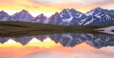
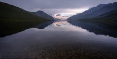
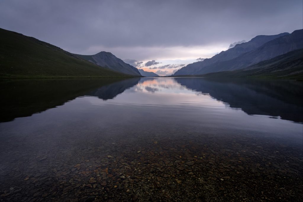
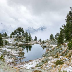
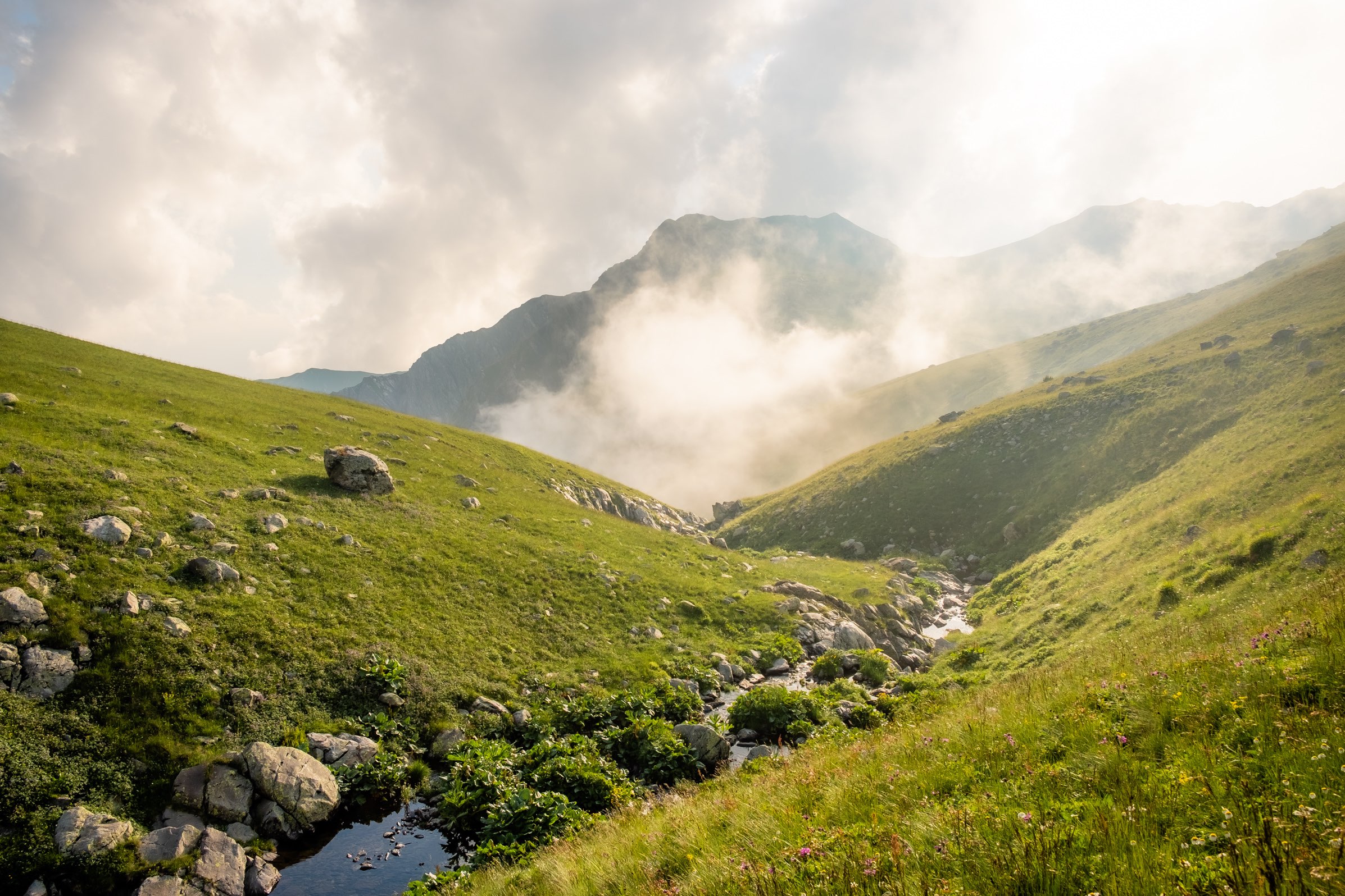
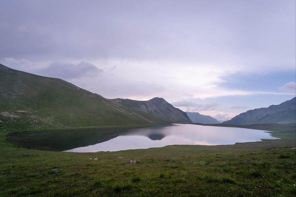
From the border control we ascend again and when we reach the top of the pass we spot various smaller alpine lakes. The one pictured below we’ve been told is quite often dried up and therefore it’s an uncommon sight. The small lake is pleasantly reflecting the now tranquil mountains. Blue skies open up and sense of calm washes over the landscape, which only a few hours before, was immensely inhospitable.
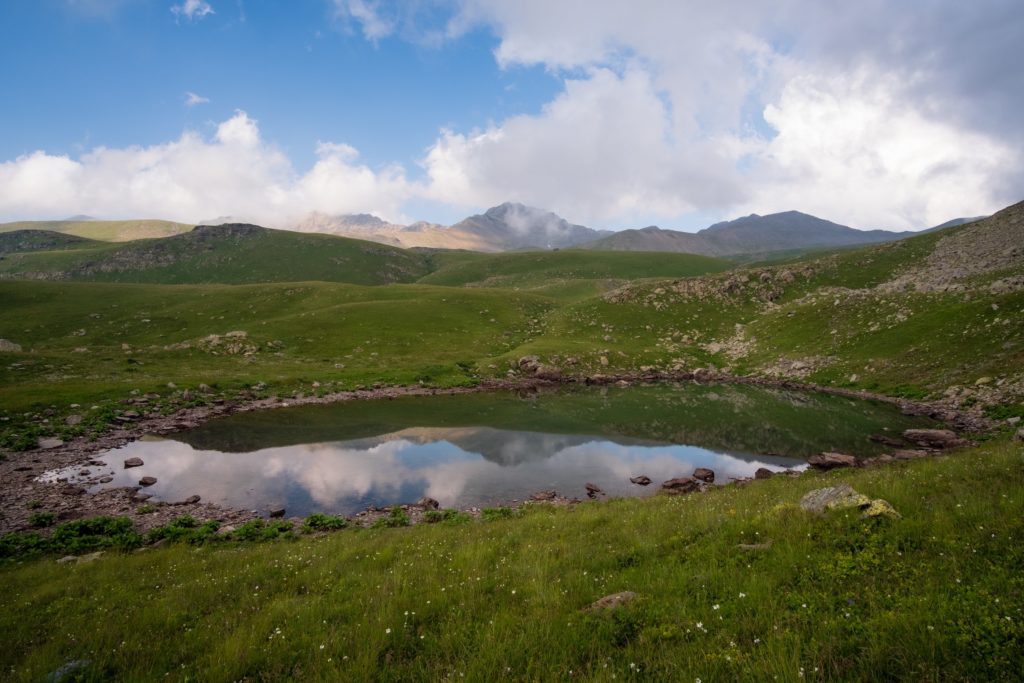
Calm before the storm
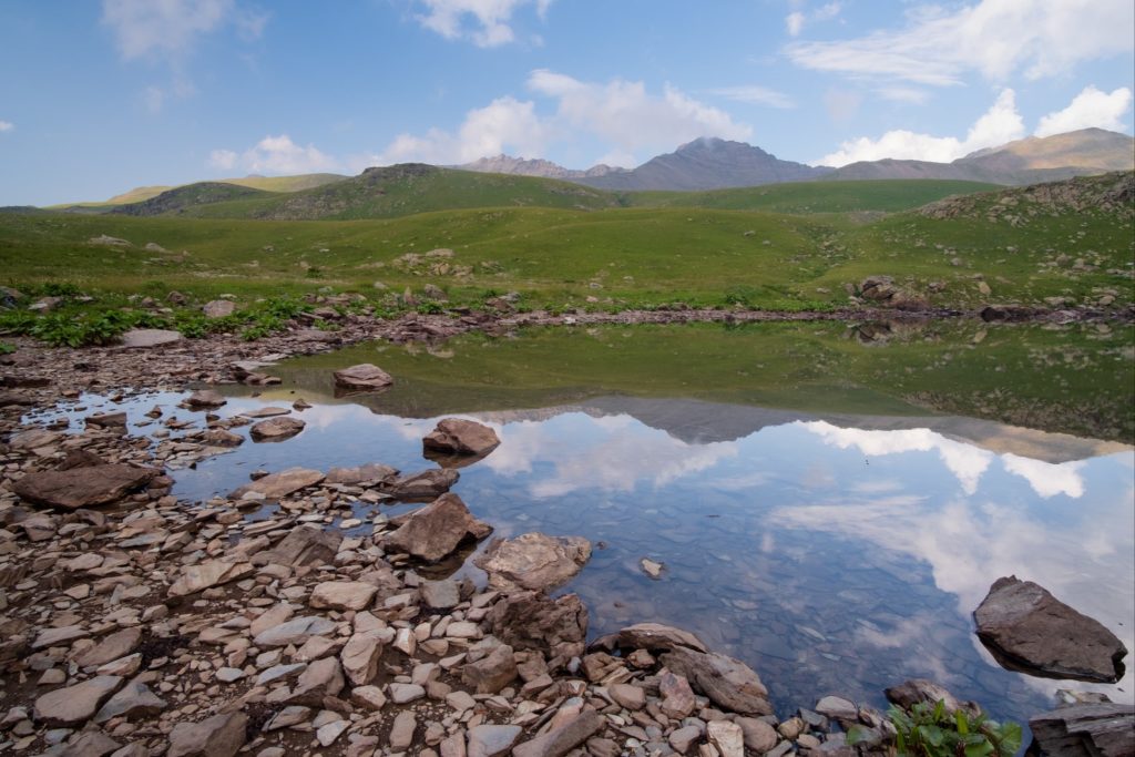
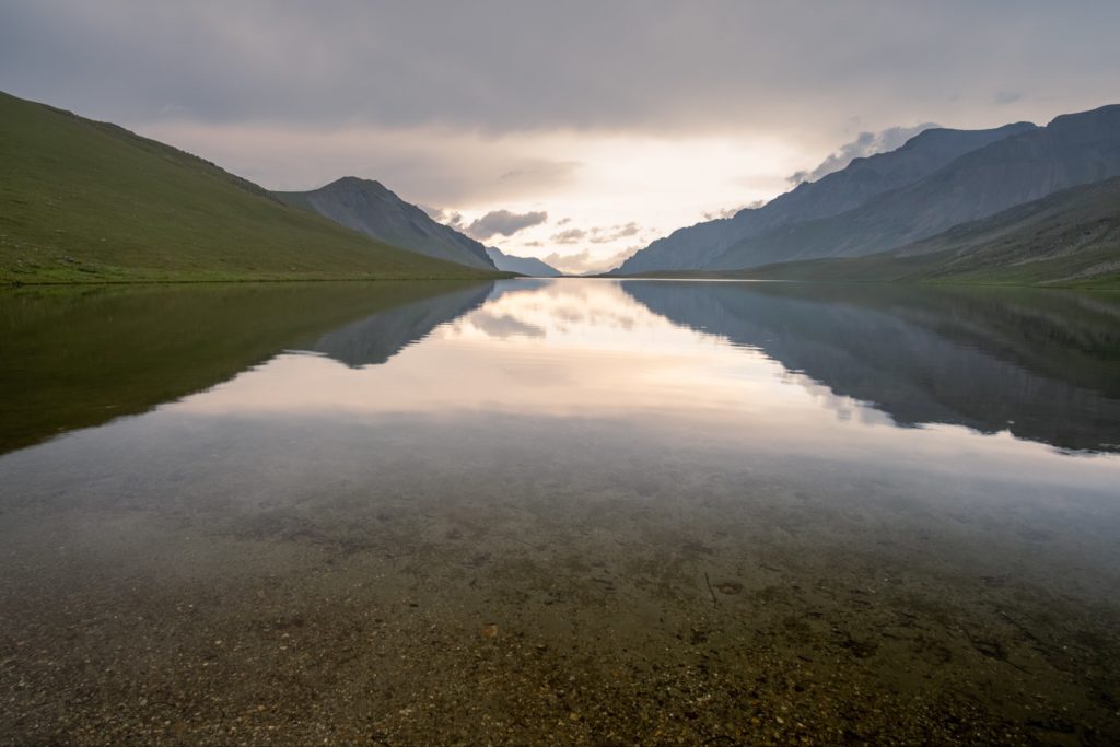
A few more ups and downs, our muscles squeal surrender and finally the fabled Black RockLake presents itself, flanked by the mountains of Russia’s Dagestan. The lake is calm and still but not for long. Rumbling in the distance gives us an idea of whats to come.
The day is drawing in and sunset is near. I survey the shore and grab my tripod. I’m determined to photograph the sunset here after not having much luck with photography so far on the hike. I want to capture this enchanting landscape and portray to others the same emotions that overcame me.
Everyone else slowly departs. It’s still a 3KM hike to the second hut, Demidov’s hut, with another pass to cross, and even though it’s not particularly sizeable, it’s no mean feat after the elevation we’ve already covered. Caroline decides to leave with the group in an attempt to avoid the oncoming storm. There’s been a few occasions where we’ve been caught in thunderstorms and rightfully so, she’d like to avoid it if at all possible.
The formidable Black Rock Lake
There are no real signs of a border here, even though it cuts directly through the middle of the lake. No fences, barbed wire, signs or border posts within sight. However, the park ranger at the visitor centre cautioned us regarding a Russian shepherd we might come across. Apparently he tempts unsuspecting hikers with Chacha. We were warned to stay away, his true identity being that of a Russian military officer, hellbent on causing trouble. Fortunately, we didn’t spot the so-called trouble maker. Stick to the trails and don’t walk around the lake, however appealing it may be. Illegally crossing the border will no doubt result in undesired consequences.
I setup my tripod and wait. The water is so clear you can see the individual colour of each pebble lining the floor of the lake. Every now and then a ripple echoes from the centre of the lake to the shore. The light never does come and the rumbling intensifies, a glimmer of colour in the distance hints to a sunset somewhere, but not here, amongst the storm clouds. A bolt of lightning strikes nearby and the rain begins to pour. It’s time to get out of here.

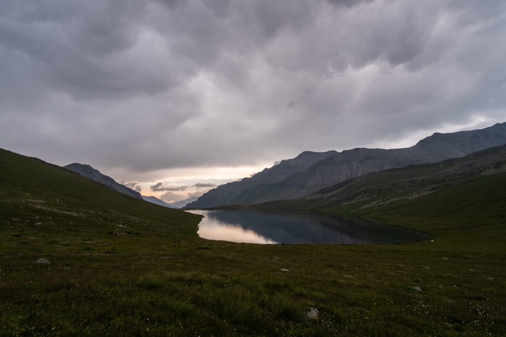
I walk as fast as I can, hoping to catch up with the group, but it’s futile. They’re long gone, they must have sped up to avoid the storm. Before long I am soaking wet again and thunder strikes all around me. I begin to regret my decision to stay by the lake. Especially as the trail keeps on ascending. It’s been enough climbing already today, this is just painful. As I reach the top of the pass I’m slowing to a snail like pace, reaching from the depths within to muster the courage to continue on through the harsh rain and wind. I hope to see the destination, for some motivation, but it never presents itself. On the other side of the pass I begin to run, eager to make it to safety. It seems like an eternity but eventually I make it.
Demidov’s hut
The entrance to the hut is blocked with drenched boots. The shelters interior is dressed with the wet belongings of all the deflated hikers. Rain hammers the roof, and although this hut is newer than the previous, leaks present themselves. It’s a mystery this thing survives in this harsh climate all together. The hut consists of three rooms and a common area with a big bench where we all make dinner around. The group cook a much more elaborate dinner of stews complete with rehydrated fruits and vegetables. We eat ramen noodles.
It isn’t the most comfortable evening, what with Caroline’s bed being broke. A missing wooden slat makes it most uncomfortable. To add to the problems, another guest demands Caroline wait outside while their partner changes clothes, taking over half an hour, blocking the entrance to Caroline’s only bit of respite.
Day Three – Demidov’s hut to Lagodekhi Visitors Centre
Morning comes and we listen carefully, the rain has stopped. I get up and look out the door, thick clouds shroud the mountains but it’s not raining. We’ve read that the hike down is brutal without rain, and worse when it’s been raining. Lucky us!
We make the decision to eat breakfast and get the hell out of here before the next storm comes. The rest of the hut is bustling with the group, we don’t want to wait for them this time, the hut is to share, not just for them. We chew our cereal bars for breakfast, thankful that it’s for the last time in a while. We pack our stuff and get on the trail. It’s beautiful, green and calm.
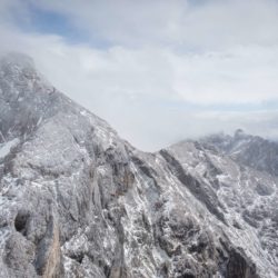
We can see peaks and ridges, all hidden the previous day. In good conditions we’ve read from here you can see Lagodekhi and all across the Kakheti plains, maybe even as far as Signahgi. Not today though, but it doesn’t matter, it’s beautiful nontheless. The path winds upwards and circumvents peaks by traversing around their slopes. We lose orientation as we head in a myriad of different directions, it feels like we’ve done a complete 360.
Through the clouds we can see streams and waterfalls navigating steep cliff faces. There’s been enough water falling the last two days to feed these water sources for a life time.
The paths are good so far, solid and well marked. They weave romantically through meadows of wild flowers as we finally begin to descend. Today we have to descend a total of 2100 meters. That’s not an everyday walk. I can feel my knees wobbling just thinking about it.
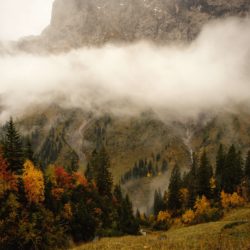
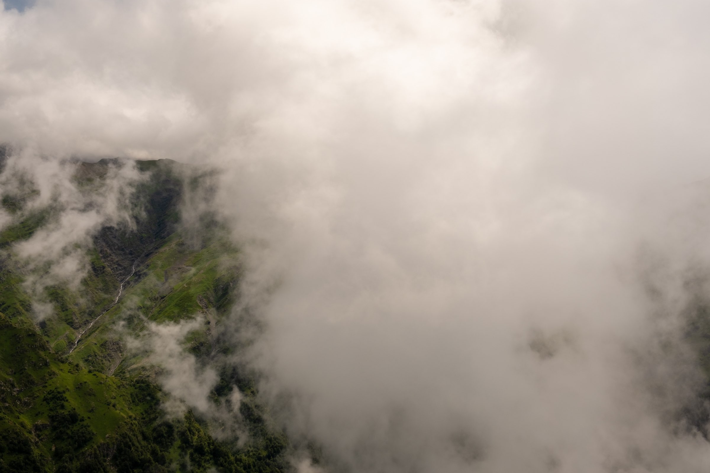
Descending from Black Rock Lake through the clouds
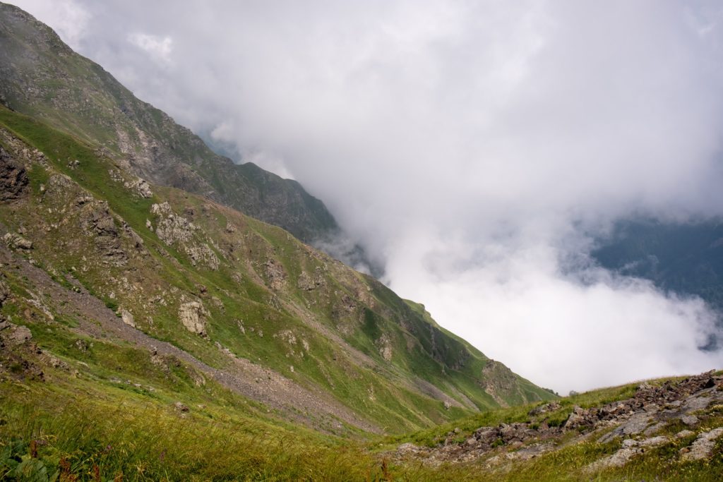
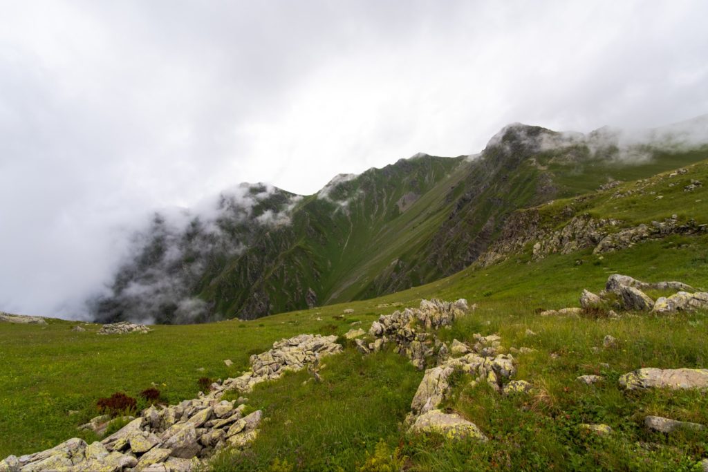
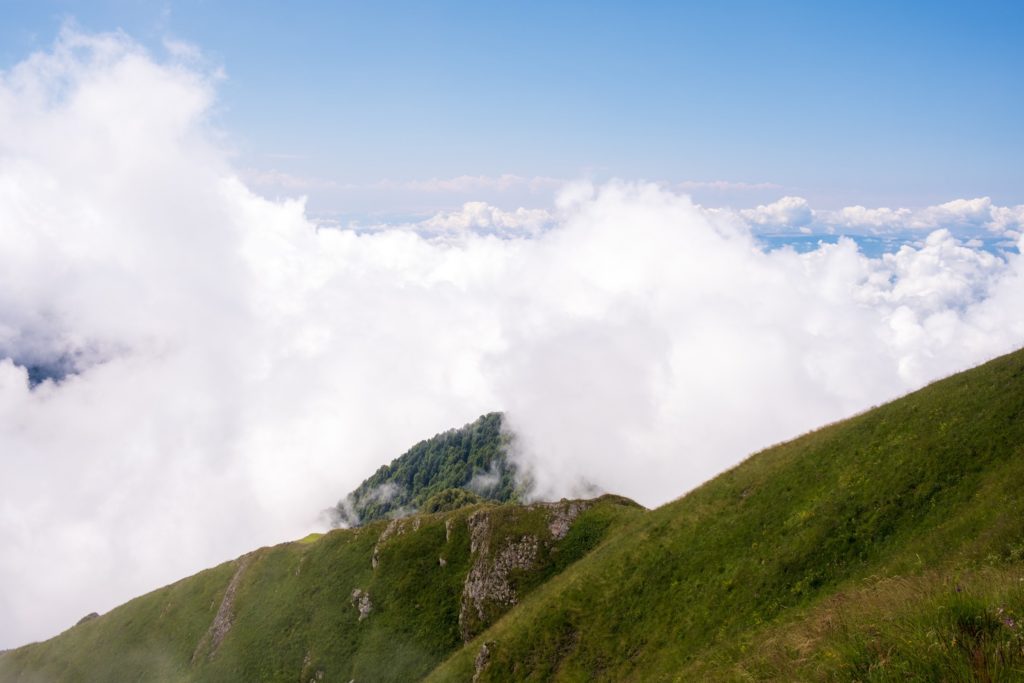
As we head south the trail zig-zags steeply down the mountain, some parts are precarious but not anywhere near as dangerous as the impression we got from other articles. Maybe the thick clouds warp our perception of height. The views are incredible and even though we cannot see to the Kakheti plains, we can see mountains and ridges peek through the sea of clouds. The drama in the sky and landscape is incredible. In this instance I’m thankful for the bad weather.
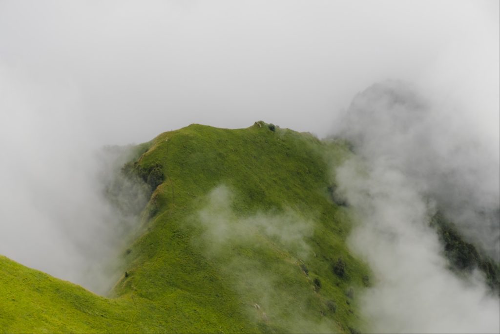
On the lonely ridge
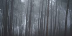
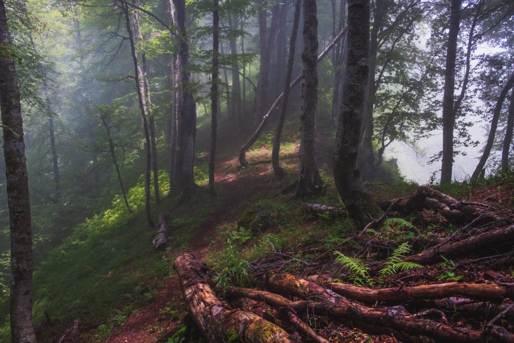
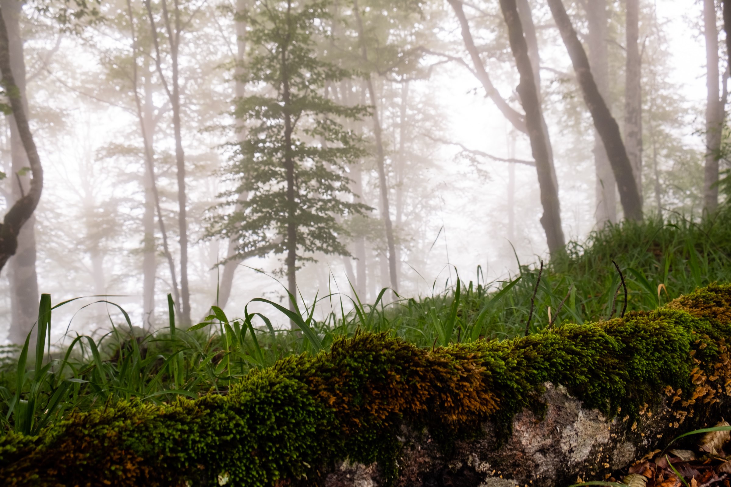
The path descends steeply and we see a ridge below which we must cross. The sight is incredible as the fog hugs one side of the ridge and never covers it. We can see the path follow the line of fog as if it’s floating in the sky. It looks terrifying but at the same times completely exhilarating. We race down the serpentine slopes and on to the ridge, where we walk across the floating island in the the sky. Just below the ridge we enter the forest where we will descend for 3-4 more hours.
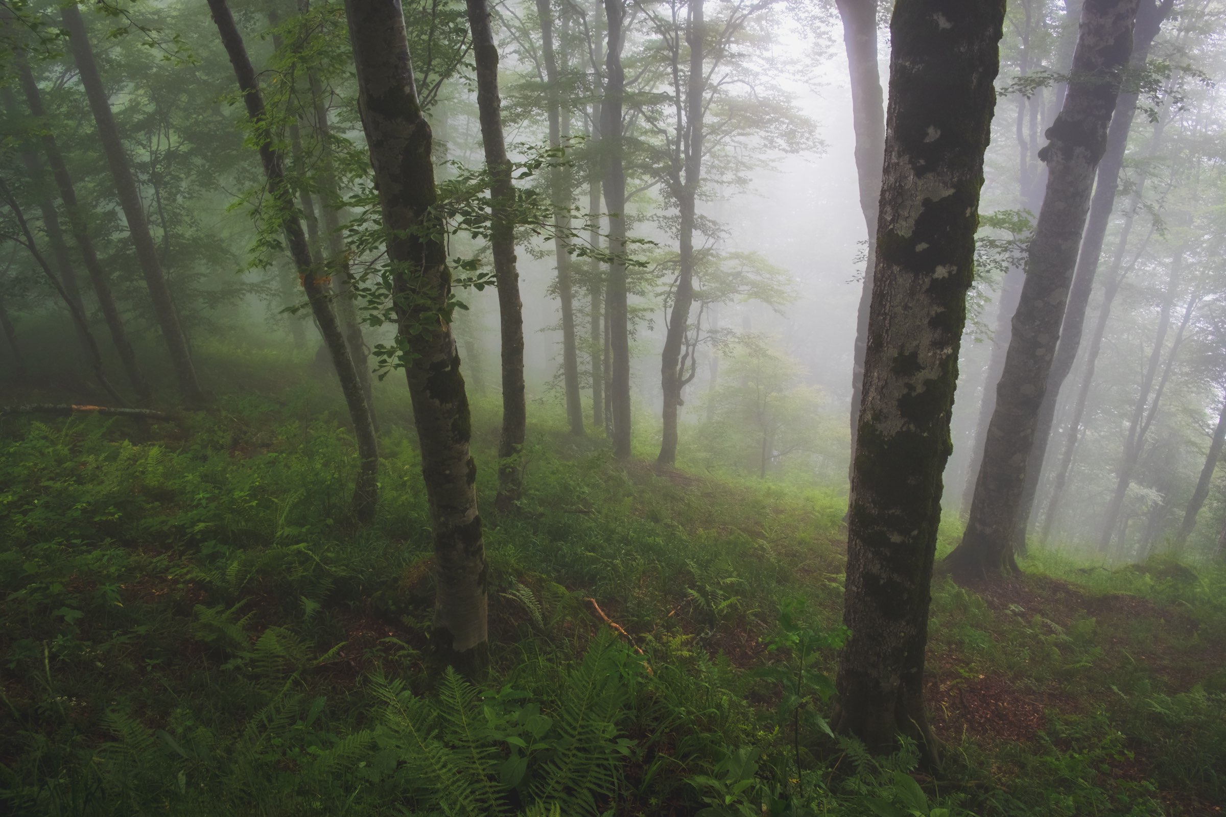
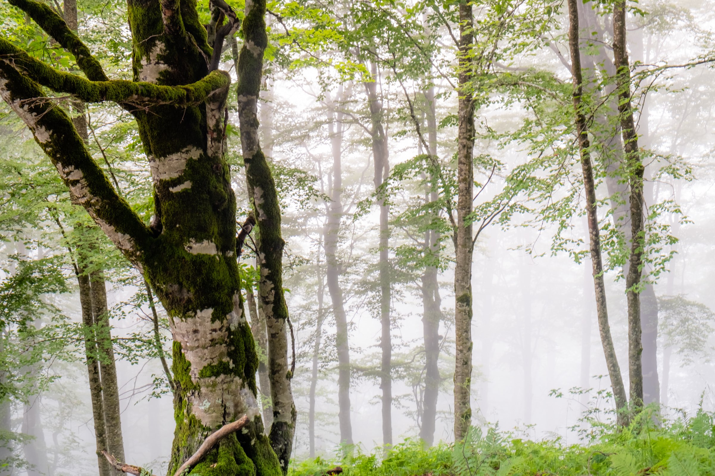
Enchanting forests
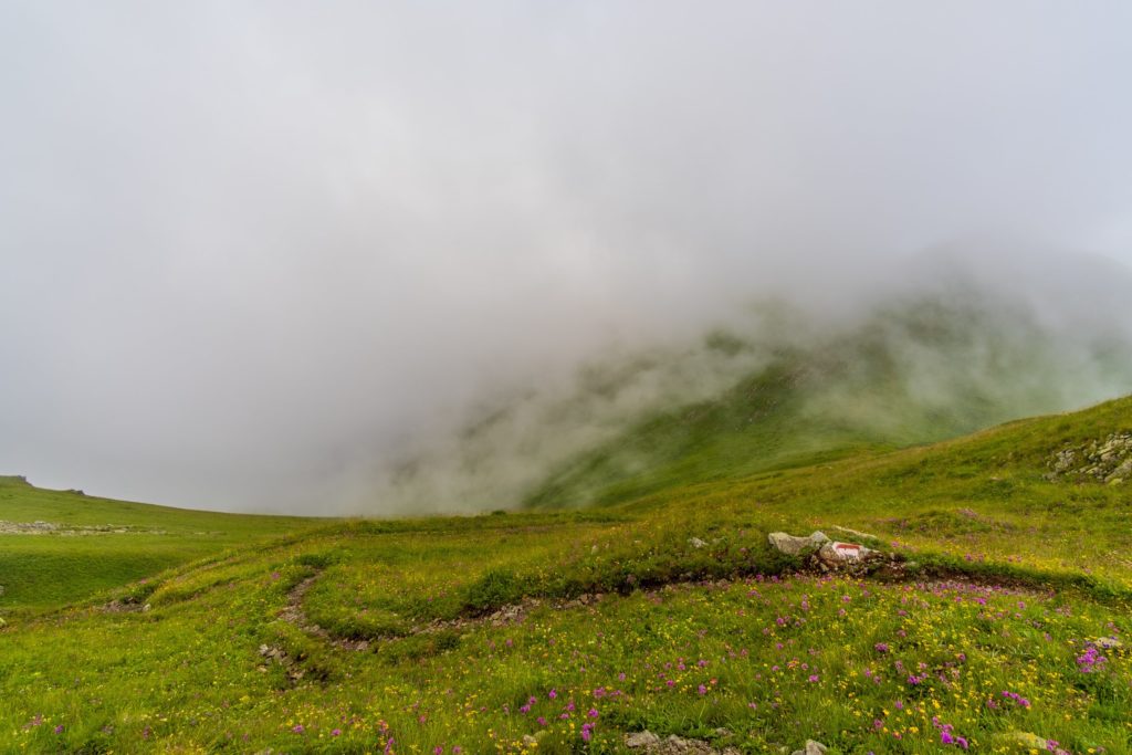
The forests are full of fog and the sun is desperately trying to pierce through, the result is an enchanting fairy tale like scene. The trails weaves along the ridge with trees slowly fading in to slopes through the thick fog, getting deeper as we descend. This is my favourite part of the hike so far and I’m trigger happy with the camera. Eventually Caroline tires of waiting around and we continue the downhill slog.
Down and down, some steep bits, some flat bits, but down. On and On. It’s an eternity. But not dangerous, even with all the rain the trail is solid and we never slip or have any accidents. We descend fast, taking full advantage of our trekking poles, using them to keep balance as we tackle steep descents. One thing we notice is the heat, with every dent we make in the descent, it gets hotter and more humid. We can feel the heat of Kakheti plains.
A dip in the glacial river
There’s not much more to report from this point, the trail is easy to follow and we just keep descending. Until we’re at the bottom some hours later with throbbing knees. The trail joins the Black Grouse waterfall trail, the one we branched off from on day one. As we join the wider trail, we look up and feel the sun, the sky is almost clear and the heat is savage. Everything is hurting and we feel filthy, so what better thing to do than head to the river and bathe in the glacial water. I immediately tear of my clothes and lay in the rushing waters. It’s icy cold but it’s exactly what I need. And I just lay there, for almost thirty minutes.
The sun begins to dip and we know it’s time to leave. We walk the remaining two kilometres back to the National Park visitor centre and pick up our car, drive down the road to our apartment where we check in to an incredible room and our hosts feed us the most incredible home-made vegetarian feast. It’s the perfect evening after an incredible, but arduous hike.
FACTS FACTS FACTS
How to get to Lagodekhi
Marshrutkas to Lagodekhi depart from Isani bus station in Tbilisi. It goes every hour from 7:40 to 18:30. It takes around 2.5 hours and costs 7 GEL. Check the Visit Lagodekhi website for exact locations and more travel options, eg from nearby towns.
What to take
Electronics
- Phone + charging cable (there wasn’t really much signal throughout the hike)
- Powerbank (there is no electricity in the huts)
- Camera (bring spare batteries)
Food & Cooking Gear
If you want to eat warm food then you will also need to bring a stove and gas. We use the MSR PocketRocker. You can buy Gas in Tbilisi. Check here. We went to MPlus. You won’t find any gas in Lagodekhi.
- Stove
- Gas
- Cooking Pot
- Spork
- Bowl/plate (we just use tupperware)
- Mug (for tea and coffee)
Breakfast
- Cereal bars
- Apples/pears or any other fruit
Lunch
- Bread (Shoti)
- Cheese (Sulguni)
- Cucumber/tomatoes
Dinner
- Instant noodes (they’re light and we’re lazy)
Snacks
- Nuts
- Chocolate
- Fruit
Hiking Gear
- Trekking poles – we really recommend them for this hike
- Head torch (in case you get stuck or need to fetch water in the dark)
- Knife/multitool
- Trekking rucksack
- Rucksack rain cover (this one is very important, all our gear would have been soaked without it)
- Towel (maybe you want it for swimming or for washing)
- First aid kit (plasters, blister plasters, disinfectant, whistle, emergency blanket, pain killers, etc)
Clothes
- Waterproof Jacket
- Tshirts (keep a clean one for the campsite)
- Base layer (we didn’t take any for this hike but you might want to)
- Hiking boots or trail runners, whichever you prefer
- Socks/underwear
- Cosy jumper/hoody for campsite/evening
- Trekking bottoms/shorts
- Gloves/scarf in case its cold
- Flip flops (it makes the campsite a little more comfortable at the expense of some extra weight)
Extra:
- Passport (for the border guards near Black Rock Lake)
- Trash bags (take your trash out!)
Sleeping:
- Sleeping Bag (not just a liner, an actual sleeping bag, Caroline was freezing in her liner)
Toiletries:
- Deodorant
- Toothpaste & toothbrush
- Toilet paper
- Sunscreen
- Bug spray
- Earplugs (there’s always a snorer and sometimes a mouse)
Water
Most places say to take around 2-3 litres of water per day when hiking all day. 1.5 litres is usually enough for us. There are springs at each hut so you can drink plenty at the end of each day and refill for the next day. When you are at the huts ask around and you will find the source with no problem.
All the sources are marked on maps.me and are marked on the GPX trail from Trekking in the Caucasus website. Be sure to check in with the Lagodekhi visitor centre, they will give you up to date information on the springs, as some of them can dry up in late summer.
Huts & Camping
There are two huts to stay in Meteo Shelter & Demidov’s Hut. You need to book and pay for them at the Visitors center. It costs 20 GEL per person per night/hut. You can also camp outside the huts and then it is cheaper.
If you want to camp but don’t have the gear then you can rent it from the visitors centre also.
Distance & Elevation
Total Distance: 38.2 KM
Total Up: 2588M
Total Down: 2530M
- Day 1 – Distance: 11.2 KM – Up: 1504M – Down: 130M
- Day 2 – Distance: 13 KM – Up: 1000M – Down: 300M
- Day 3 – Distance: 14 KM – Up: 84M – Down: 2100M
Maps & GPX Trails
We use a combination of Apps. Maps.me we use for routing between two points. It gives pretty spot on information regarding the elevation difference and the distance. It’s walking estimates are quite accurate as well. The second app we use is Gaia GPS. The app is not as intuitive as Maps.me but it allows to import GPX trails so you can always see where you should be walking in relation to where you are. It also provides much better contour lines so you can easily spot elevation changes.
We didn’t record our hike but if you want a GPX trail, grab it here. That’s the one we used.
When to Hike
The best time to hike this trail is the summer. It’s quite possible maybe a little earlier and later. Best to check with the national park visitor centre. We did the hike mid July.
Accommodation in Lagodekhi
You might want to stay somewhere a bit more comfortable in Lagodekhi before or after your hike. We stayed at Guest House Old Wall and absolutely loved it. The room was massive and sparkling clean. We were treated to a home cooked vegetarian feast for both dinner and breakfast.
Pin it!
You Might Also Like