Menu
- Countries
 Apr 3, 2025
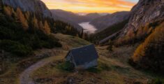
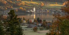
11+ Austrian towns to rival Hallstatt
 Jun 19, 2019
Feel the Bern
 Jun 12, 2019
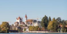
Fun in Thun: A pit stop on the way to Bern
 Jun 3, 2019
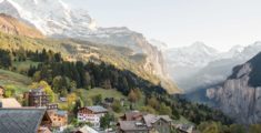
Wild and without money: Hiking Kleine Scheidegg
 Jan 13, 2020
Nine wild rides to the Pyrenees
 Oct 17, 2019
Wild and without the Alps: Camargue
 Jan 12, 2022
The wonders of Ronda: A bridge between the eras
 Feb 17, 2020
Wild and without enough time: Catalonia to Portugal
 Nov 6, 2021
City to sea: A day trip to Sintra
 Oct 18, 2021
Benagil to Faro: All along the Algarve
 Aug 16, 2021
Wild and without a campground: Lisbon to Benagil
 Sep 7, 2024
The top three destinations in Adjara, Georgia
 Jan 14, 2023
Mestia to Koruldi Lakes: Camping at 2700 meters
 Nov 17, 2022
Ushguli: 4 day hike from Mestia via Tsvirmi
 Oct 31, 2021
Black Rock Lake: 3 Day hike from Lagodekhi
 Aug 14, 2022
Madness in Marrakesh: The final leg
 Jun 25, 2022
Merzouga: The Gateway to the Sahara Desert
- Categories
 May 11, 2022
17 locations for vintage Wes Anderson vibes
 May 9, 2022
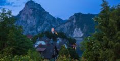
14 Gorgeous Churches in the Austrian Alps
Oct 18, 2021Benagil to Faro: All along the Algarve
Aug 16, 2021Wild and without a campground: Lisbon to Benagil
Feb 17, 2020Wild and without enough time: Catalonia to Portugal
Sep 7, 2024The top three destinations in Adjara, Georgia
Jan 14, 2023Mestia to Koruldi Lakes: Camping at 2700 meters

Ushguli: 4 day hike from Mestia via Tsvirmi
4547 M
Total Ascent
3769 M
Total Descent
68.6 KM
Total Distance
2737 M
Highest Elevation
4 Days
Duration
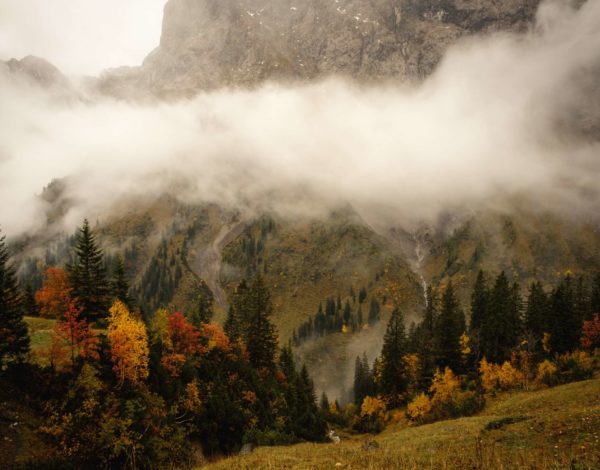
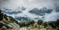
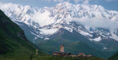
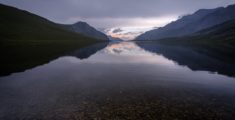
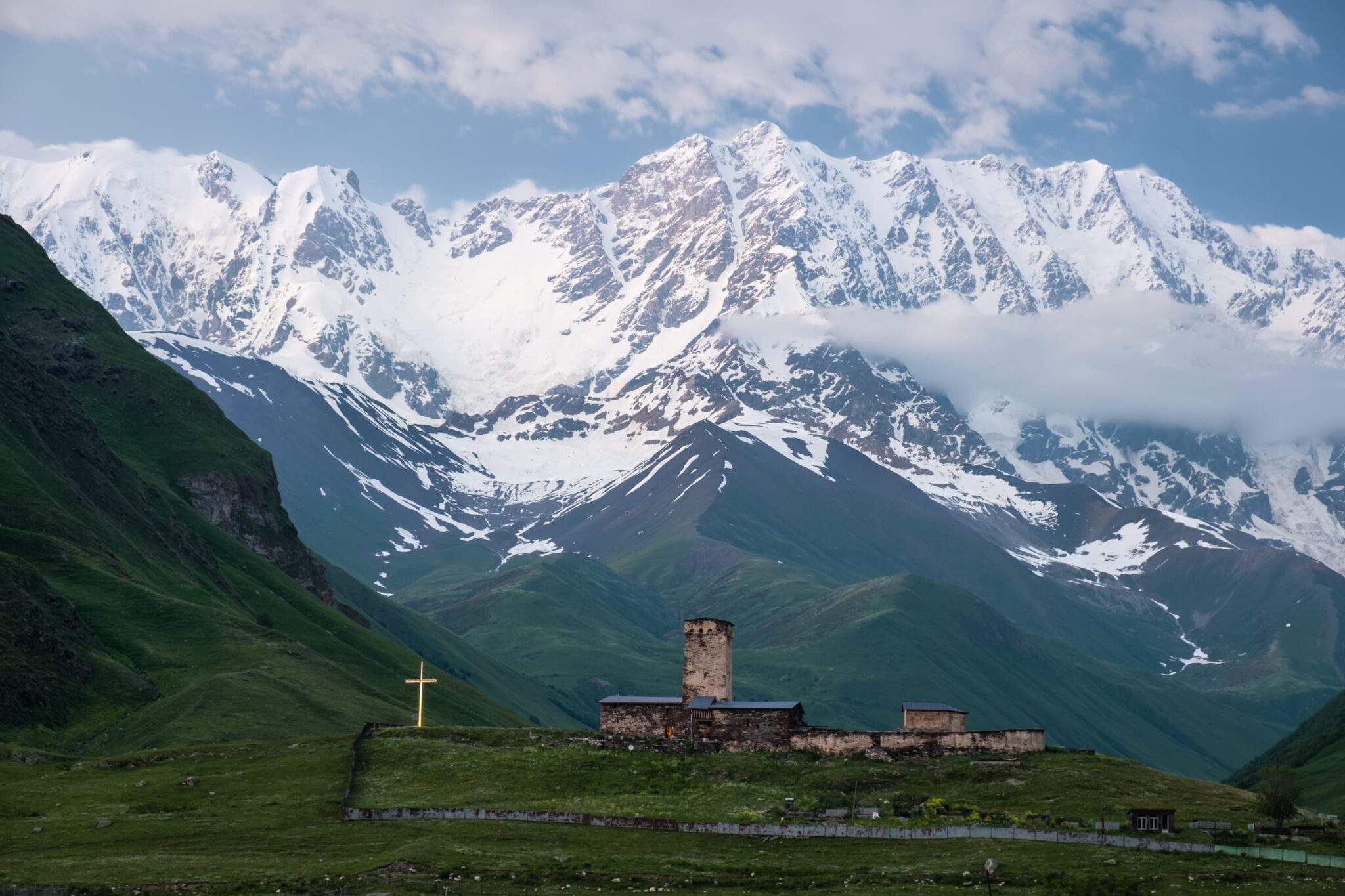
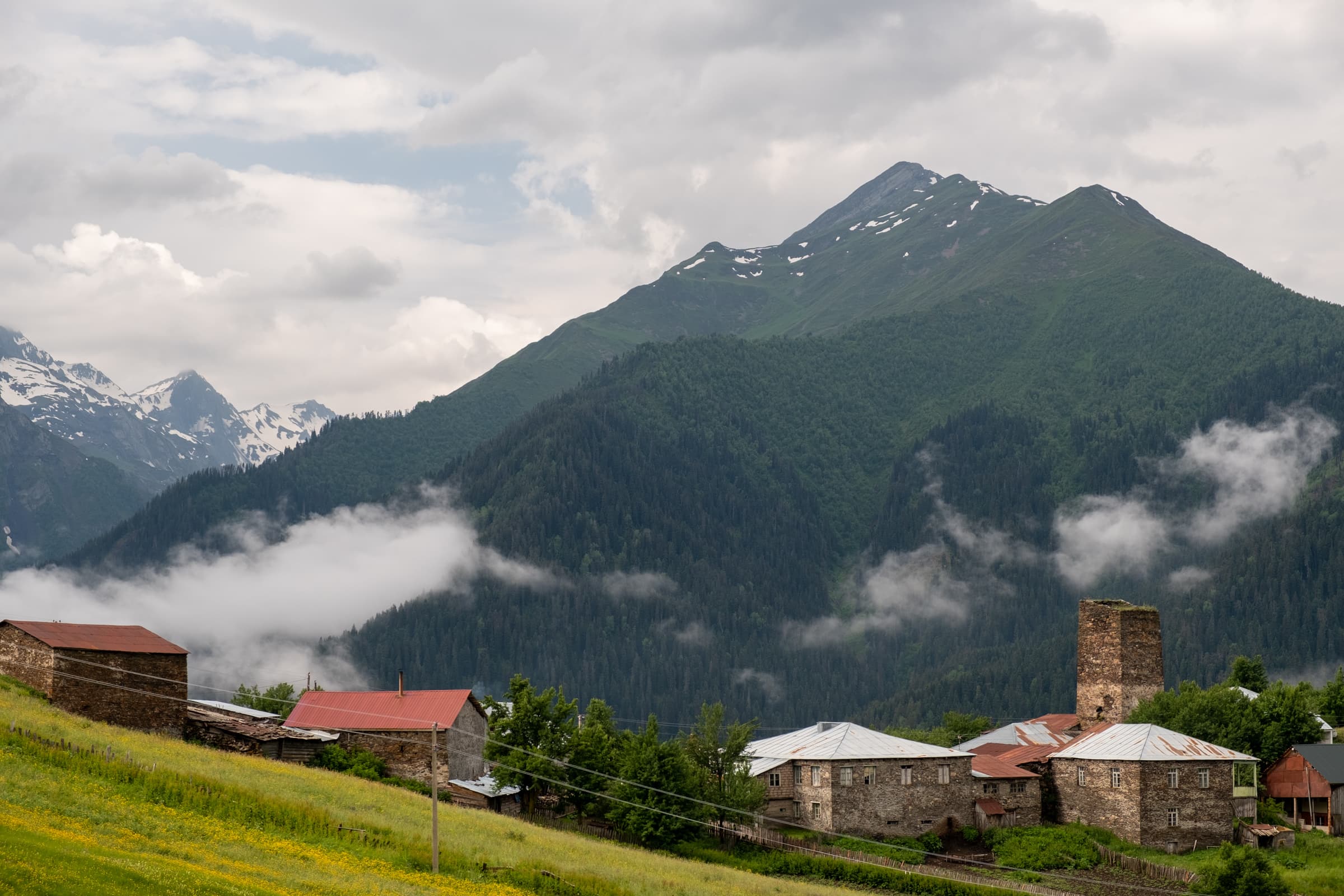
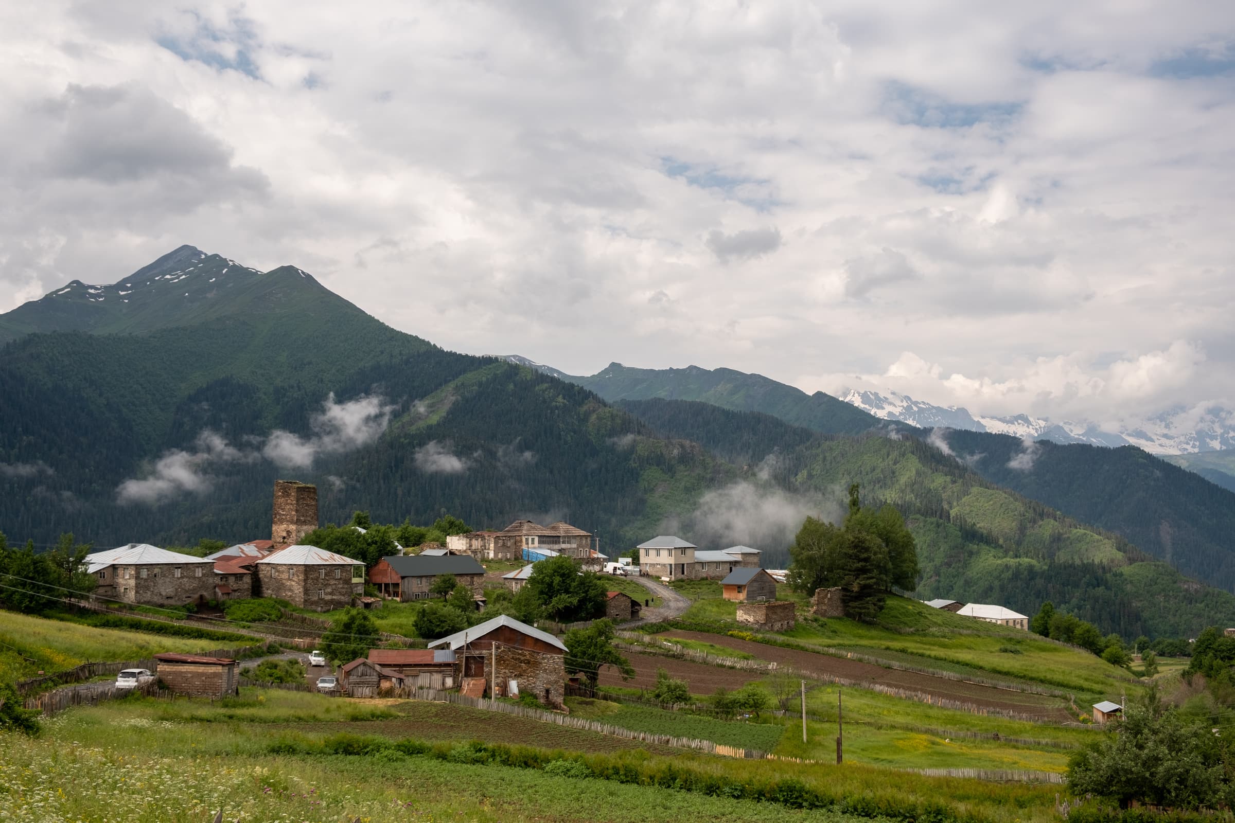
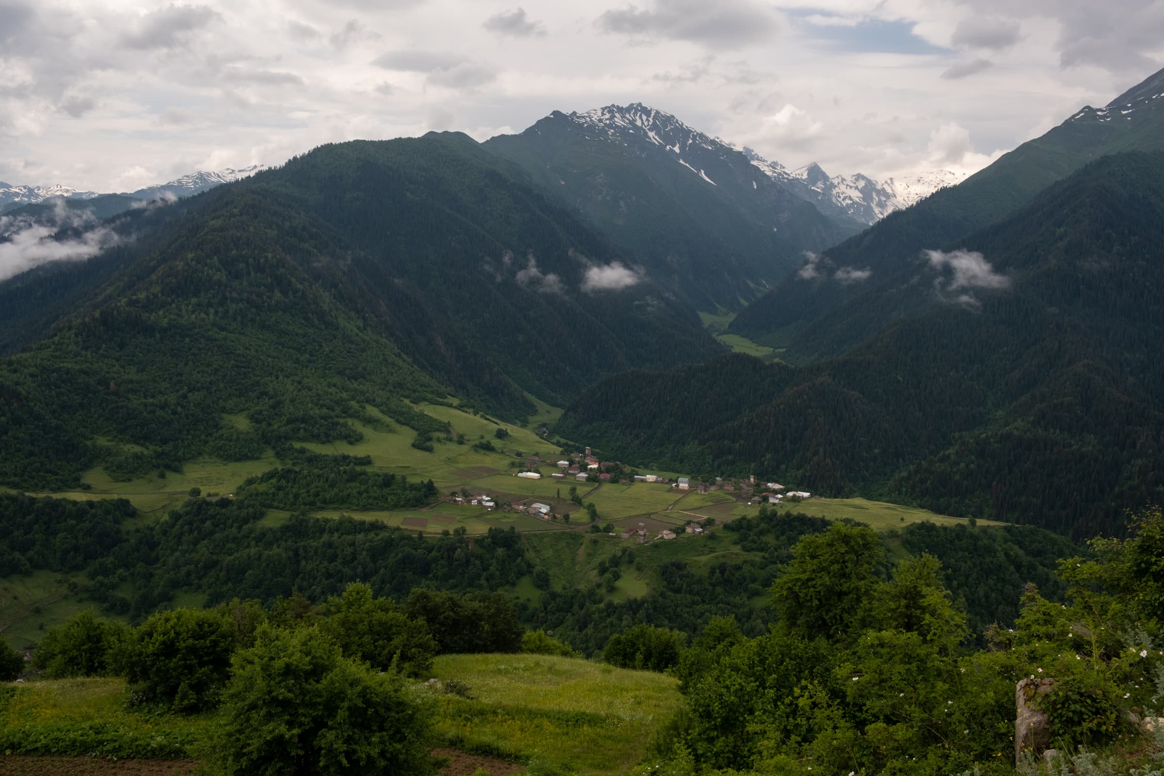
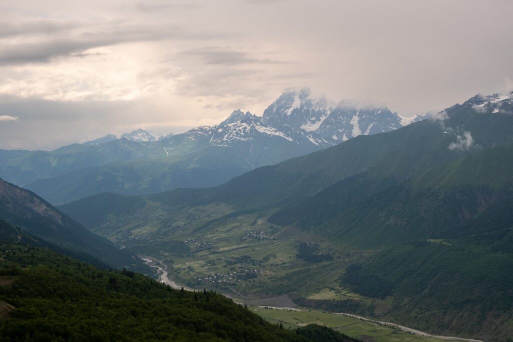
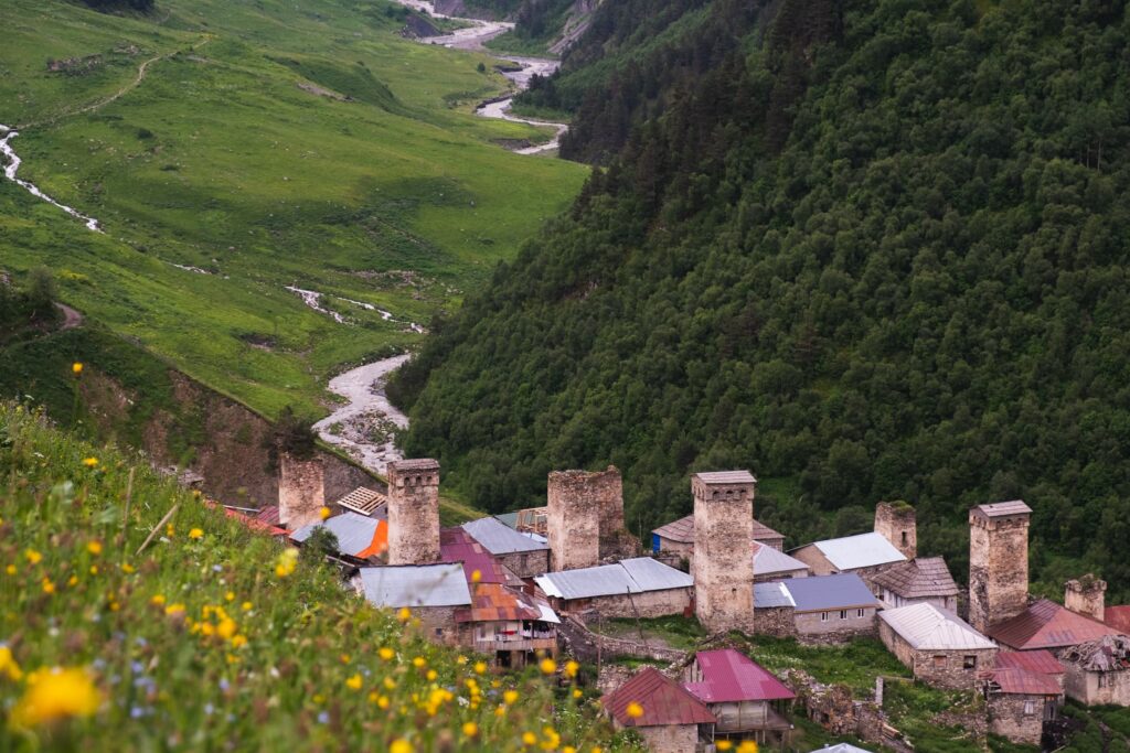
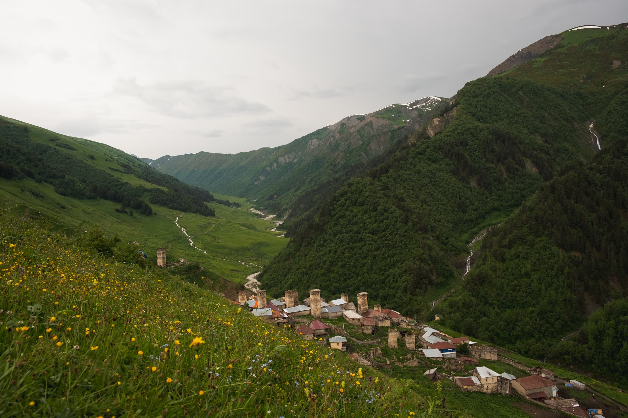
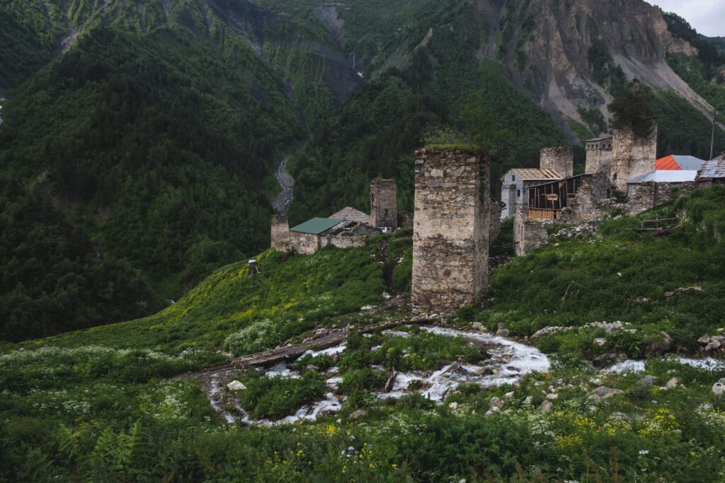
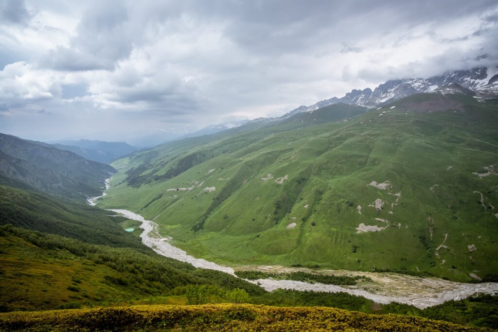
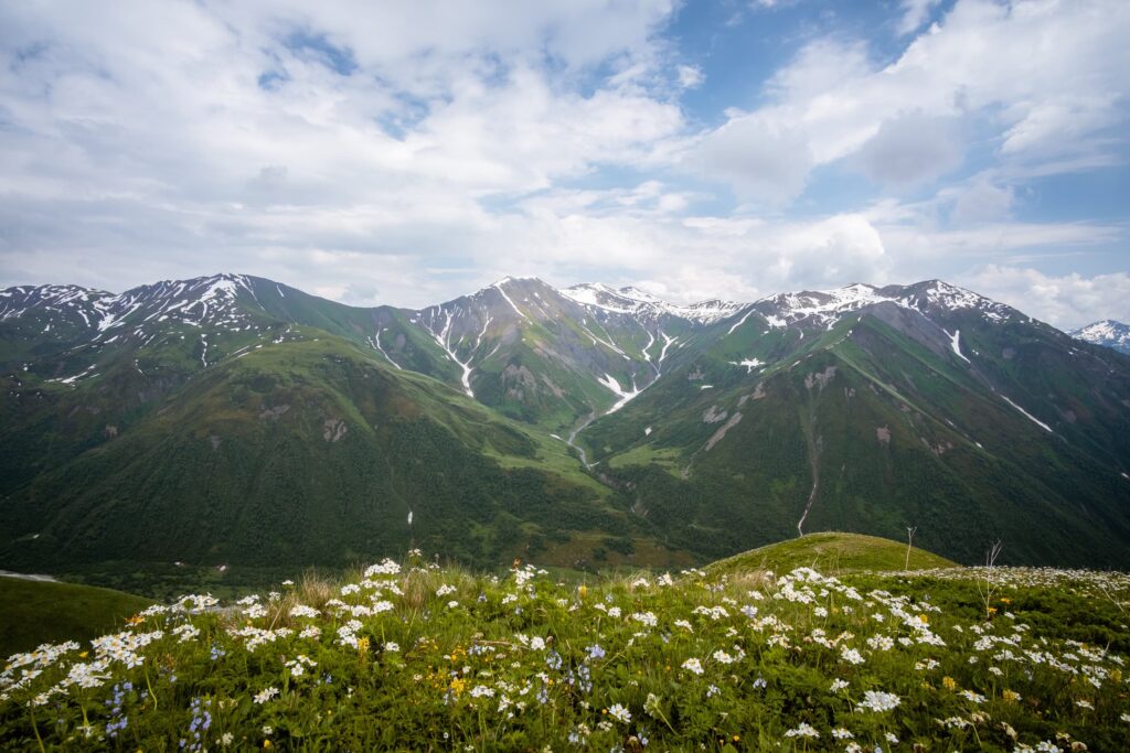
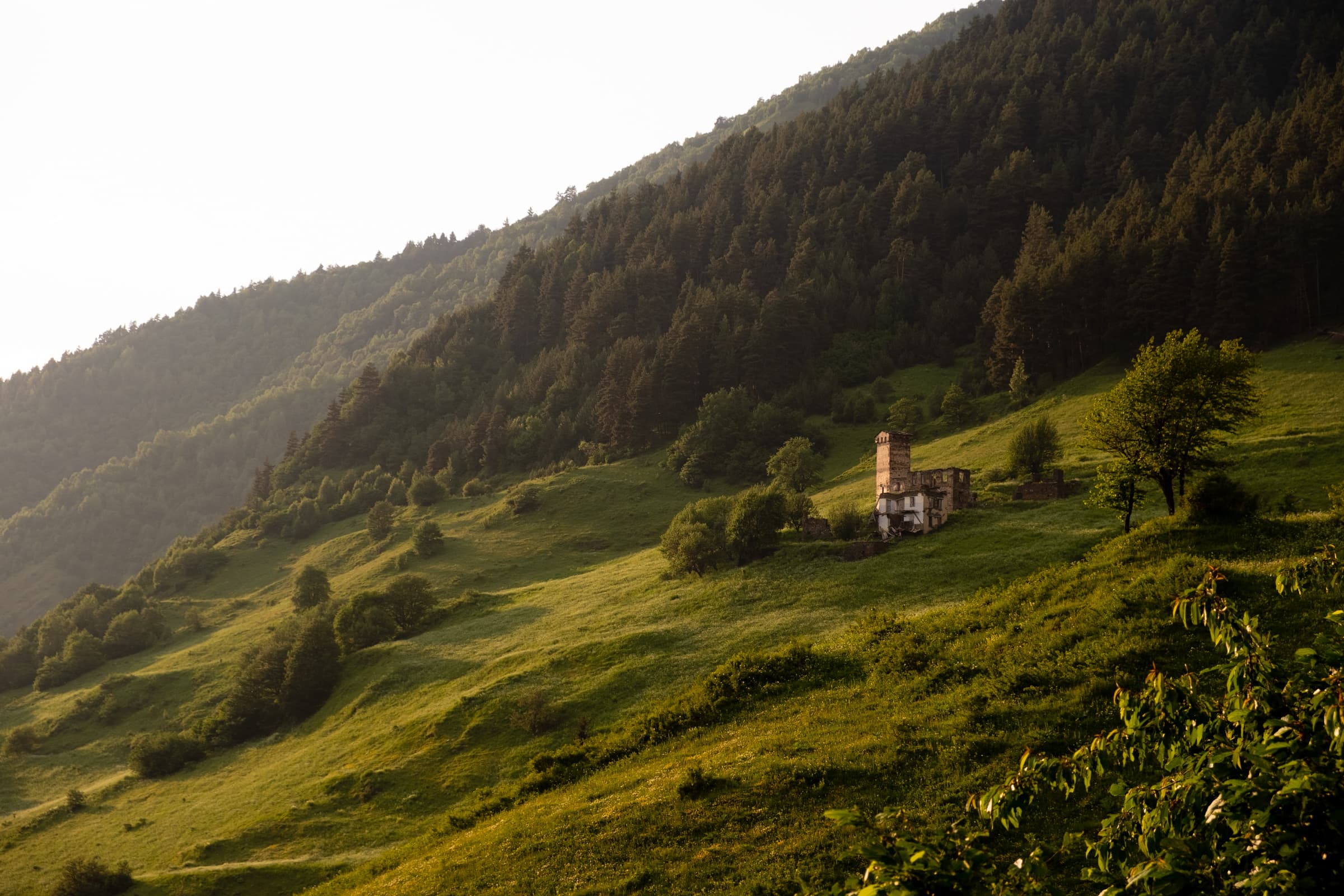
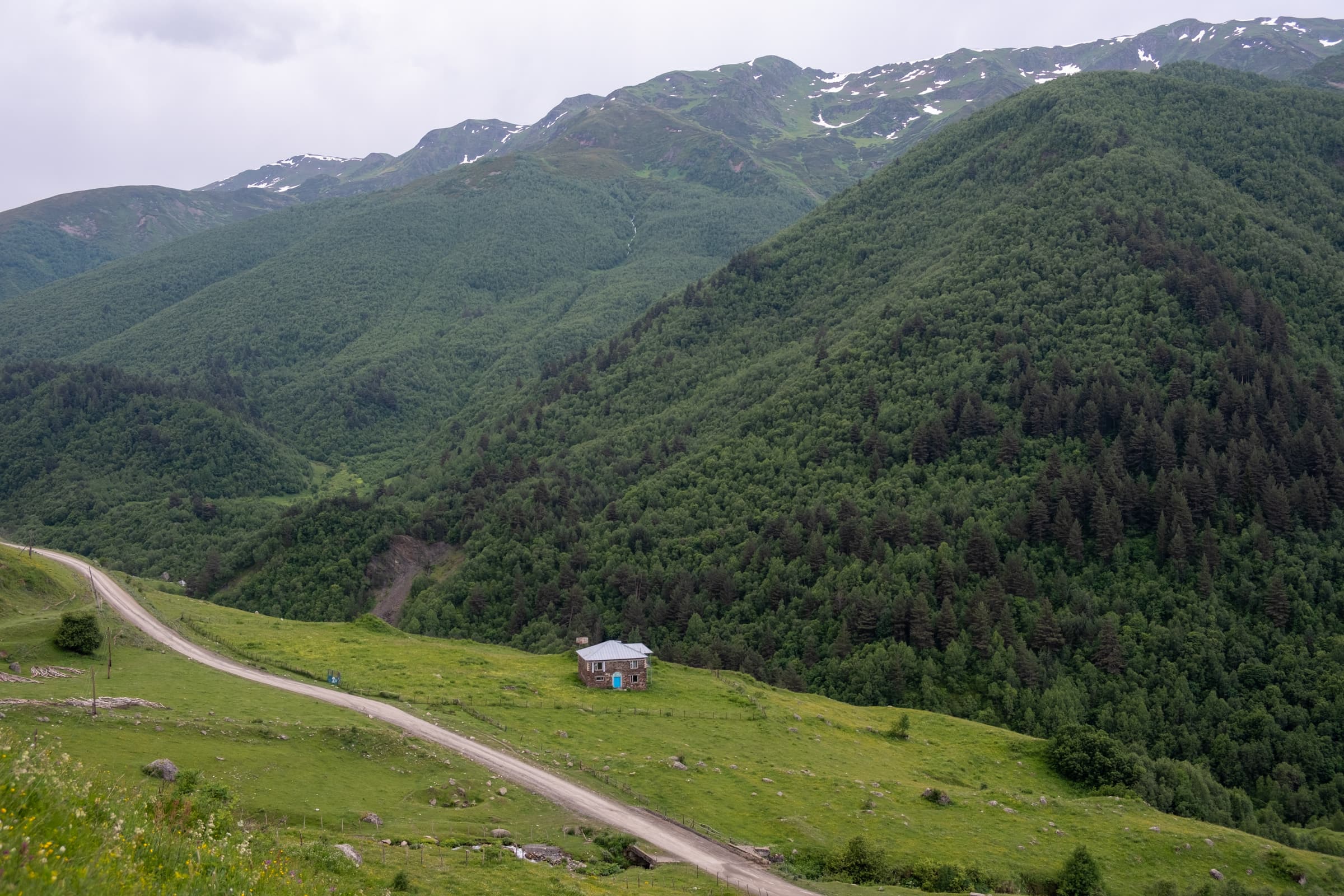
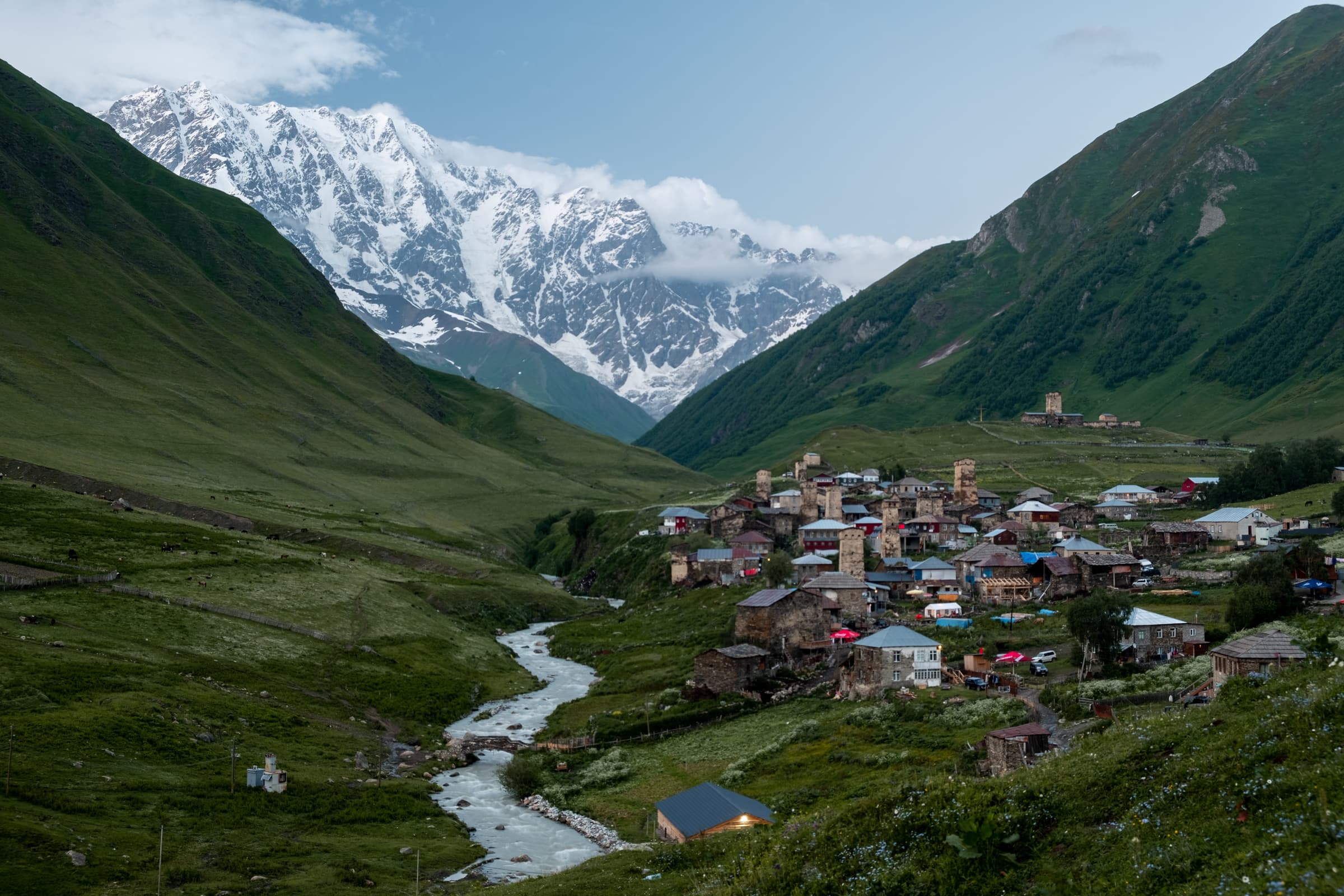
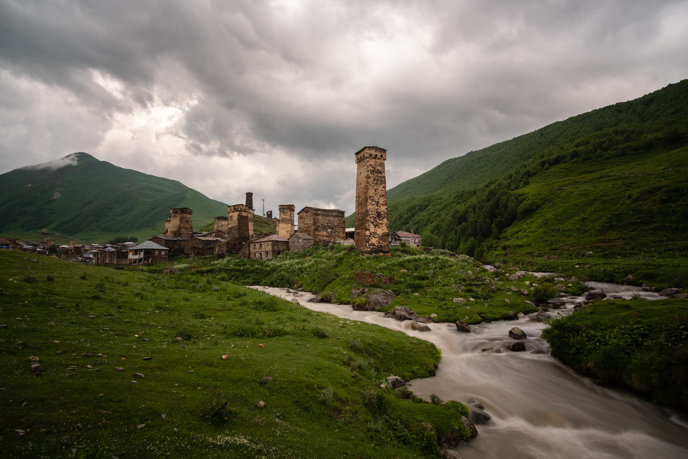
Ushguli is one of the essential reasons intrepid travellers yearn for Georgia. It’s the highest continually inhabited village in all of Europe. Actually, it’s a group of five villages nestled at an impressive 2100 meters elevation. Situated at the head of the Enguri valley, a stones throw away from Shkara glacier, where, even in the height of summer the towering peaks of the Caucasus mountains, the natural land border to Russia, are covered in snow. About 200 people live in the villages where six months of snow and regular road closures keep them isolated in the majestic but seemingly inhospitable environment.
If you’re after accommodation info, pack lists and travel information, just head right to the facts section at the bottom.
Skip to a specific day:
- Day 1 – Mestia to Tsvirmi
- Day 2 – Tsvirmi to Adishi
- Day 3 – Adishi to Iprali
- Day 4 – Iprali to Ushguli
The villages of Ushguli are somewhat inaccessible, contributing to the slow development of the area. Ultimately though preserving their charm and traditional architecture for thousands of years, including through various wars and purges. There is a road that leads from Mestia to Ushguli but it is fraught with difficulty. It’s paved only half way, with the remaining track encompassing death defying drops into the raging glacial runoff whilst the road itself is a slippy muddy soup with barely enough room for one way of traffic. Regular landslides occur, flooding, snow, etc. Couple this with the taxi mafia and regular local drivers with a notorious disregard of caution, what you are left with, to use the technical term, is a recipe for disaster. But I digress.
Ushguli: The right of passage in Svaneti
The best way to visit to Ushguli is by foot. And it’s the mountain trail we will take. The ancient pilgrimage through the Svaneti Highlands, a UNESCO World Heritage site, is the adventure we’ve been dreaming of through the cold winter. We’ve spent the winter mostly in Tbilisi working, and while we were planning to head out on the road in early spring, things took an ugly turn for the worse.
To cut a long story short Caroline’s appendix ruptured and we took the next two months easy while she was recovering. Our first adventure after the ordeal was a posh weekend in Samtskhe-Javakheti with a hike through Borjomi National Park. The weekend culminates in our car breaking down as we are supposed to drive across the country to pick up our friends at the airport. Always an adventure.
All this to say: we are not in the required state of fitness for the four day hike to Ushguli, so in preparation we decide to hike to and camp at Koruldi lakes as an intro, to acclimatise so to say. We find a campsite in Mestia and make it our home for the next few days.
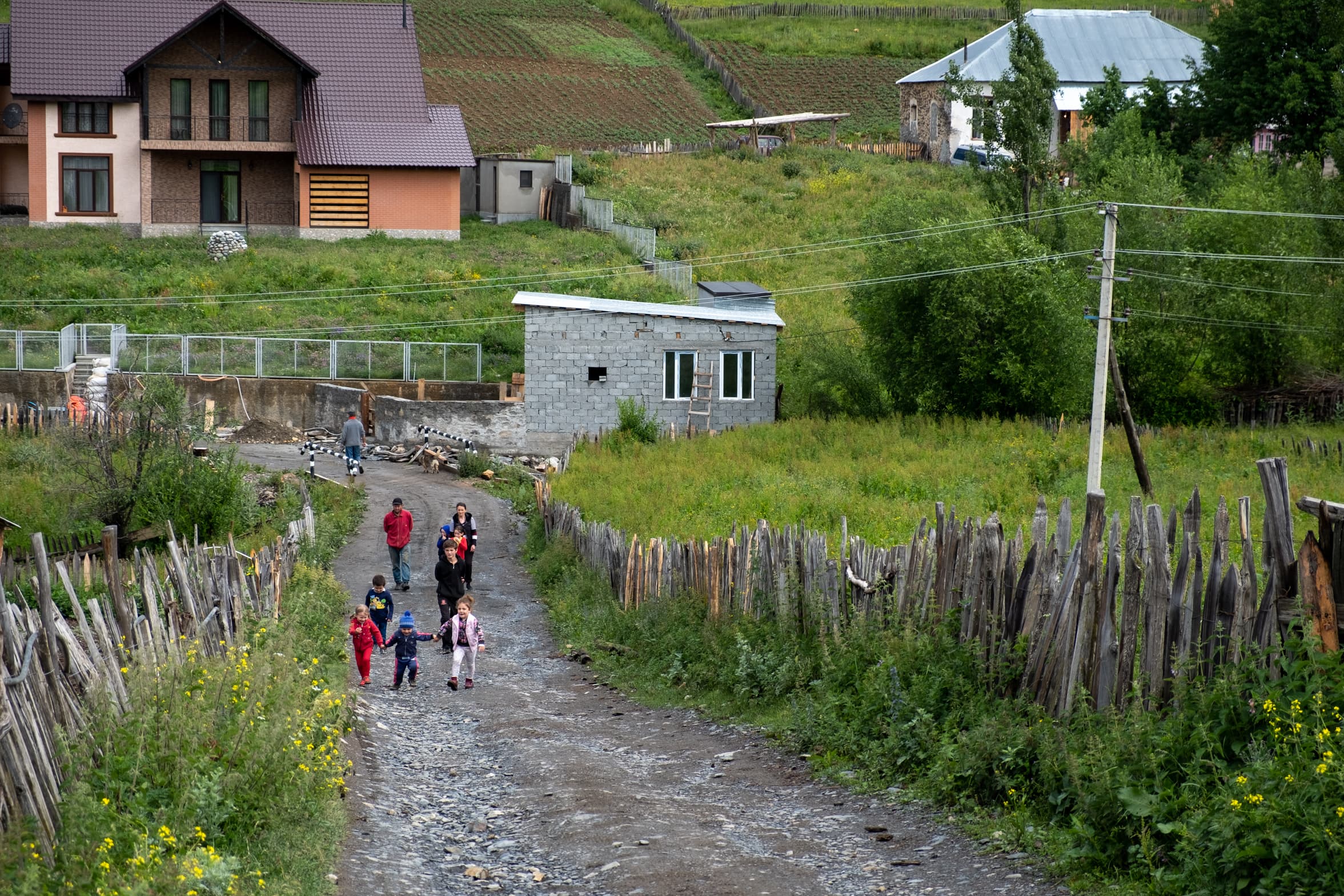
Mestia is a developed town and the regional capital of Svaneti. It can easily be reached by public transport (Marshrutka) from Zugdidi. Having a car, naturally we drive. The drive is a fantastic one through mountains, valleys and medieval villages with sweeping views of alpine scenery. The roads are mostly paved aside from some road works and it’s fairly simple to drive and navigate if one is used to driving in mountainous areas, at least in the summer season anyway.
Hike preparation
Whilst at the campsite we do all of the required planning, booking of guest houses, food shopping, route planning, GPX trail downloading and so on. The weather is fine and there are many other hikers and travellers at the camp site whom with we exchange information. The campsite owner is also a trusty source, full of tidbits of local wisdom.
Most of our route planning is done using the website of the regional hiking expert, Jozef over at Caucasus Trekking, in particular, the Mestia – Ushguli and Mestia – Ushguli via Tsvirmi guides.
The campsite owner kindly allows us to leave our car at the campsite for free while we hike the trail, even though we won’t return to stay. Top guy.
One of the final things we do, aside for some snack shopping is book a room in Old House hotel for our return from Ushguli. A bit more upmarket than our usual standard but we haggle a little discount and hey, by the time we will arrive we will have hiked over 60 kilometers with 4500 meters of elevation gain. We will absolutely deserve it.
Day One – Mestia to Tsvirmi
Having studied many of the hikes on the Caucasus Trekking website we decided to walk the alternative route of the traditional Mestia Ushguli hike. I suppose to add our own little flair on to the adventure, and well, because it sounds pretty beautiful as per Jozef’s description. Instead of hiking via Zhabeshi to Tetnuldi ski resort we will traverse Zuruldi Massif and descend into the village of Tsvirmi where we will stay the night before rejoining the traditional route the next day.
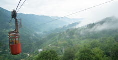
The only disadvantage is that the trail traverses some fairly boring roads for the first few kilometres, gaining some serious elevation. Luckily there is an alternative, we can take the cable car. Just outside of Mestia is the cable car base and it will whiz us up from 920 metres to 2348 meters, thus skipping a long, arduous and boring section of the hike. This will work greatly in our favour because the weather is due to turn in the late afternoon, with expected rain. We will have plenty of time to reach our destination and avoid the onslaught.
That, of course, would be far too simple. On the morning of the hike we pack away our tent and other belongings that we won’t need for the next days into the car. We set off for the cable car, crossing the Enguri canyon with its thrashing perilous waters, via the Svaneti Museum of History and Ethnography and navigate the road up to the cable car. Only to find it.is.shut.
Alternative route for the alternative route
We were assured it would be open. But it is absolutely not. Closed for maintenance, no estimated reopening time. It wouldn’t be the first time either. Last week we visited with friends and attempted to ride the cable car but it broke down before we got the chance to embark. Passengers were swaying in the wind in their stationary cable cars. The bemused tourists were waiting for at least an hour before it was fixed and they were released.
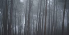
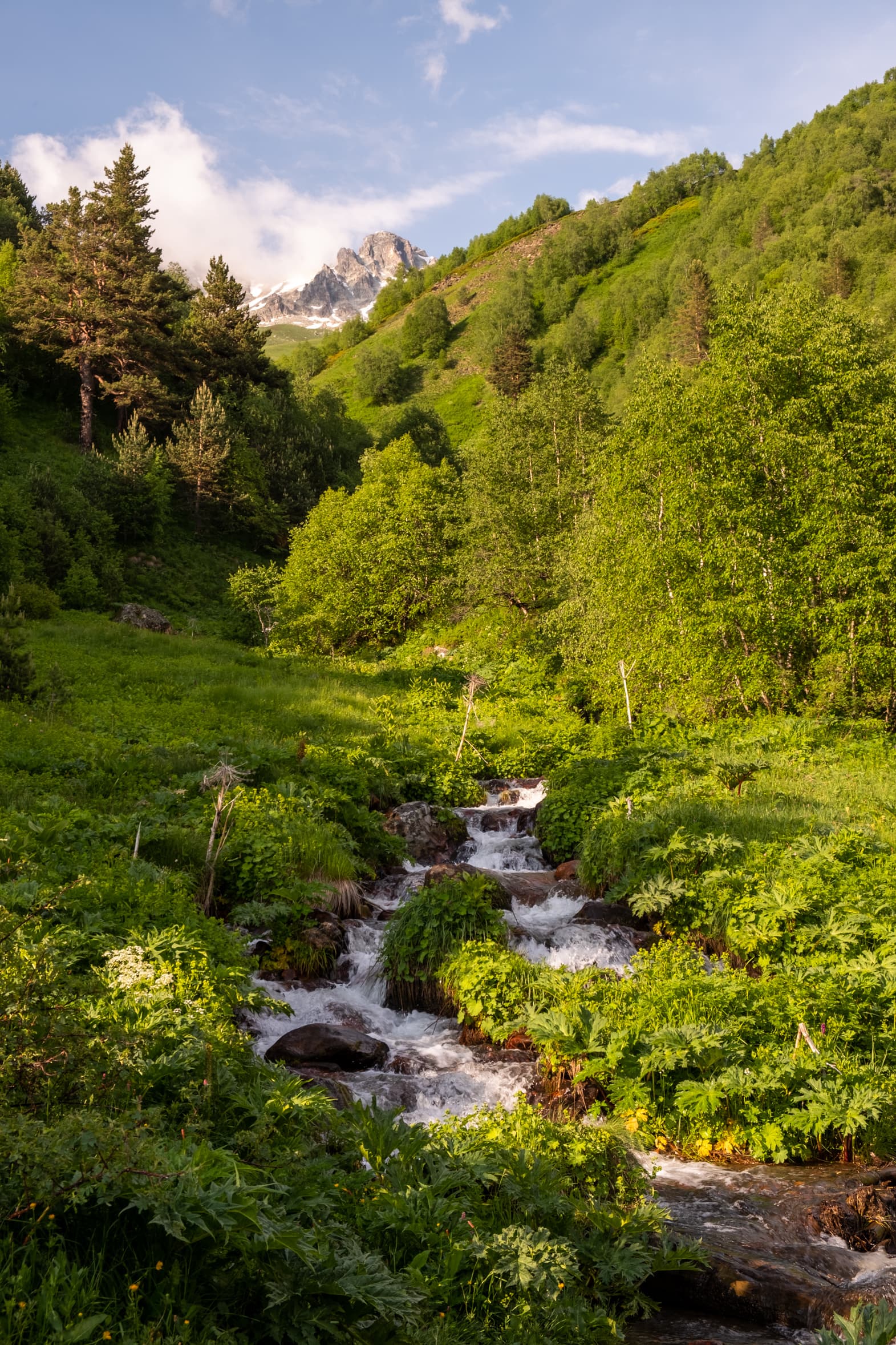
Regardless, we don’t have another option now, our guest houses are booked, the days are locked in. We must continue with the burden of an almost extra 1000 meter ascent. And my god is it boring. The sky is cloudy and the views are nonexistent. We climb switchback after switchback through endless forest. Due to our fitness, or lack of, it’s hard. Caroline has an excuse (I don’t) and it appears she is coping with it better than me. We are performing the hike in 50 meter height intervals taking small breathers in between. I’m so bored I’m thinking about building an elevation alarm app for my phone which rings a little bell after climbing a certain amount of meters.
As we near the top ski station the temperature drops and the clouds darken. The wind picks up and the first drops of rain trickle on to our foreheads as we gaze up to the heavens, apprehensive of the remaining journey.
There is an closed restaurant at the top cable car station where we rest on the outside eating area and snack some lunch. We don’t stay long, fearing the worst of the weather. From here the hike traverses the Zuruldi ridge towards the Mentashi transmitter where impressive panoramic vistas present themselves. Well, maybe in better weather.
Through rivers of mud
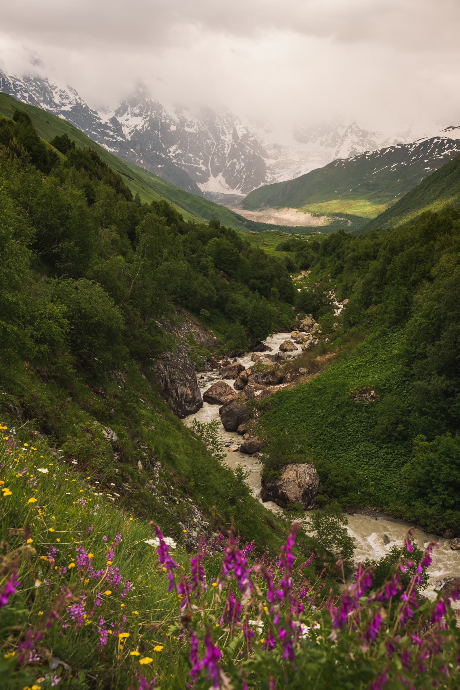
The rain starts to pour, the skies ever darker, there are no views. From Mentashi the path descends steeply through forest. It’s quite complicated in some places with steep drops, in fact it’s very scary. Exacerbated by the weather, even in better conditions it would be a challenging obstacle. However, now, it requires the utmost care and attention to navigate. The trail has turned into a stream, it’s slippy and in some places almost vertical. We carefully climb down using our trekking poles for balance and roots and plants to hold on to to avoid falling. It’s also not easy to keep track of the path with various other offshoots and promising redirections ultimately leading to sudden peril.
The Mestia – Ushguli via Tsvirmi guide at Caucasus Trekking describes an alternate route circumnavigating Mentashi hill which might be favourable if you are blessed with weather conditions similar to ours.
After the treacherous descent the landscape opens up to a meadow, where the trail navigates over the hilltop for around two kilometres with impressive views all around. This would, in good conditions, be the best part of the hike, but for us the rain is still thrashing down. We are soaked, it’s getting dark and we are hungry, longing for a warm room. We begin to wonder whether we will make it at all to Ushguli.
Descending to Tsvirmi
We cross the meadow and a herd of wild horses gallop past us, seemingly unfazed by the rains. After the meadow the trail turns into a small road which has itself turned into a ravenous brown river, which we navigate all the way down to Tsvirmi – no easy feat! It’s steep, muddy, and in some sections the water is almost half a meter deep with nowhere else to walk.
By the time we reach the outskirts of Tsvirmi we are covered in mud and exhausted, however, there is one more, or even two more challenges to solve. Find a place to stay, because, we read, due to being almost untouched by tourism, it’s not required to pre-book a guest house in Tsvirmi. It’s now dark and solemn, an easy task turned hard. Before we can get to that though, we must directly cross a ferocious barking dog, undeterred by any stone throwing, hand waving, shouting or sweet talking. It takes us a good thirty minutes to pass and then it continually lunges and barks from behind as we shake our walking sticks at it.
The situation is aggravated by the fact that at the campsite in Mestia we learned of a girl who was attacked and bitten by a local stray dog and had to be rushed to hospital.
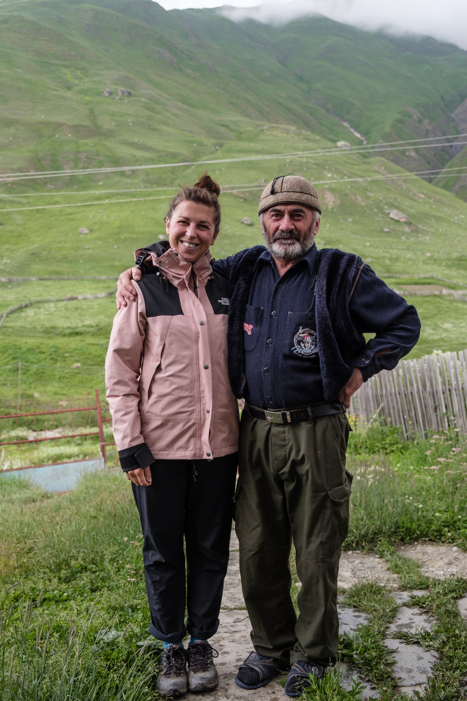
The final challenge is complete when we call at Guesthouse Shorena and are quickly invited into a cosy home, by a burning fire. A sympathetic couple tends to our every need with warmth and kindness. Our clothes are hung to dry and a feast is prepared. The troubles of the day are behind us, a warm bed awaits and a new day shall bring good fortune.
More adventures in Georgia
Black Rock Lake: 3 Day hike from Lagodekhi
Our time in Georgia is coming to an end and while we’re sad, we’ve got big plans for the summer. We are going to drive through Central Asia on the Silk Road with a final destination of Kyrgyzstan. A country not many people have ever heard of. When the summer is over we will head […]
Wild, dramatic, mystical: A trip to age-old Khevsureti
We’ve seen the pictures, we’ve heard the stories. Now we want to go to Khevsureti. Does our car want to though? Sometimes I’m glad I can’t personally ask Vlad, our trusty Opel Astra. Khevsureti looks like a fascinating place. Medieval tower villages, pagan rituals and lots of myths, folktales and history, all perched away in […]
The ultimate guide to canyons and swimming spots in Georgia
It seems you guys loved our guide to waterfalls in Georgia so we’re rolling out the next one to help you escape Sakartvelo’s summer heat! Canyon dig it?! Spending a summer in Georgia, we realised just how many beautiful canyons there are. And while Martvili and Okatse are undoubtedly beautiful, they frustrate you at the […]
Daytripping through Kvemo Kartli to Dashbashi Canyon
City life became a bit too much for us lately. We’ve only been in Tbilisi for a month but after spending so much time in the nature before that, combined with somewhat stressful jobs after not working for while, we need a little escape. Hikes are difficult at this time of the year and unfortunately, […]
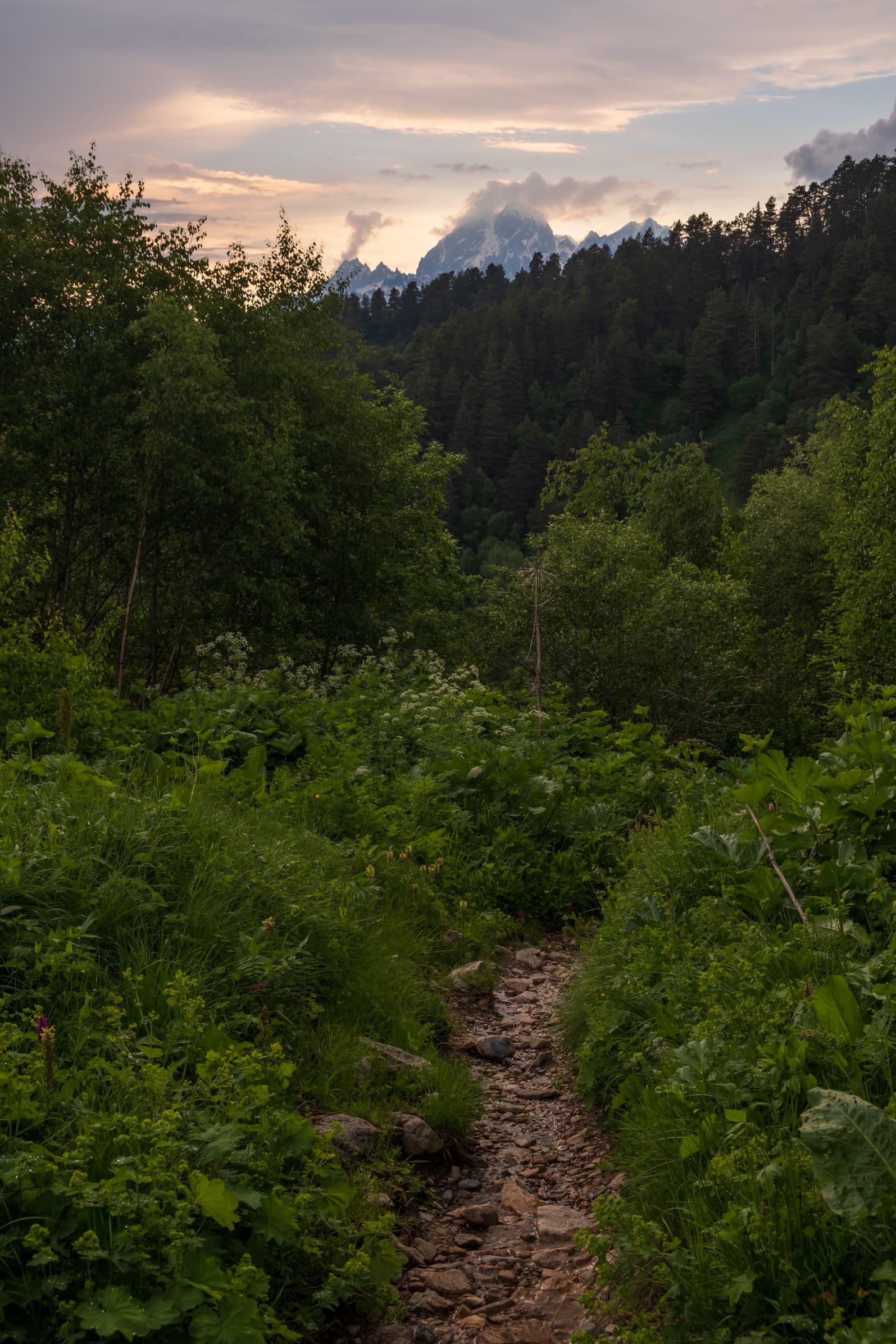
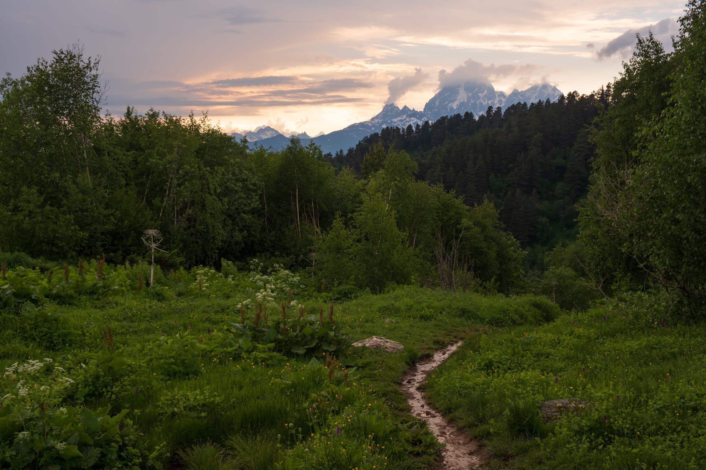
Day Two – Tsvirmi to Adishi
After a long comfy sleep we wake up to the sound of freshly baked Georgian bread, Shoti. A delight we discovered far too late during our adventures around Georgia, a delight we make sure to indulge in as much as humanly possible during our final weeks in the country. Nothing beats it fresh. The rest of the breakfast is mouthwatering too, Khachapuri (a traditional baked cheese-filled bread), fried potatoes and homemade jams, all the good stuff for a long day of hiking toward Ushguli.
All of our clothes are dry and after a massive breakfast our lunch packs are prepared and we go over the route for the day and check the weather forecast: sunshine with stormy intervals. Typical summer mountain weather. The lunch packs mostly consist of more bread, cheese, tomatoes and cucumber. However, they vary from guest house to guesthouse.
We wave goodbye and the vast expanse of the Caucasus mountains opens up all around us, a scene we’re yet to witness, arriving in the dark we had no appreciation for our surroundings. The rain is finally gone, instead fluffy clouds and fog fill the valleys and crevices.
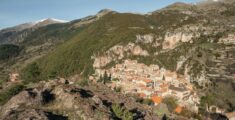
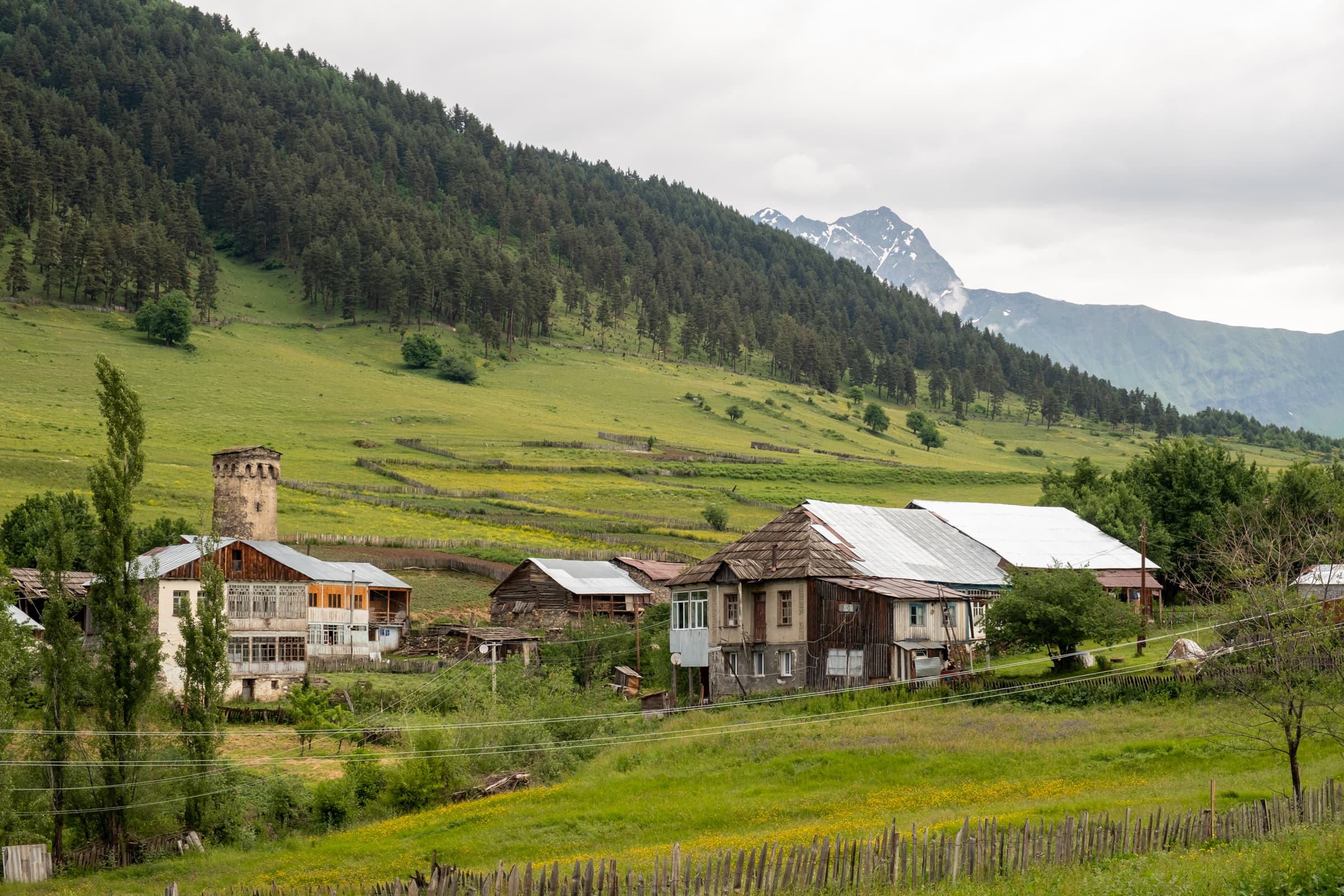
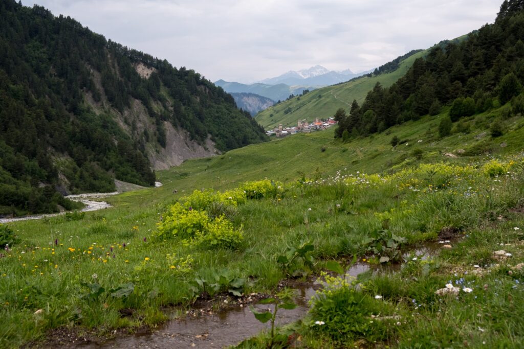
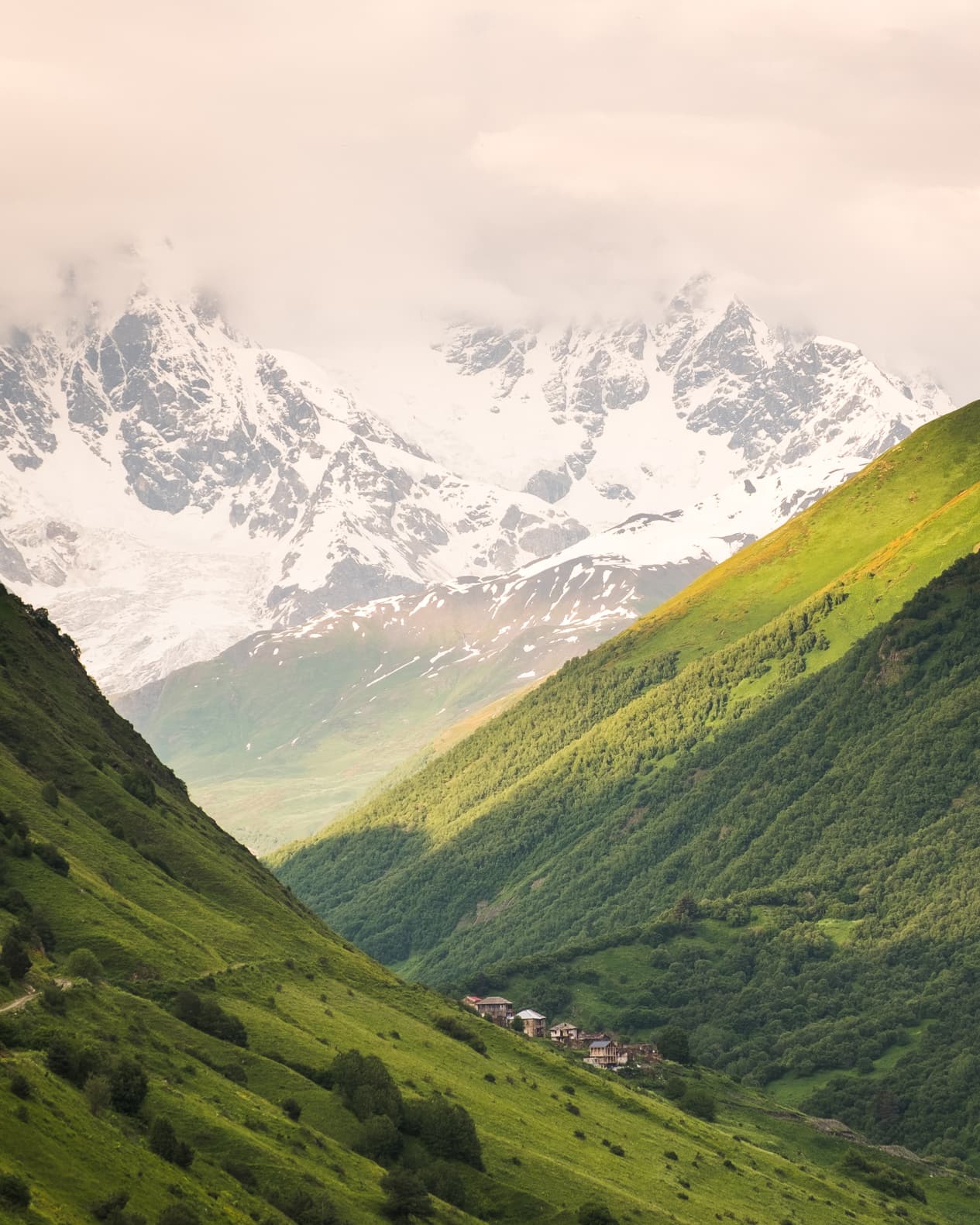
Tsvirmi is situated on a plateau on the side of the Zuruldi ridge, just above the valley floor with lovely views all around. The village is alive, but not with tourists or hikers, of which none can be seen, but with locals. Children on their way to school, farmers tending to their animals and the fields, others simply out for a chinwag.
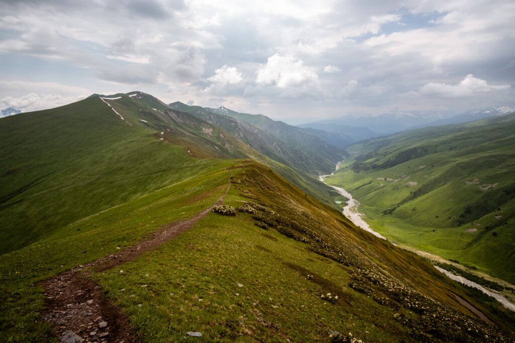
Traversing Mount Tetnuldi
We follow the high road which skirts around the mountain showcasing views of tiny villages on the valley floor with the odd iconic medieval tower that Svaneti is so famous for. A mountain football pitch is wedged in an ever so rare spot of flat ground. Around the next corner the road joins Ughviri Pass, the main road into Ushguli. We turn right onto the main road and then immediately left a few meters later onto the road to Tetnuldi ski resort. The road climbs up the mountain, winding through forest with views of Mount Ushba and various villages around Zhabeshi until a track branches off at the lower cable car station. It is possible to take a high path around to Adishi; consult the Caucasus Trekking guide for more info, search for Upper trail to Adishi.
The skies are rumbling and lightning strikes. After being terrorised at Koruldi lakes all night by a menacing thunderstorm and with the prospect of little to no tree cover on the upper trail, wanting to avoid overexposing ourselves, we opt for the lower trail.
A few hundred meters down the trail we encounter a small snack bar, albeit just closed. The owner is packing away in anticipation of the storm that is now in full force. We take cover under the umbrellas, praying the owner doesn’t want to pack them away. Luckily for us it’s short lived; we eat half of our lunch and get back on the trail.
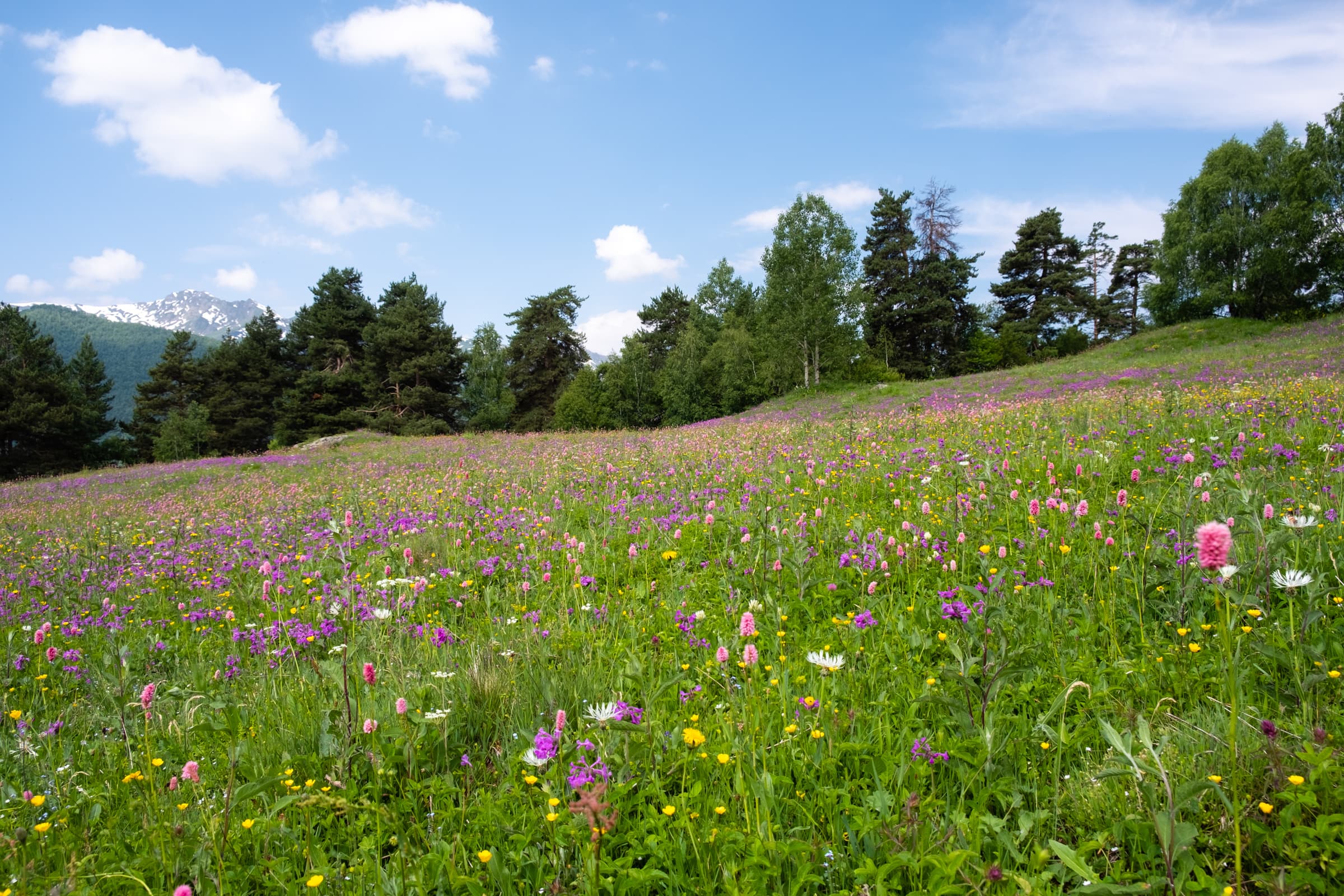
Idyllic streams and meadows
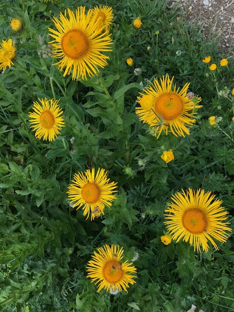
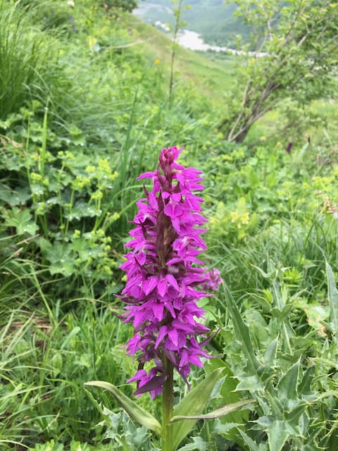
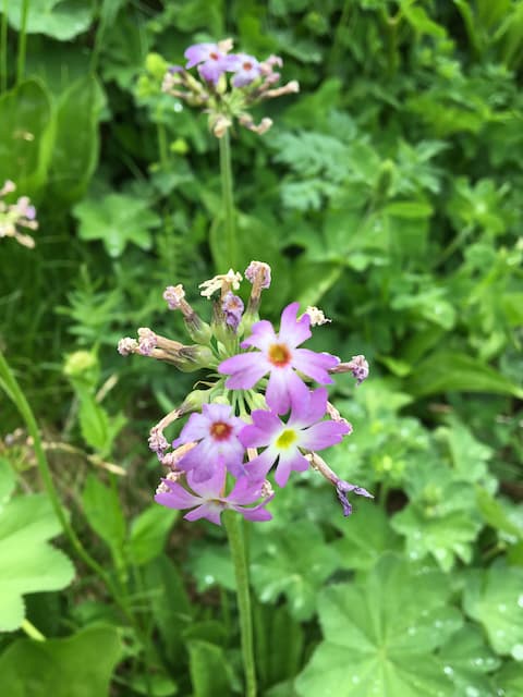
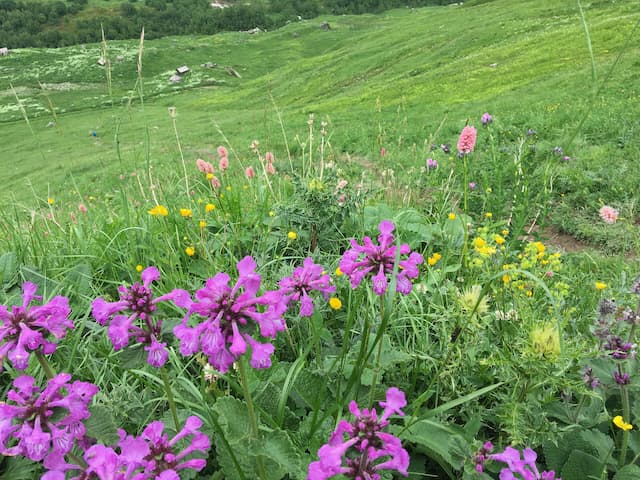
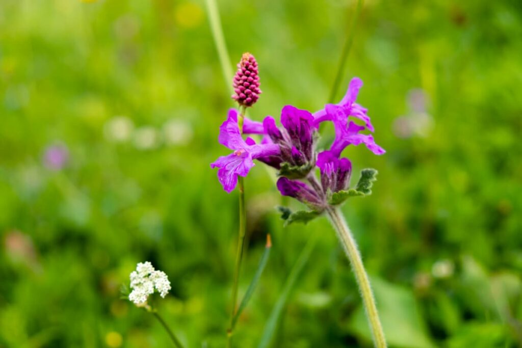
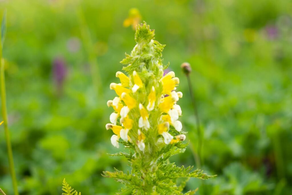
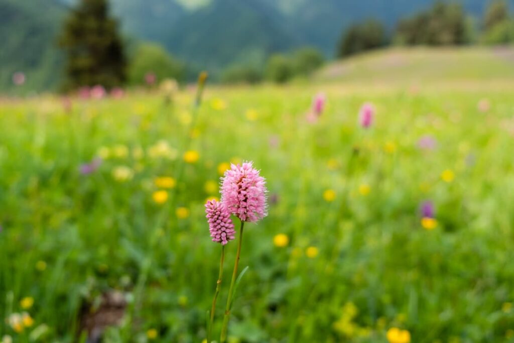
This part of the hike is the nicest of the day, lush green meadows full of wild flowers line the trail, tiny streams cross the path and sometimes follow the course of the path for a short while, jagged peaks behind us, gentle green hills in front. The trail navigates around Tetnuldi for a few hours. We eat the remainder of our lunch in a patch of grass by a stream, looking up to a waterfall with a precarious limestone peak peeking over the top.
The paths are quite tricky in this section, since they function as both hiking trails and stream beds. There is an abundance of water, mud and marshes surround the trails. Helpful planks of wood are placed in the worst sections to aid crossing but it takes some serious skill to not lose a boot in the mud.
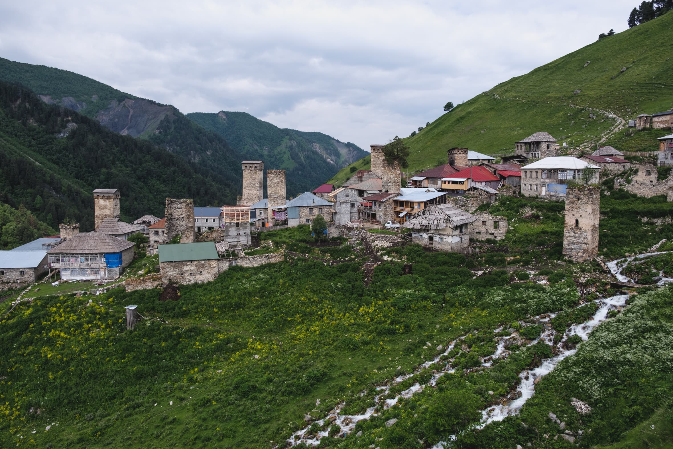
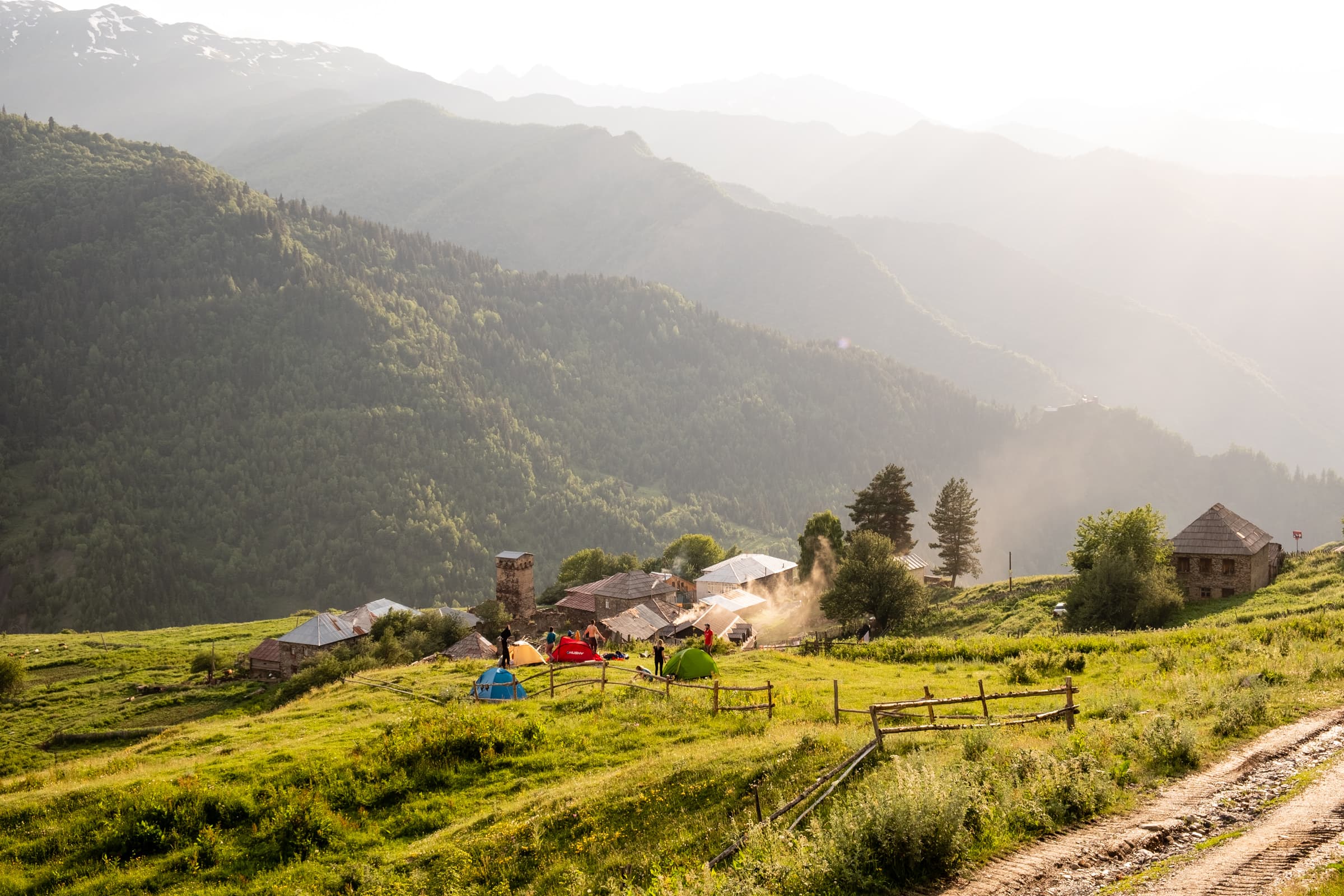
The hidden medieval village of Adishi
The final part of the hike navigates through some forest before descending into the valley, where at the last possible minute the medieval towers of Adishi reveal themselves and we are transported back to the middle ages. We descend on narrow, washed away streets to the centre of the village. Cows and sheep block the way. The muddy floor is awash with animal excrement, local male eyes pry and snarl as they drink cans of strong beer. We try to find our guesthouse without looking like complete outsiders, and of course immediately miss the turn and have to backtrack past the piercing stares.
We find our guesthouse and immediately the female host is kind and welcoming. The room is a shared dorm with around 6 beds in it. Our dorm mates insist on keeping the door open all night so that no one is woken up “if someone has to use the toilet” (Like how often would that happen?!) and the hallway in front of the room is a gallery with no windows, only the frames are left. The room is freezing.
We queue to use the shower but it appears the drunk man of the house has used the remaining hot water so we join the rest of the guests in the kitchen around the dinner table. The fire is burning, the electricity flowing, the food delicious and the company heartwarming. We spend the next few hours in the company of other like-minded individuals, sharing stories and discussing the growing political unrest garnering in Tbilisi, our home for the winter, which now feels a million miles away.
More beautiful hikes around Europe
The most beautiful winter hiking trails in Carinthia: Part 1
We spent a whole winter in Carinthia during lockdown and what better way to alleviate the stresses of the pandemic and world in general than enjoying the beautiful outdoors? Carinthia has a great deal to offer when it comes to landscapes, hiking opportunities, skiing and in general all adventure sports including winter walking. Winter 2020 […]
Wild and without: Aigüestortes i Estany of Saint Maurici National Park
In the heart of the Pyrenees, we wake up from a cosy nights sleep in our tent, it was cold but not excruciatingly so. Wide awake, freshened and energetic to explore. We came to Espot to experience the mighty Pyrenees mountains. We decided randomly on the national park Aigüestortes i Estany of Saint Maurici. Well […]
Wild and without: 3 day trek in Karwendel Alps – Part 1
Of all the things we wanted to do while travelling – long distance trekking was one of the most important. We wanted to escape the hustle and bustle of the city and retreat to the nature. To get as far away as we possibly could by ourselves, by our own means. We wanted to challenge […]
Wild and without beer at Grüner See
Grüner See (Green lake, I’ll let you guess why) is a karst lake in Styria, Austria. No one knew it even existed until Ashton Kutcher posted about it on Facebook a few years back. After that, the council had to impose a swimming and diving ban to protect the environment due to the tourist masses. […]
Day Three – Adishi to Iprali
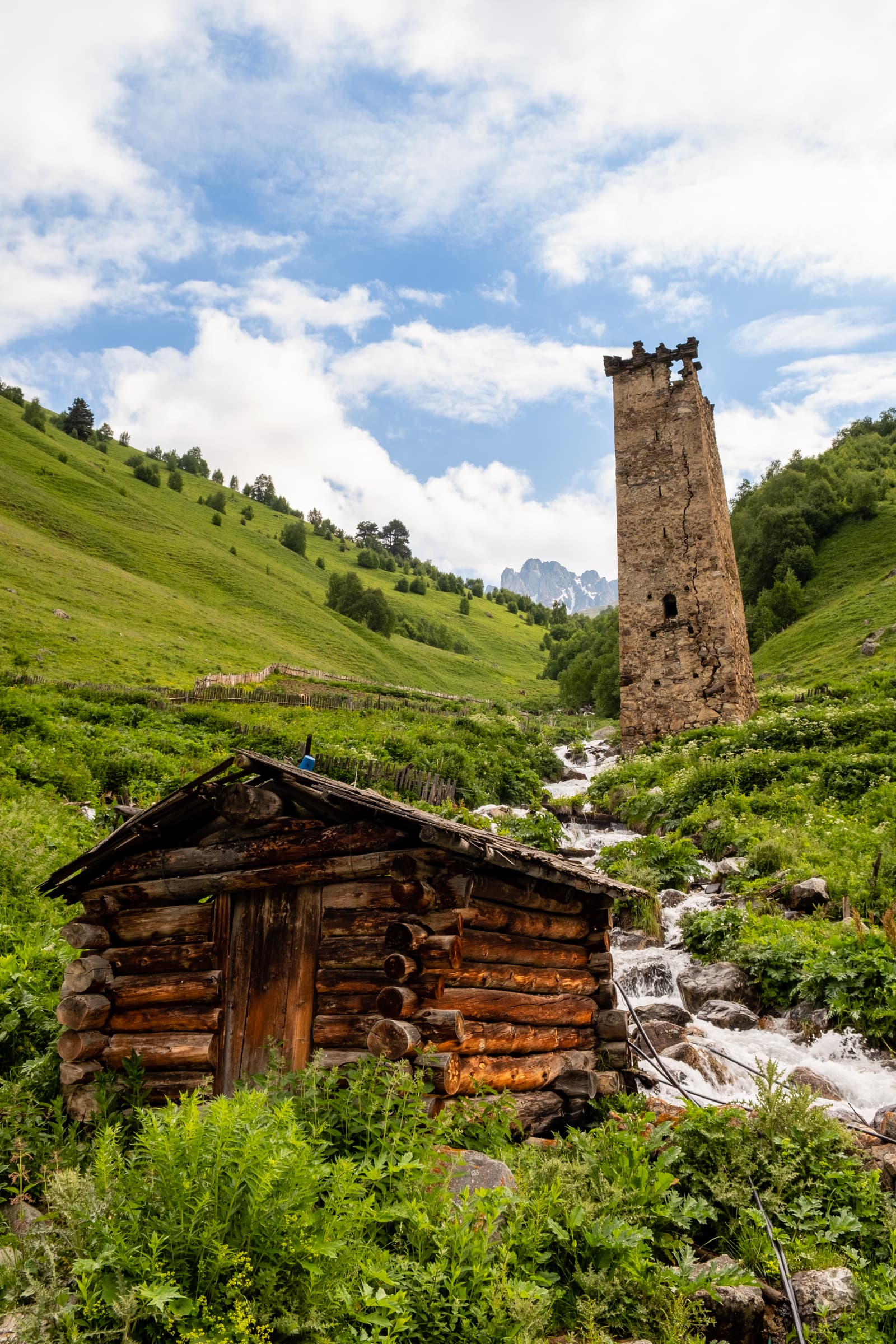
We are both looking forward to the hike today because supposedly it’s the most beautiful section of the multi-day trek to Ushguli. There is just a little complication to kick-start the day with, we must ford the Adishi river. That might sounds like an easy task but I can assure you it’s not. Crossing raging glacial run-off with a huge rucksack on is not something to scoff at, one foot wrong and a fall could have you crashing down waterfalls and through deep gorges with a fair few broken bones.
We leave the guest house as early as we can, without being rude to our hosts who put together another delicious and calorific breakfast. It’s about an hour’s walk to the river crossing point, but it takes us a little longer. The views back down to Adishi are stunning with a waterfall forming a natural border to the village, dilapidated Svan towers flank the village and mountains surround in every direction.
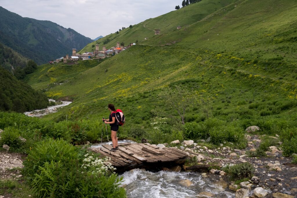
Fording the glacial river Adishischala
Getting to the river crossing point at the bottom of Chkhunderi Pass early is important because the water level is lower. As the sun rises higher and the temperature warms, the glacier begins to melt faster, this in turn fills up the river making the crossing harder and more dangerous. Luckily for some, local entrepreneurs have capitalised on the lack of a bridge and offer rides across the river for the princely sum of 25 GEL (around €10) or more per person. If you want to take a horse, just head to the crossing point and you will find the locals hanging around (at least in the main hiking season anyway). Otherwise, ask at your guesthouse.
If you decide, like us, to avoid the extortion, prepare yourself. If you have large packs, do not attempt the crossing without trekking poles. Make sure to explore the area and find a suitable crossing.
The crossing is a challenge like no other. The force at which the river flows is incomprehensible. To even find a spot which looks remotely passable is a feat, and then there are another four parts of it to cross. Then there is the cold. The water is so cold it numbs your feet and when you exit it burns. It burns so much it makes you squeal and squirm in pain. The only saving grace is our trekking poles which help keep us balanced, but sometimes make it worse: the force of the water almost makes it impossible to steady them.
After crossing we take a break and watch a few other people struggle across. We pass on our knowledge of best crossing spots and even chuck our trekking poles to one struggling guy who almost falls in.
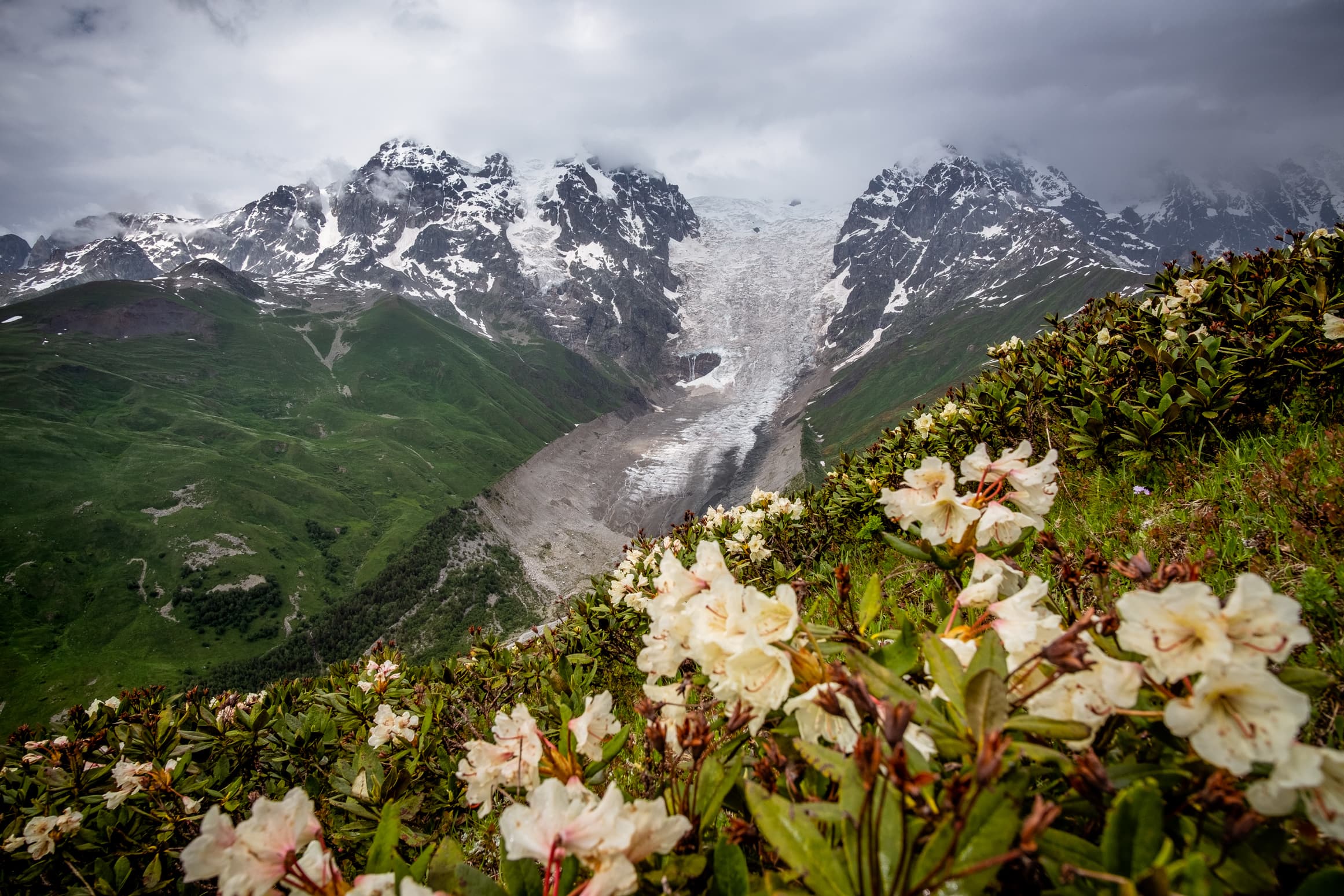
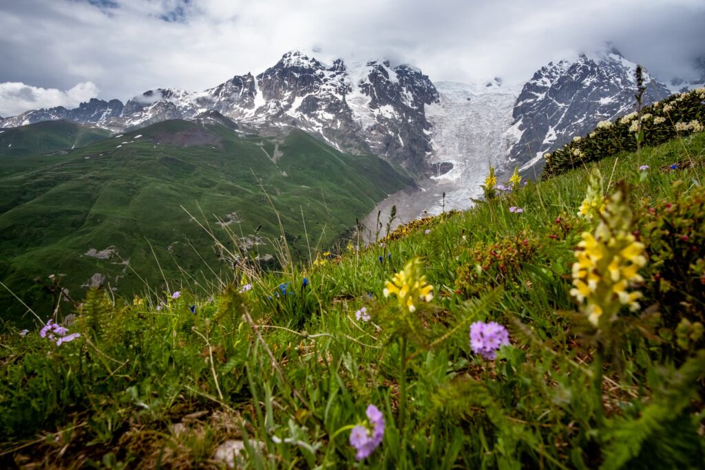
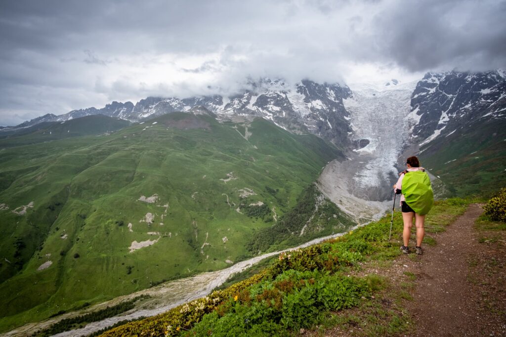
Majestic views at Chkhunderi Pass
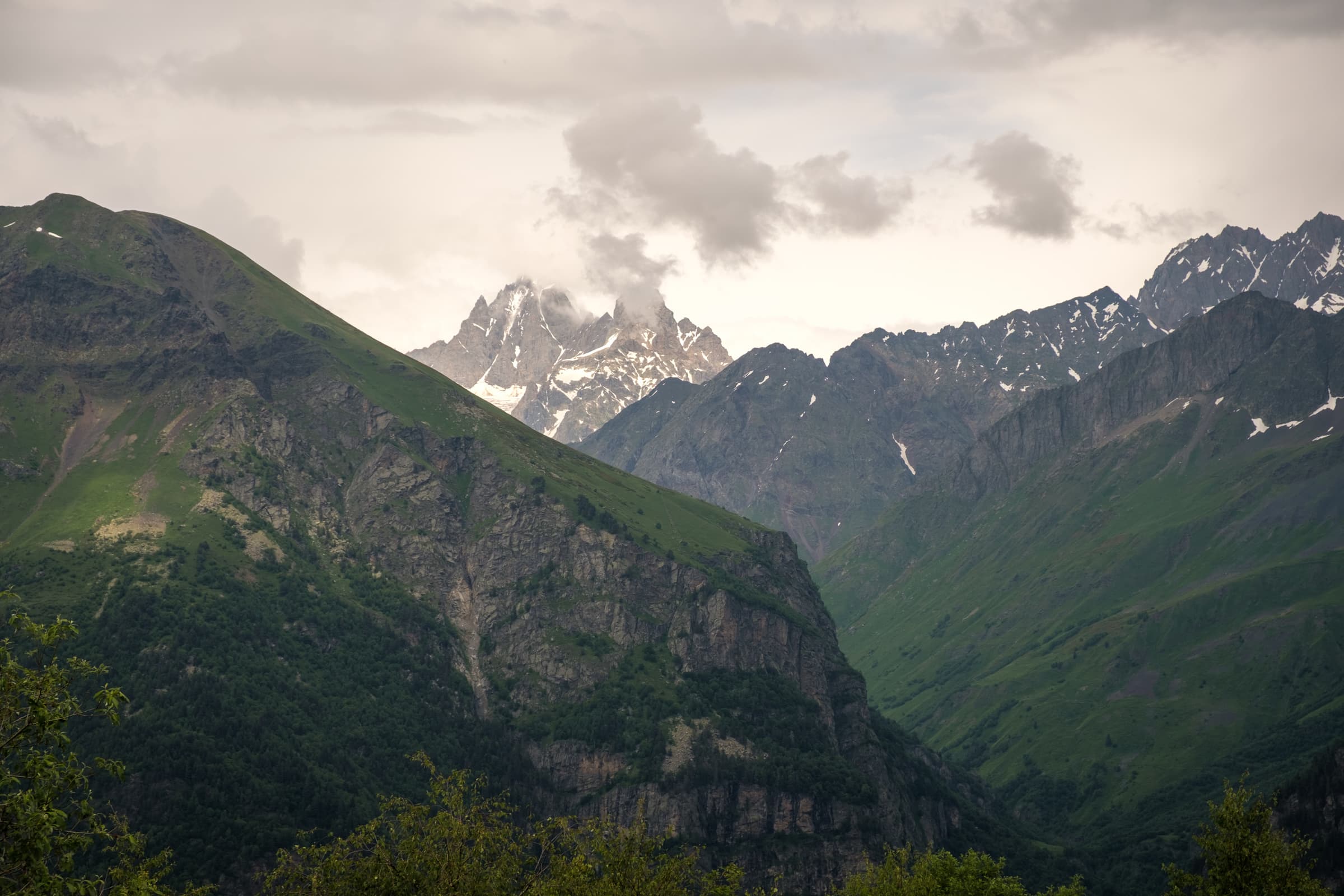
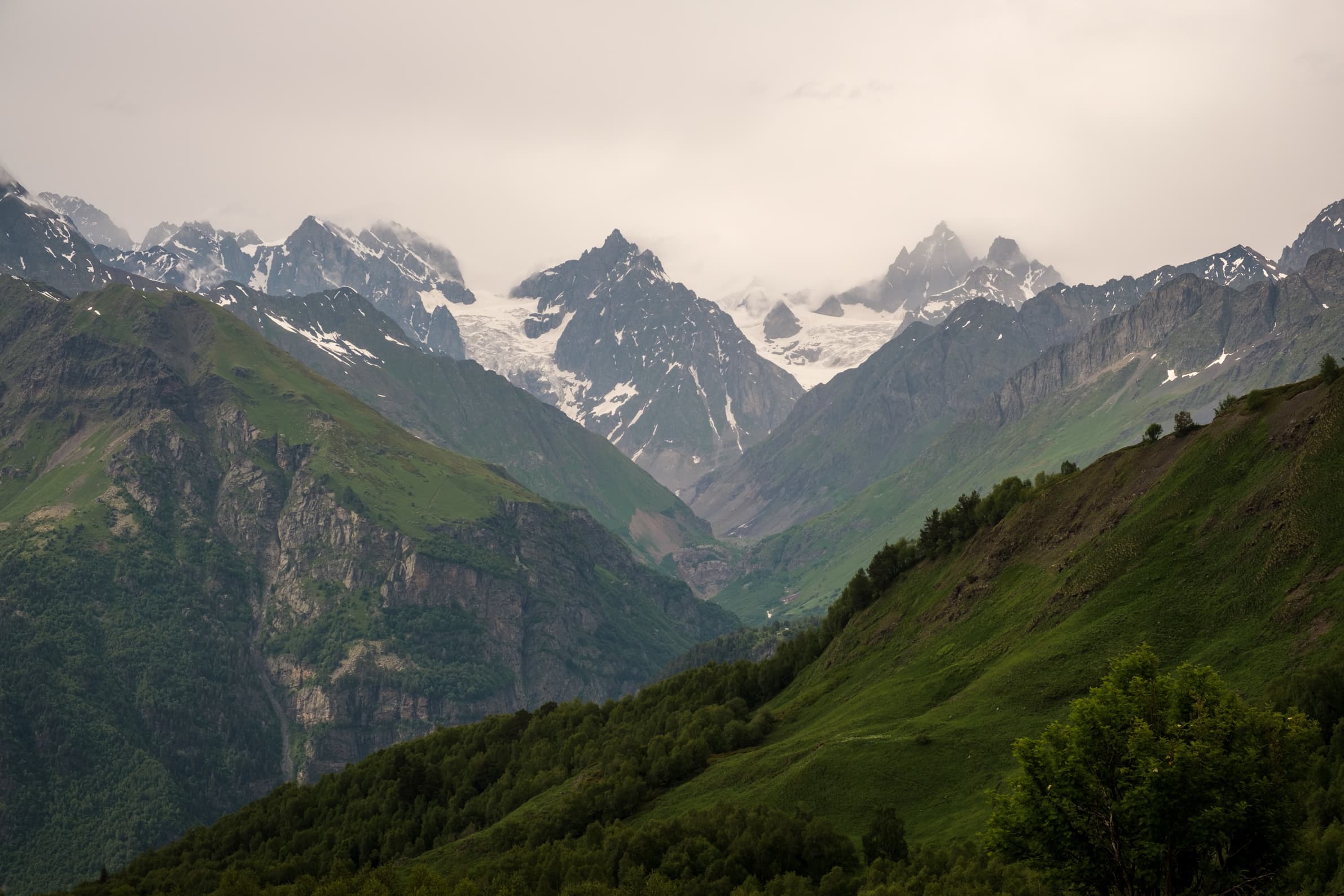
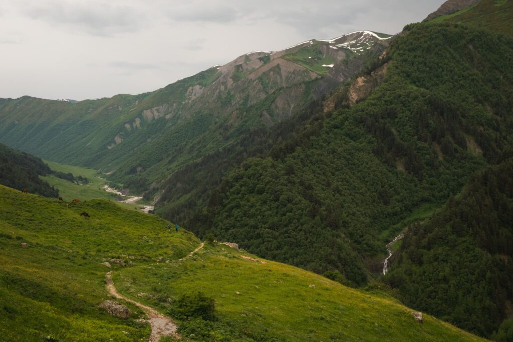
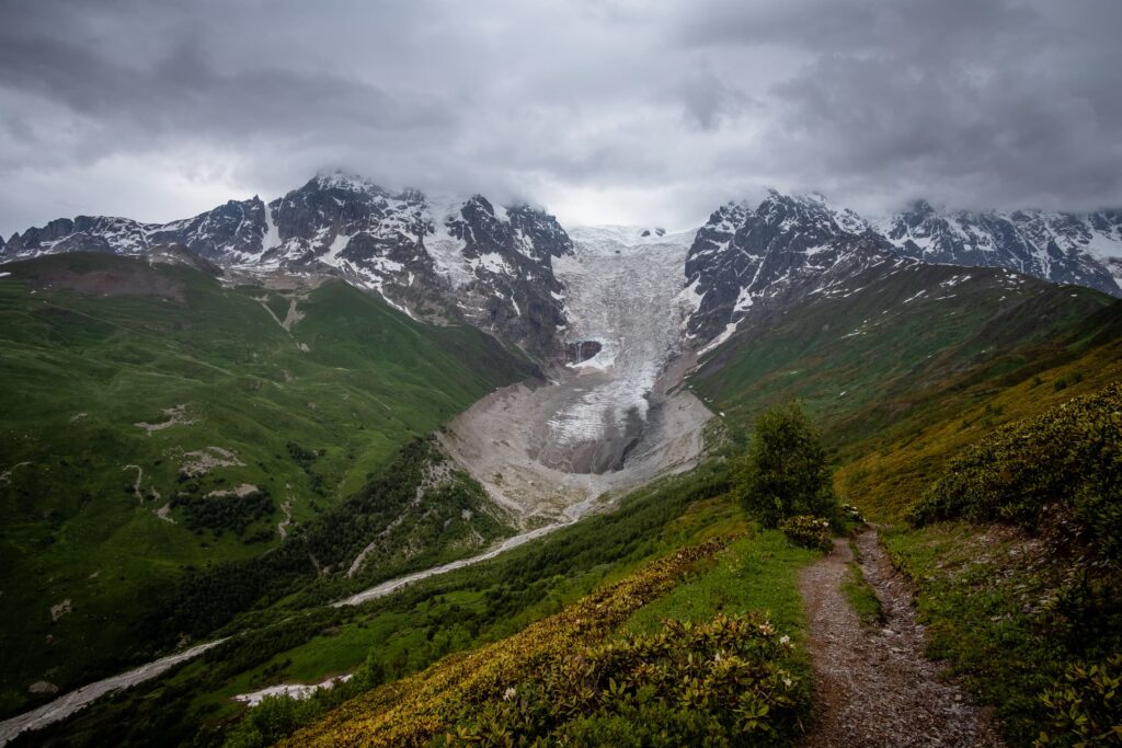
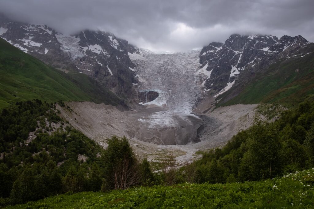
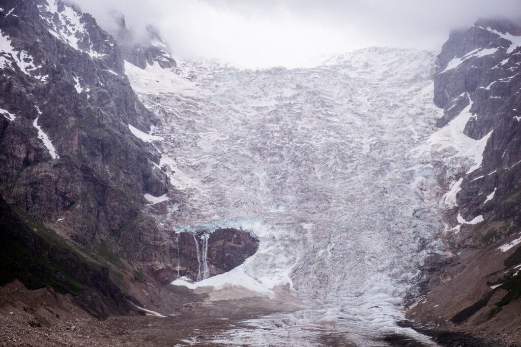
The next hour is spent climbing Chkhunderi Pass, where majestic panoramic views are on display in abundance. Adishi glacier in all its snow-capped glory. We’re 2650 meters high. Dark clouds brew around the jagged peaks and we wonder when the rain will begin again. The path immediately descends into the adjacent valley on the way to Iprali, but if you have the time and energy it’s worth following the trail over the ridge closer towards Adishi glacier for some even more impressive views. I follow it for fifteen minutes until the low rumbling of the heavens begins, and scurry back to Caroline and my backpack. The views here are some of the best throughout the whole trek to Ushguli.
To Iprali along the Khaldechala river
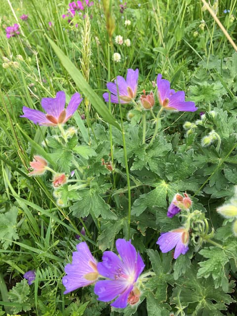
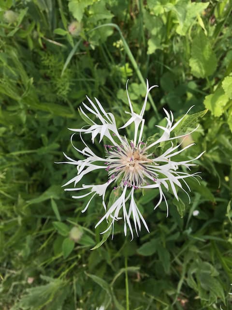
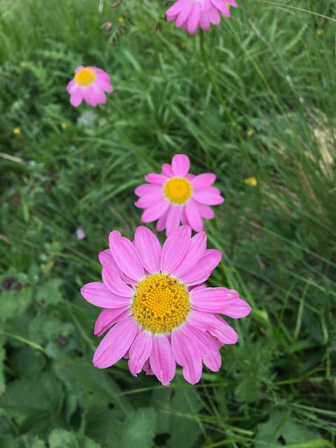
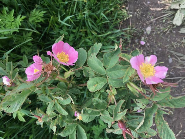
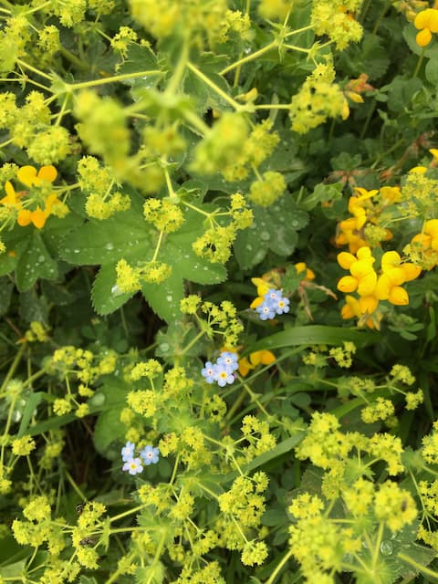
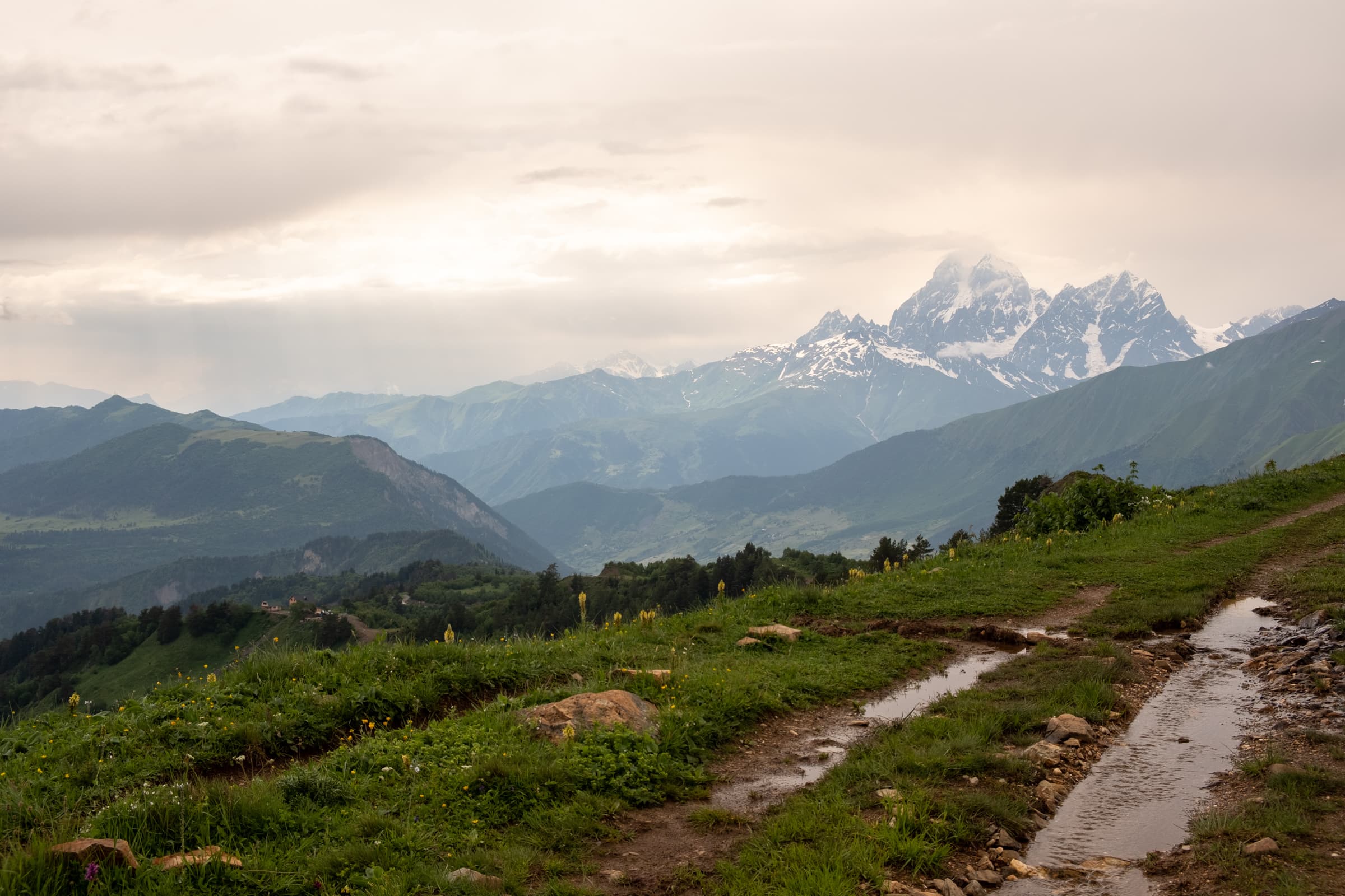
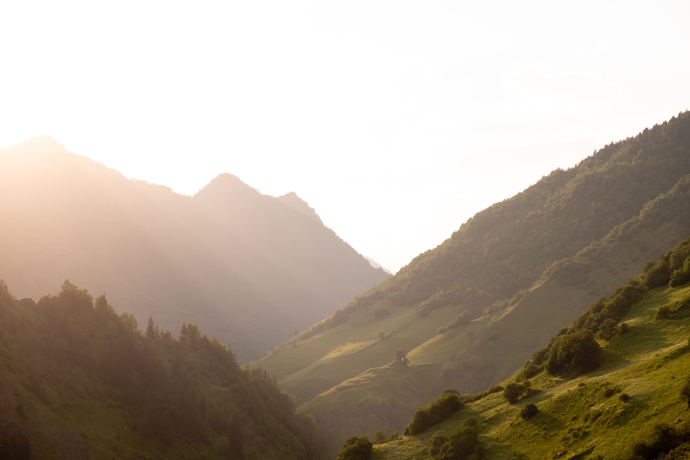
The trails snakes steeply down the mountain side until it reaches the river Khaldechala where it flattens out for a good few kilometres. The clouds have begun to clear and the sun is making a last ditch attempt to spread some warmth. The myriad of summer wild flower species sway and we inspect colours and shapes we’ve never laid eyes upon before. Every now and then the trail meanders around a river bend and the impressive views behind us come back into view. The snow covered peaks are glistening and glowing in the late afternoon sun.
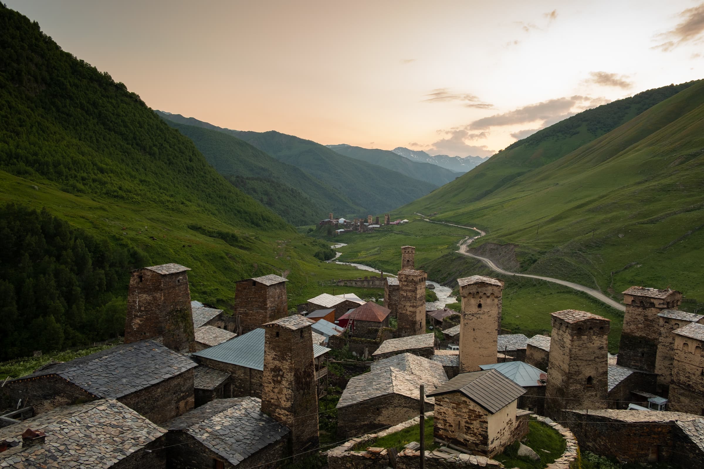
As usual we seem to be the last on the trail as every other hiker overtakes us. We vow to enjoy ourselves rather than race to the end in a competition. Nearing the final descent and the guest house, we see a campsite glowing in golden afternoon light. We certainly wish we had the tent at this point! A beer and a tent! What a campsite, overlooking ancient Svan towers. This is what Georgia is all about.
Partying in Svaneti
We finally make it to Iprali as darkness descends, we have a tiny private room with a shared bathroom. Pretty perfect. We eat a tasty dinner and head to our room to rest. Or at least we try. A group of obnoxious Americans decide to drink and play music on a loud speaker, getting progressively drunker and rowdier. It goes on for a few hours until a village neighbour asks them to quieten down a little, since the village is mourning a death this very day. They pretend to care for a moment only to turn it back up fifteen minutes later. We ask them to keep the noise down and they continue to ignore everyone.
At some point during the night the speaker is sabotaged and the selfish fun is put to an end. Finally we can sleep. We might just make it to Ushguli.
Day Four – Iprali to Ushguli
After an exhaustingly long day, we take it easy in the morning. We eat another nice breakfast; all the food on the trek so far has been better than expected. It’s the final day. Ushguli, here we come! The sun is shining as we depart. We hit the road, heading for the village of Davberi, where the trail will head back up the mountain off the main road. There is an option to stay on the main road to Ushguli if you are not feeling up to the longer hike since this day of hiking is not the most interesting.
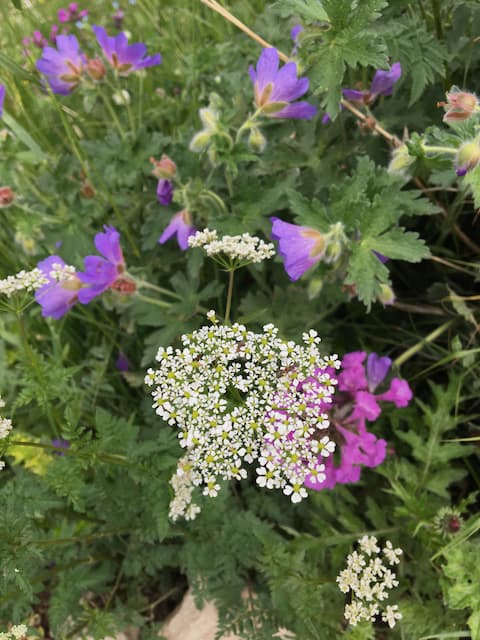
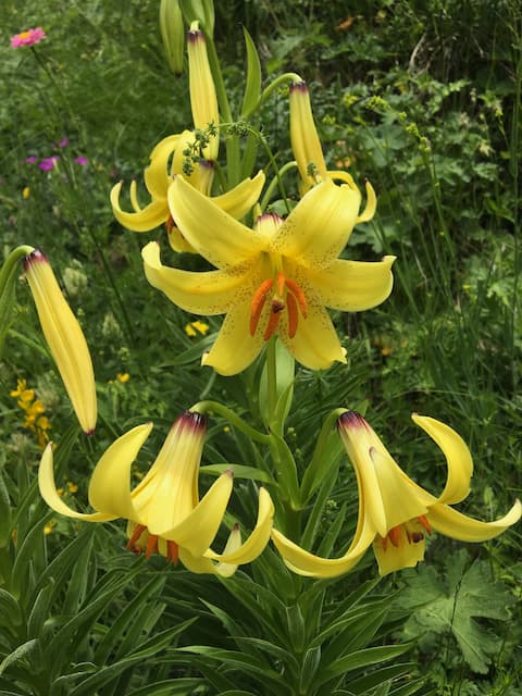
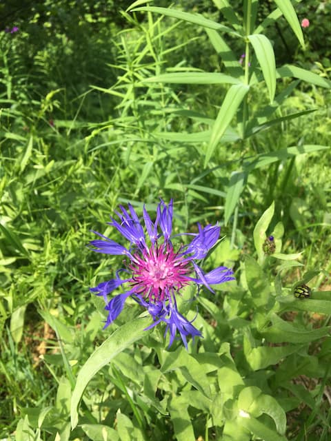
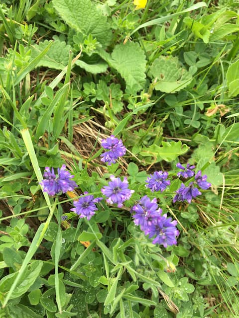
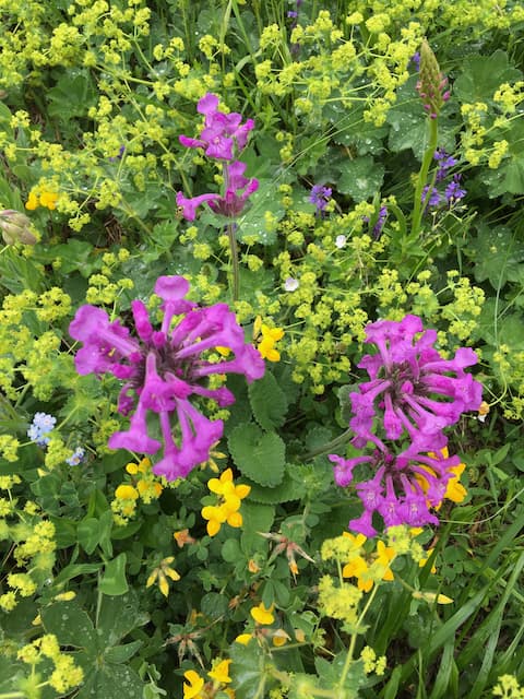
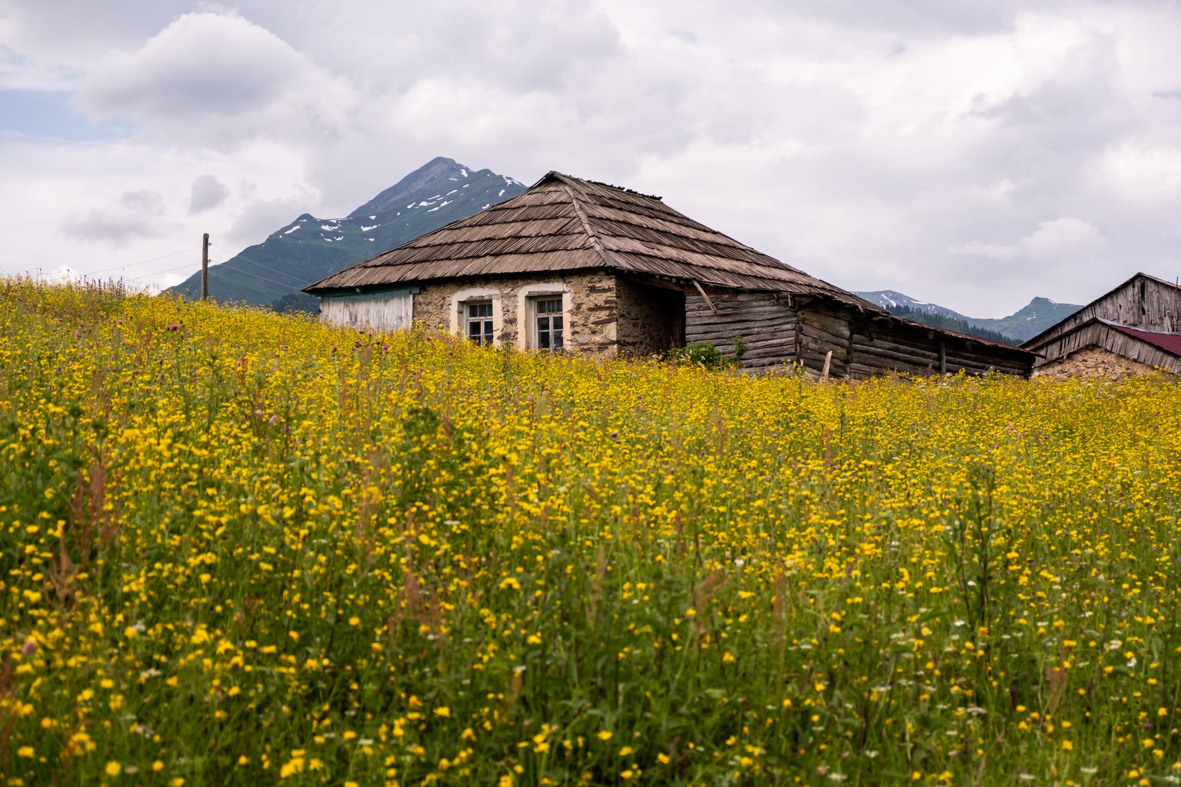
Coming into Davberi we head up through the village looking for the hiking trail. A mad Frenchman is getting himself in a tizz complaining that he can’t pass the trail because of overgrown hogweed. We pass on by and leave him to it. After crossing the church we head right up a steep trail, a short while later passing a lovely summer meadow. We can’t help but lie down and bask in the sun. A sea of purple and yellow flowers, buzzing bees and distant snowy peaks, it’s idyllic.
The final stretch to Ushguli
Back on the trail, we gain more elevation until we plateau around 2000 meters. We weave in and out of the forest with sporadic views of the Enguri valley and surrounding mountains. A few kilometers later the trail begins to wind down and join the main road. The final two kilometers of the trek are on the dusty road. It’s possible to take a little detour through the village of Murkmeli, however you apparently have to pay a small a fee to access that now.
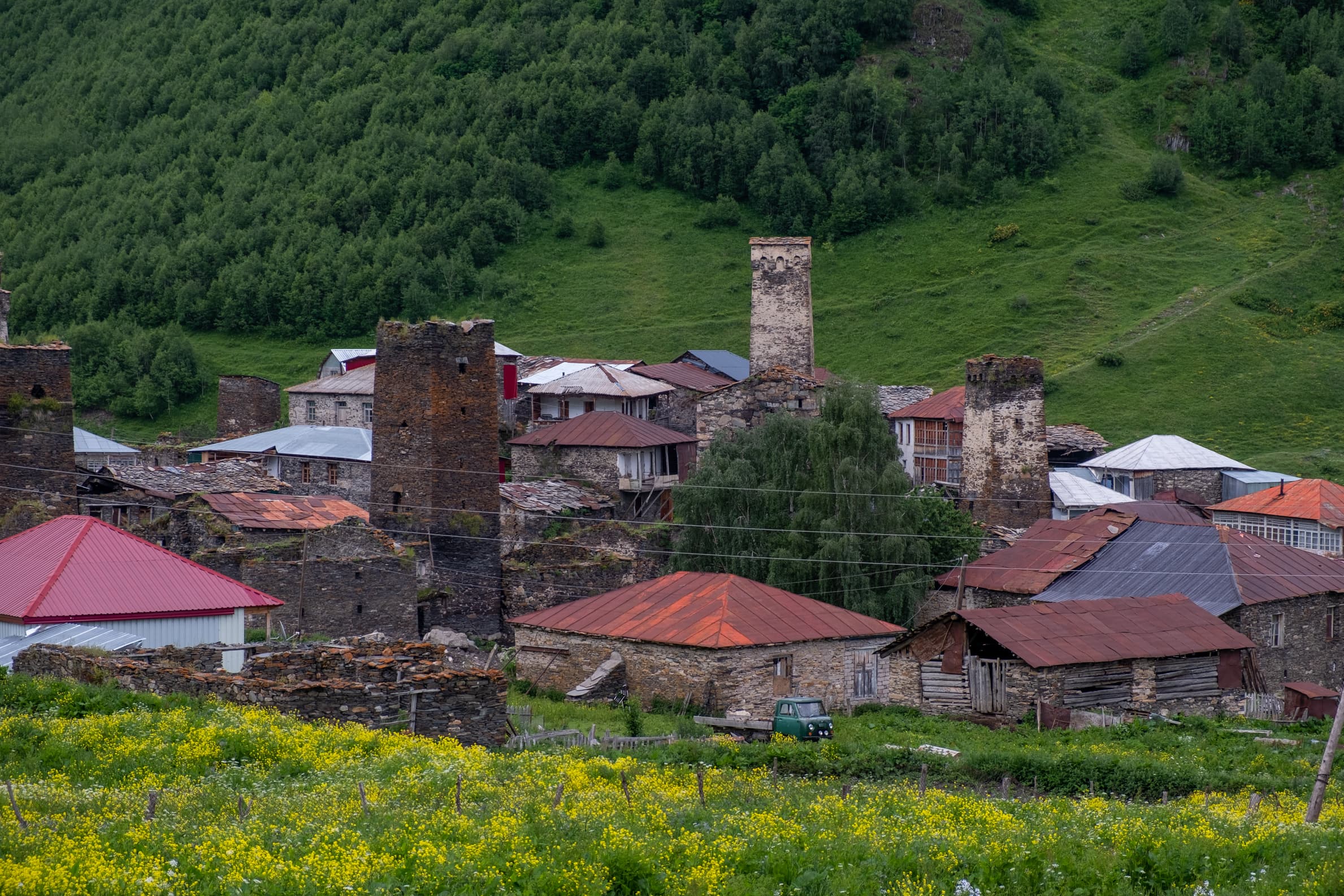
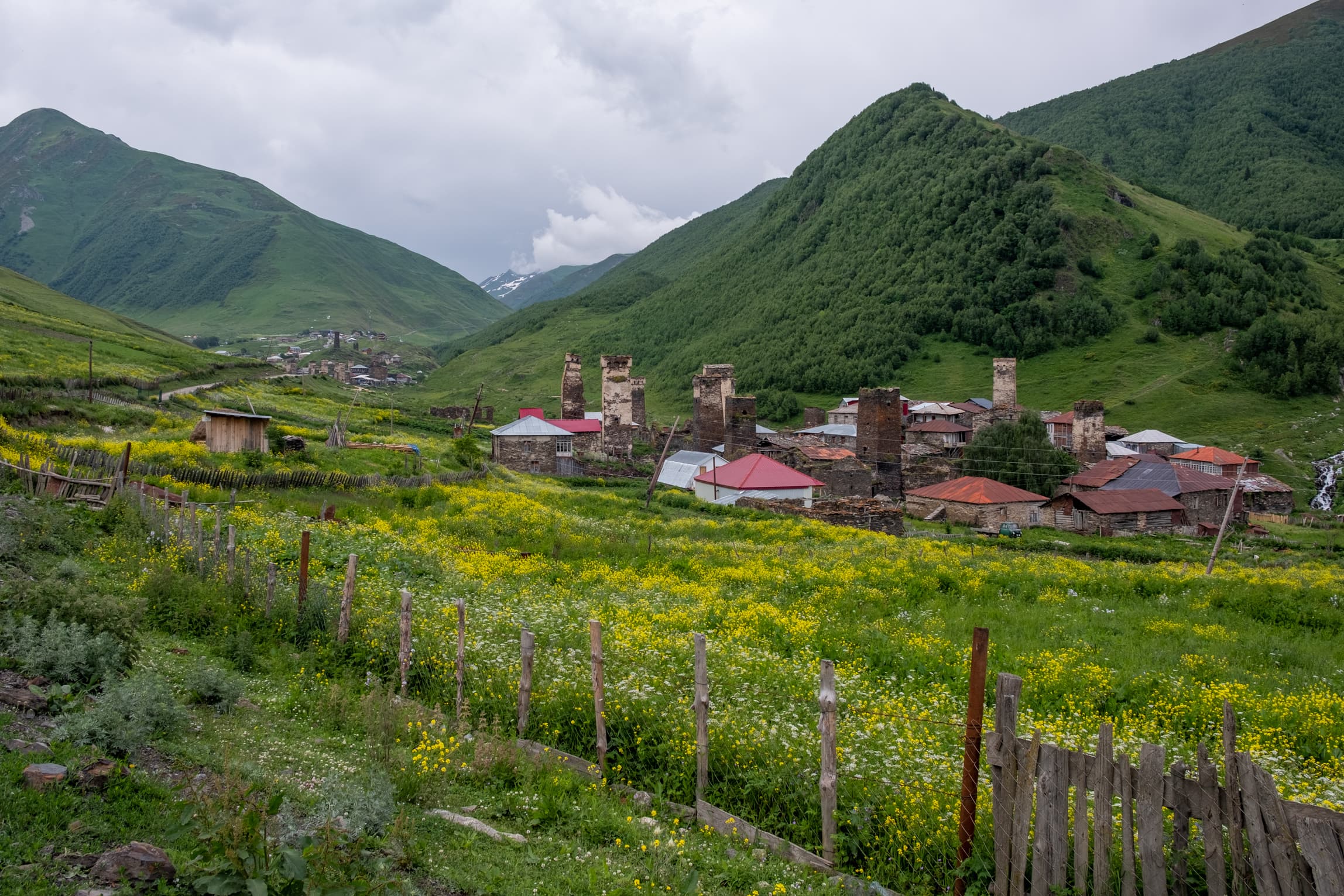
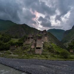
The sight is incredible. The bounty of medieval towers patrolling the landscape, the guardian Mount Shkhara looming over, sheer rock, smothered in snow. Lamaria church of Ushguli standing solemnly on a distant hill – where the only light in all the landscape glows from its open door. It’s a spectacle to behold. One absolutely worth the four day trek for.
Even so, after four days of hiking we decide to not mess about and head straight to our guesthouse to check in and drop our bags. We march directly to Caucasus Guesthouse where Tariel and his son warmly welcome us. Tariel, a proud Svan father, takes an extra liking to us when we utter a few words in his native Svan language. Our hosts are tough but also kind, gentle and hospitable. We eat some of the best food in Svaneti here. Our hosts serve a rare specialty which we only see twice during our time in Georgia: Gebjalia. It’s (and excuse me Georgians for quite possibly butchering the description) Sulguni cheese with mint and spices stuffed into Sulguni cheese pockets cooked in milk. So cheese stuffed with cheese.

We get some much needed sleep in preparation for a day of exploring Ushguli, before heading back to Mestia. Lookout for another post detailing our escapades in Ushguli.
FACTS FACTS FACTS
Getting to Georgia
There are two main options to fly into Georgia: Kutaisi or Tbilisi. Kutaisi is the budget option. Check Skyscanner for your options.
How to get to Mestia
Mestia is the best place to stay when starting the 4 day hike. It’s easy to reach, has lots of guesthouses and hotels and you can buy all the supplies you might need. You will most likely want to visit Svaneti from Tibilisi, Zugdidi, Batumi or Kutaisi.
From Tibilisi
Take the train to Zugdidi and then marshrutka for the final section (you don’t want to be on a marshrutka for 10 hours). The train departs at 8.25AM, check the schedule for more up-to-date information. You can book your tickets online. The train station is here. The price is very cheap, at 16 GEL, roughly €6.
From Zugdidi
From Zugdidi it’s Marshrutka time. They depart from the main train station (where you will arrive from Tbilisi) from 6:30 to 14:30 with possibly a few in between. The journey takes around 3-4 hours and costs 20 GEL (~€7).
From Batumi
The only real option is via marshrutka to Zugdidi. They depart from the bus station from 8AM onward. It’s hard to find up to date schedules online so best check at the bus station or ask at your hotel/guesthouse.
From Kutaisi
Take the direct marshrutka to Mestia from the train station at 10AM. It costs 25GEL, around €9. It’s apparently a popular line so you might want to get there a little early.
Other options
You can also drive yourself. The roads are quite okay, paved at least and the journey is wonderful with many places to stop and appreciate the landscape. The final option is to hitchhike! Georgians are friendly people and we are quite sure it will not be a problem to get a ride.
Getting back to Mestia
We recommend staying in Ushguli and exploring the ancient settlements and incredible mountains. There are lots more opportunities for exploration and adventure, such as hiking to Shkhara glacier.
When the time does come to leave you will need to take a shared taxi. We attempted to hitchhike out of Ushguli, a few hundred meters away from the taxi location but it was dire. The weather was terrible and any non-taxi rides were all full. It didn’t take long for us to get demotivated and head towards the nearby taxis.
We had to wait about an hour for the shared taxi to fill up. You can of course pay for the full car but it will set you back. You can expect to pay up to 30 GEL (€15) per person for the ride back. Some people report much more. It is let’s say, an interesting journey. Potholes, traffic jams, waterfalls and streams dissecting roads, sheer drops, mud roads, you get the picture.
Accommodation
Check the Caucasus Trekking guide for more options, we will simply describe the options we are familiar with.
- Tsvirmi – We stayed at Guesthouse Shorena – and loved it. It was perfect.
- Adishi – We stayed at Gunter’s Guesthouse – the food was great and the host lovely but the guesthouse was very basic.
- Iprali – We stayed at Robinzon Guesthouse – everything worked with decent food. We would recommend.
- Ushguli – We stayed at Caucasus Guesthouse – our hosts were great and the food was incredible. A true Svan family. If the booking.com link is not working, check the Facebook page.
Mestia
On finishing the trek we stayed in a hotel a little more upmarket than usual: Old House hotel. It was fantastic and we could barely bring ourselves to leave. Gorgeous comfy rooms with great views. Incredible restaurant.
Before the hike we camped at Camping & Hostel Svanland, which was great value for money and the owner was helpful and knowledgeable.
There are many other properties for all luxury levels in Mestia. Explore yourself on www.booking.com.
What to take
Electronics
- Phone + charging cable (there’s surprisingly good signal around Svaneti)
- Powerbank
- Camera (and spare batteries!)
Food & Cooking Gear
You don’t need much food and no cooking gear if you are planning on staying in guesthouses. They will provide everything so you just need water and some snacks such as:
- Cereal bars
- Nuts
- Chocolate
- Fruit
Hiking Gear
- Trekking poles – We really recommend them for this hike, for when it’s raining and absolutely for the river crossing
- Head torch (In case you get stuck or need to fetch water in the dark)
- Knife/multitool
- Trekking rucksack
- Rucksack rain cover (This one is very important, all our gear would have been soaked without it)
- Towel (Maybe you want it for swimming or for washing)
- First aid kit (Plasters, blister plasters, disinfectant, whistle, emergency blanket, pain killers, etc)
Clothes
- Waterproof jacket
- T-shirts (Keep a clean one for the guesthouse)
- Base layer (We didn’t take any for this hike but you might want to if it’s a little colder)
- Hiking boots or trail runners, whichever you prefer
- Socks/underwear
- Cosy jumper/hoody for guesthouse
- Trekking bottoms/shorts
- Gloves/scarf in case it’s cold
- Flip flops (It makes the guesthouse a little more comfortable at the expense of some extra weight)
Toiletries:
- Deodorant
- Toothpaste & toothbrush
- Toilet paper
- Sunscreen
- Bug spray
- Earplugs (There’s always a snorer and sometimes a mouse, or the odd party going on in front of your window)
Water
Fresh water can be found in all of the villages and you will encounter various sources throughout each day. We never had any trouble finding water. Take a bottle with a few litres and you will be fine.
Distance & Elevation
Total Distance: 68.6 KM
Total Up: 4547M
Total Down: 3769M
- Day 1 – Distance: 20 KM – Up: 1484M – Down: 1020M
- Day 2 – Distance: 17 KM – Up: 1273M – Down: 1055M
- Day 3 – Distance: 18.8 KM – Up: 860M – Down: 1091M
- Day 4 – Distance: 12.8 KM – Up: 930M – Down: 603M
The first day can be reduced considerably by taking the cable car if it is running.
Maps & GPX Trails
We use a combination of apps. Maps.me we use for routing between two points. It gives pretty spot on information regarding the elevation difference and the distance. It’s walking estimates are quite accurate as well. The second app we use is Gaia GPS. The app is not as intuitive as Maps.me but it allows to import GPX trails so you can always see where you should be walking in relation to where you are. It also provides much better contour lines so you can easily spot elevation changes.
We didn’t record our hike but if you want a GPX trail, grab it here. That’s the one we used.
Alternative Trail
Or rather the more widely hiked original. You can skip the Zuruldi massif and instead take the more traditional route. Check Caucasus Trekking for more info and GPX trails.
When to Hike
The best time to hike this trail is the summer to autumn. It’s possible from early June to late October, depending on the weather of course. We did the hike in mid June.
You Might Also Like