Menu
- Countries
 Apr 3, 2025
11+ Austrian towns to rival Hallstatt
 Jun 19, 2019
Feel the Bern
 Jun 12, 2019
Fun in Thun: A pit stop on the way to Bern
 Jun 3, 2019
Wild and without money: Hiking Kleine Scheidegg
 Jan 13, 2020
Nine wild rides to the Pyrenees
 Oct 17, 2019
Wild and without the Alps: Camargue
 Jan 12, 2022
The wonders of Ronda: A bridge between the eras
 Feb 17, 2020
Wild and without enough time: Catalonia to Portugal
 Nov 6, 2021
City to sea: A day trip to Sintra
 Oct 18, 2021
Benagil to Faro: All along the Algarve
 Aug 16, 2021
Wild and without a campground: Lisbon to Benagil
 Sep 7, 2024
The top three destinations in Adjara, Georgia
 Jan 14, 2023
Mestia to Koruldi Lakes: Camping at 2700 meters
 Nov 17, 2022
Ushguli: 4 day hike from Mestia via Tsvirmi
 Oct 31, 2021
Black Rock Lake: 3 Day hike from Lagodekhi
 Aug 14, 2022
Madness in Marrakesh: The final leg
 Jun 25, 2022
Merzouga: The Gateway to the Sahara Desert
- Categories
 May 11, 2022
17 locations for vintage Wes Anderson vibes
 May 9, 2022
14 Gorgeous Churches in the Austrian Alps
Oct 18, 2021Benagil to Faro: All along the Algarve
Aug 16, 2021Wild and without a campground: Lisbon to Benagil
Feb 17, 2020Wild and without enough time: Catalonia to Portugal
Sep 7, 2024The top three destinations in Adjara, Georgia
Jan 14, 2023Mestia to Koruldi Lakes: Camping at 2700 meters


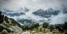
The most beautiful winter hiking trails in Carinthia: Part 2
Welcome to part two of our winter hiking guide for Carinthia, Austria! We’ve gone ahead and rounded up another 10 snow-covered winter hiking trails. Don’t worry, there are no second rate trails here, absolutely no fillers, without a doubt every single one will leave you awestruck!
However, if you haven’t seen it already – be sure to check out part one of our most beautiful winter hiking trails in Carinthia guide, where we cover some of the best locations around Carinthia!
Imposing castles, snow-covered mountain backdrops, quaint churches, gorgeous frozen alpine lakes, sledging, ice skating, incredible drives, you name it. There’s so much to see and do in Carinthia we could write another 10 of these guides!
As in part one of our guide, we’ll showcase our favourite locations, we’ll show you how to get there, hiking facts (distance, elevation and so on), popularity, how to get around and what kit you will need. Unfortunately, your best option here is a car. Whilst public transport and trains are good in Carinthia, getting to the trail head is almost impossible without a car. However, where possible, we’ll give you the details.
All of these hikes will require good cold weather clothing and hiking shoes in the winter. Snow shoes would make all of them easier, alas the winter of 2020/21 is known in Austria as the winter of the great snow shoe shortage – because of the long lockdown, people were buying up all the stock and it was impossible to get any.
1. Tatschnigteich lake Loop, Sankt Veit an der Glan
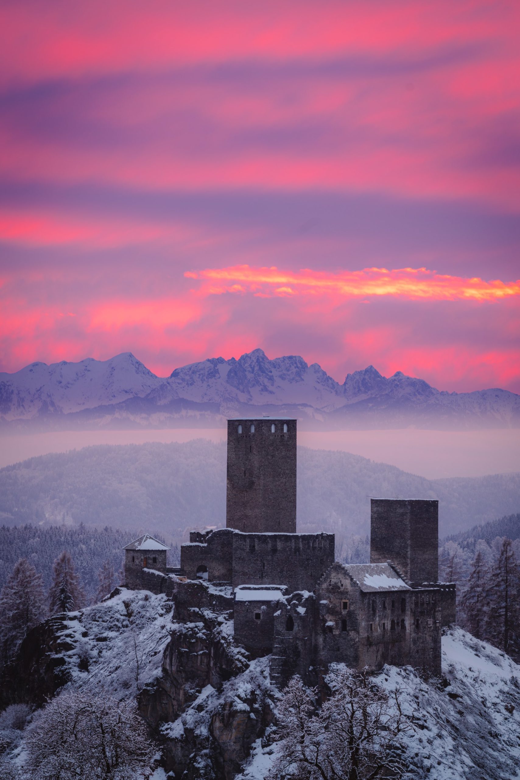
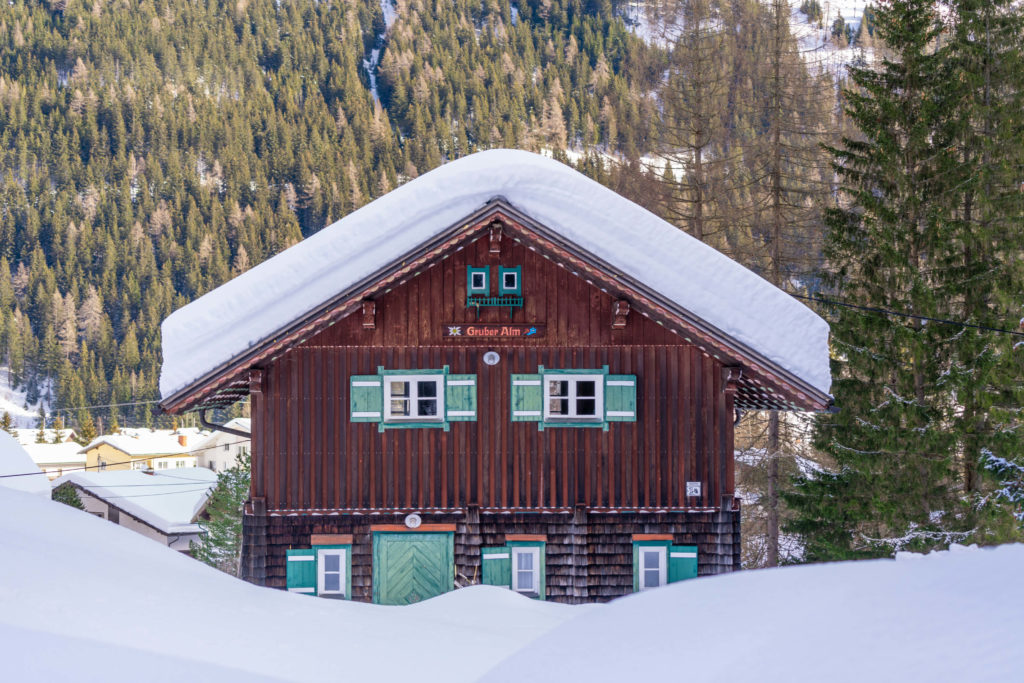
Another basically unknown group of lakes in Carinthia, well unless you’re into fishing!? This is a nice hike through forests and lakes with some great views of middle Carinthia, but the best bit is right near the beginning, where you will find an incredible view over Liebenfels castle with the Karawanken mountains towering above.

Info
Hike description & GPX:
Difficulty: Medium
Time: 3 hours
How to get there: You can park at the Church in Pulst.
Variation: You could take a detour up to Lorenziberg. Without a doubt there are great views from the top.
Kit: The trail is quite steep in the forest during some sections and when icy, it can be quite tricky. Undoubtedly hiking poles will help and boots with good grip are recommended.
Description
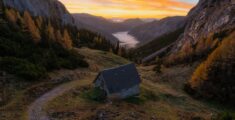
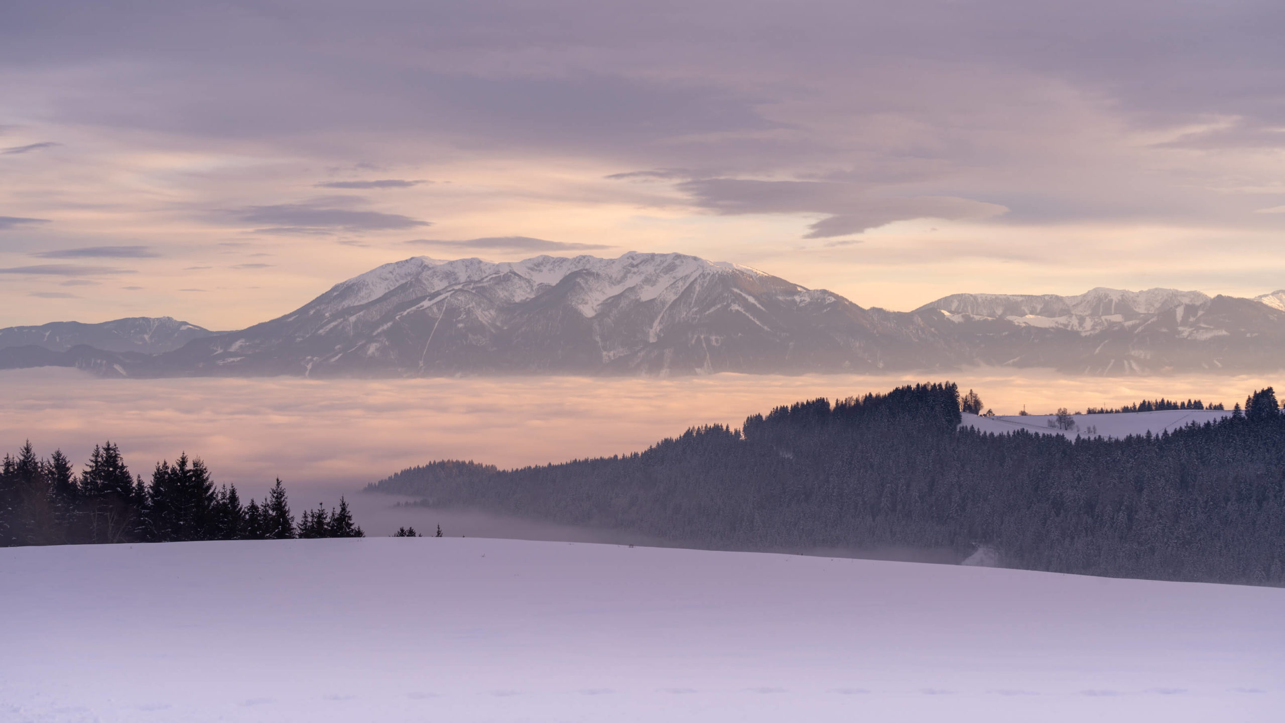
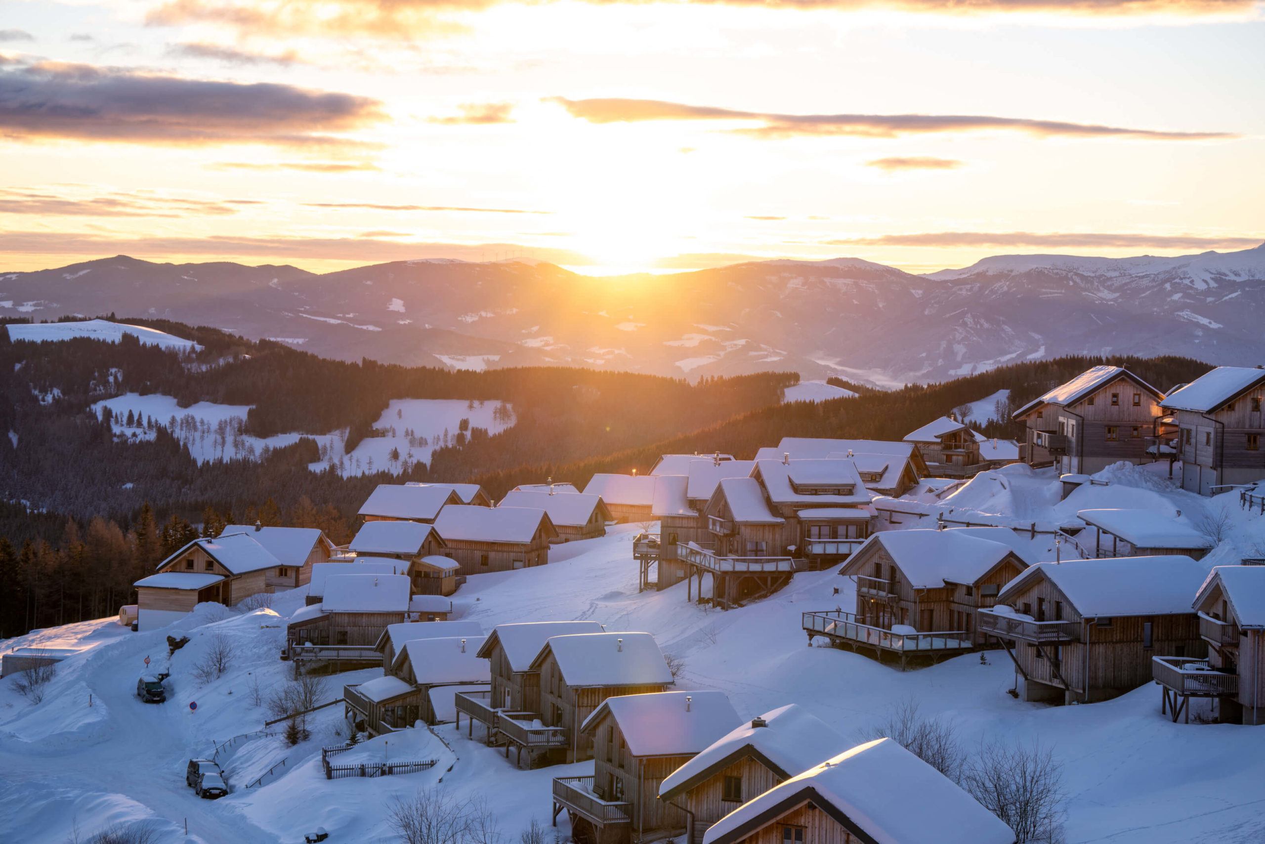
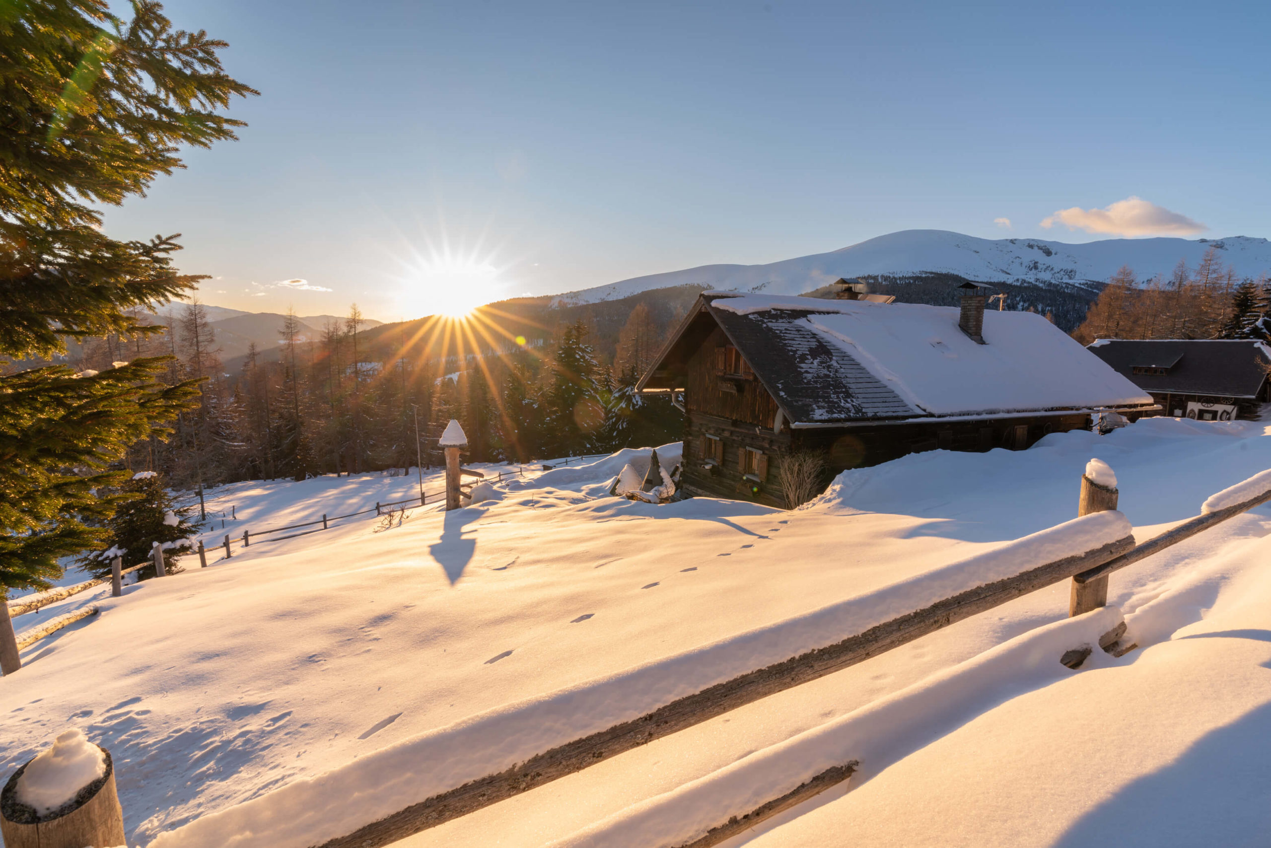
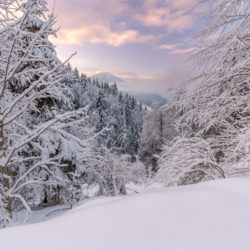
Go around the church and follow the path, zigzag up the hill passing the farm Koboldhof. Shortly after you will pass an nearby adjacent forest, where you will return to towards the end. For now, enjoy the view to the south of Liebenfels castle with the magnificent Karawanken mountains behind. The castle from other angles is not so impressive, but from here, it’s a different story. We witnessed one of the most insane sunsets we ever saw from this location (see picture below).
Continue along the path until you reach Waggendorf. Take a right on to the main road and then shortly after, a left on to a side road. The road slowly ascends past some farms and then in to the forest, where you will pass the first small lake. The road doesn’t pass the shore of the lake, but you can get down to it. The trail continues up a little more to the highest point, before steeply descending to the second lake. Here is where you might struggle a little if the ground is frozen or snowy.
Shortly after you will arrive at the largest of the lakes, which may be frozen, but not completely, like when we passed. From here you can take a left and reach a third and fourth lake, but there was too much snow when we visited. Follow the shore of the lake towards Fachau.
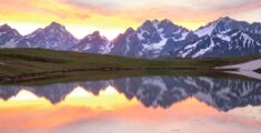
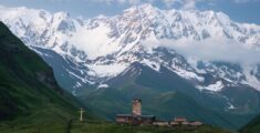
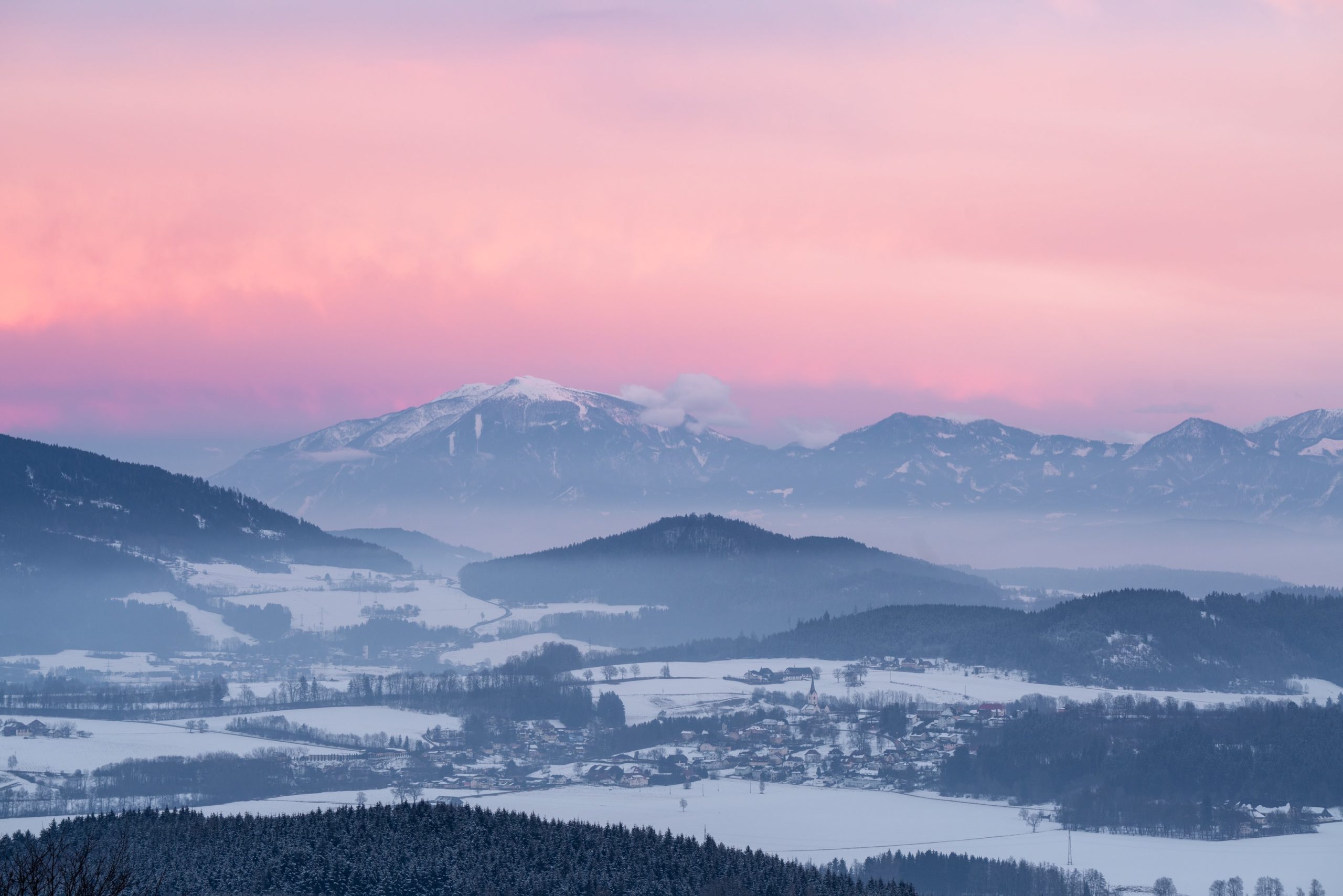
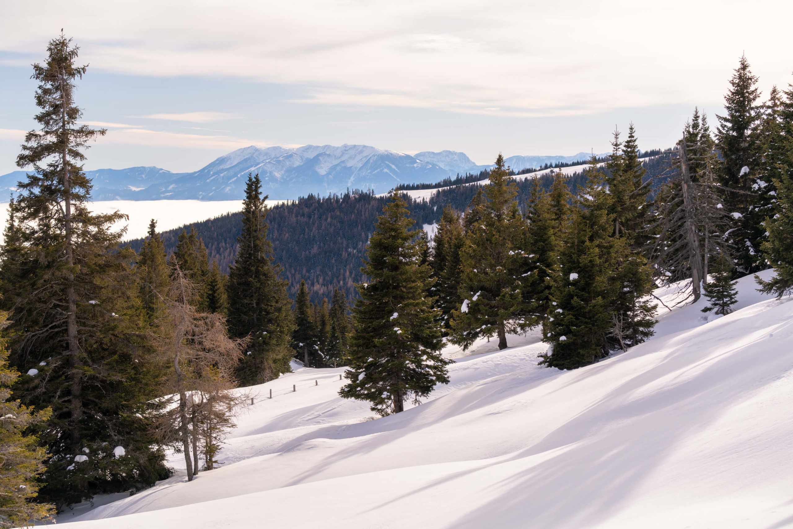
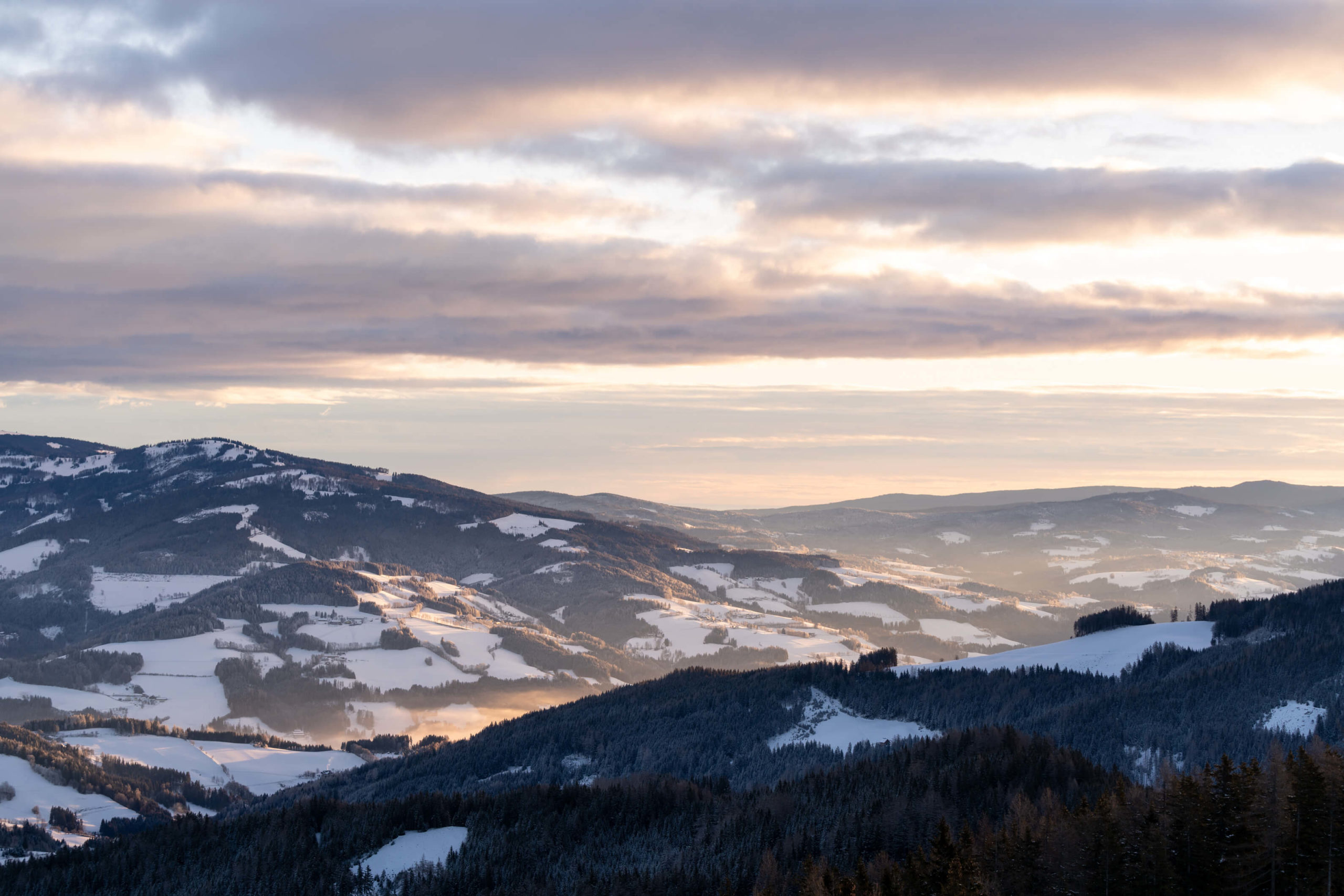
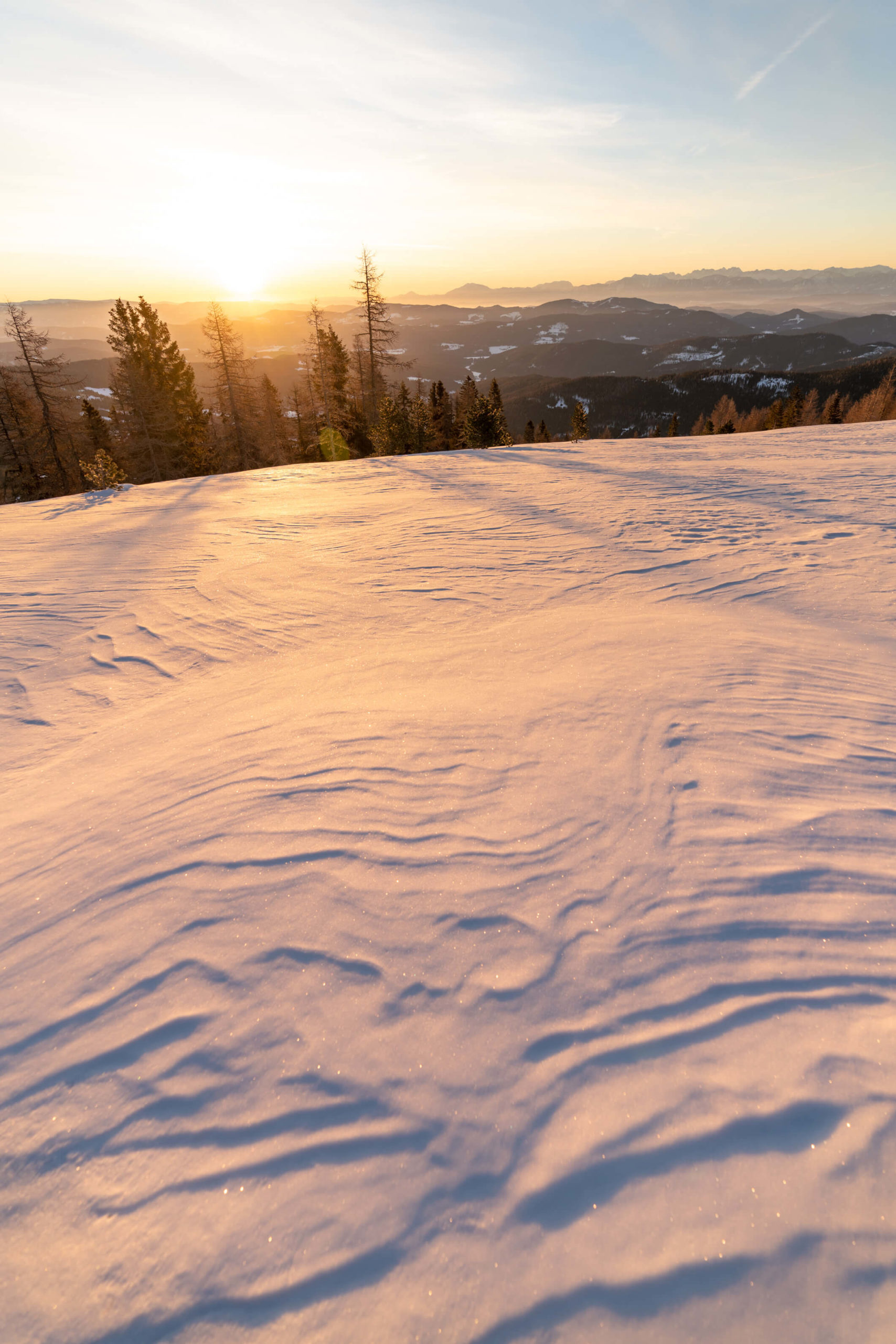
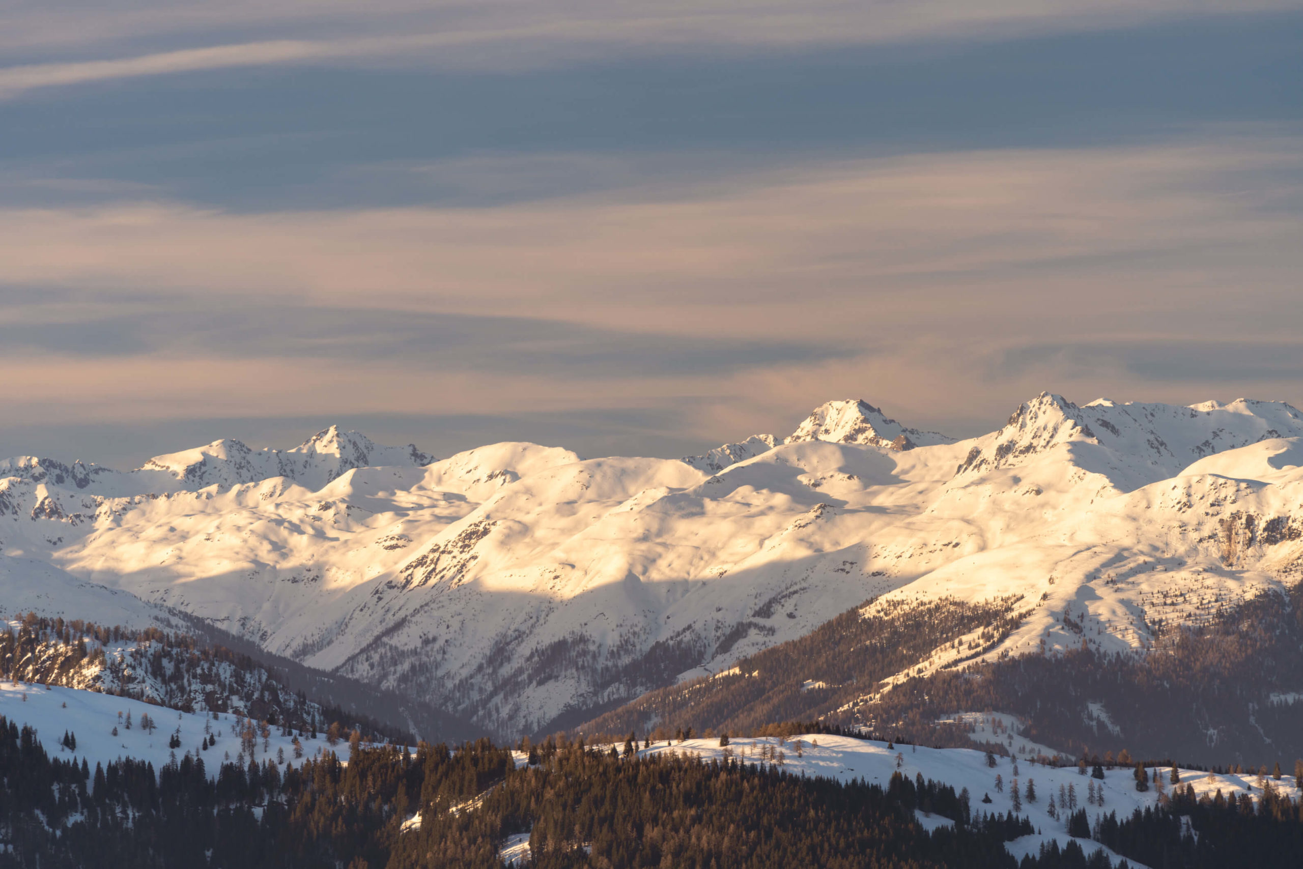
Majestic views over middle Carinthia
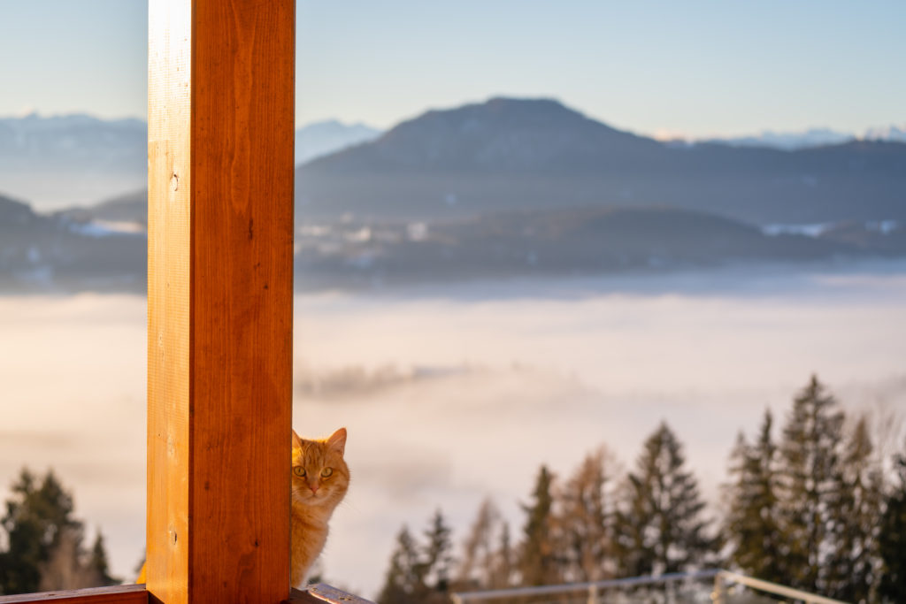
When you emerge from the forest follow the tracks through the farmland and crop fields back to the main road taking a right towards Waggendorf. Then, take the next left towards Essleggerhof (a wonderful farm stay with an outdoor pool and lots of friendly animals, including Garfield, the big fat friendly ginger cat).
Follow the road all the way to the farm and head straight through the parking area and round the back of the farm where the trail starts again. Especially wonderful views over Hörzendorf, Castle Hohenstein and even mount Triglav (all pictured above!) can be seen from this field.
Take the trail to the right, past a little pond and around the edge of the forest. Finally, you will join the path where you started from with the view on to Liebenfels castle. Take a left back to Pulst.
2. Tauerntal Loop, Mallnitz
This hike is a combination of two shorter ones, with the opportunity to get higher and see some nice views. Also, to top it off, there is an optional third section which includes having a little wander around Seebachtal with its enchanting river and possibly frozen lake.
Info
Hike description & GPX: Part One & Part Two & Part Three
Difficulty: Medium
Time: 4 ½ hours
How to get there: There is a car park in Mallnitz at the Tauernbad hotel.
Variation: If you’ve got any time left after the first two sections, you can try the third section and take a hike through Seebachtal. The route is another three hours so if you want to shorten it, drive to the Ankogel car park and walk from there towards Stappitzer See.
Kit: In fresh snow you might want snow shoes, but we did this hike totally fine in good hiking boots and hiking poles, even the poles were unnecessary. You can rent snow shoes and other gear from the Mallnitz visitor centre.
Description
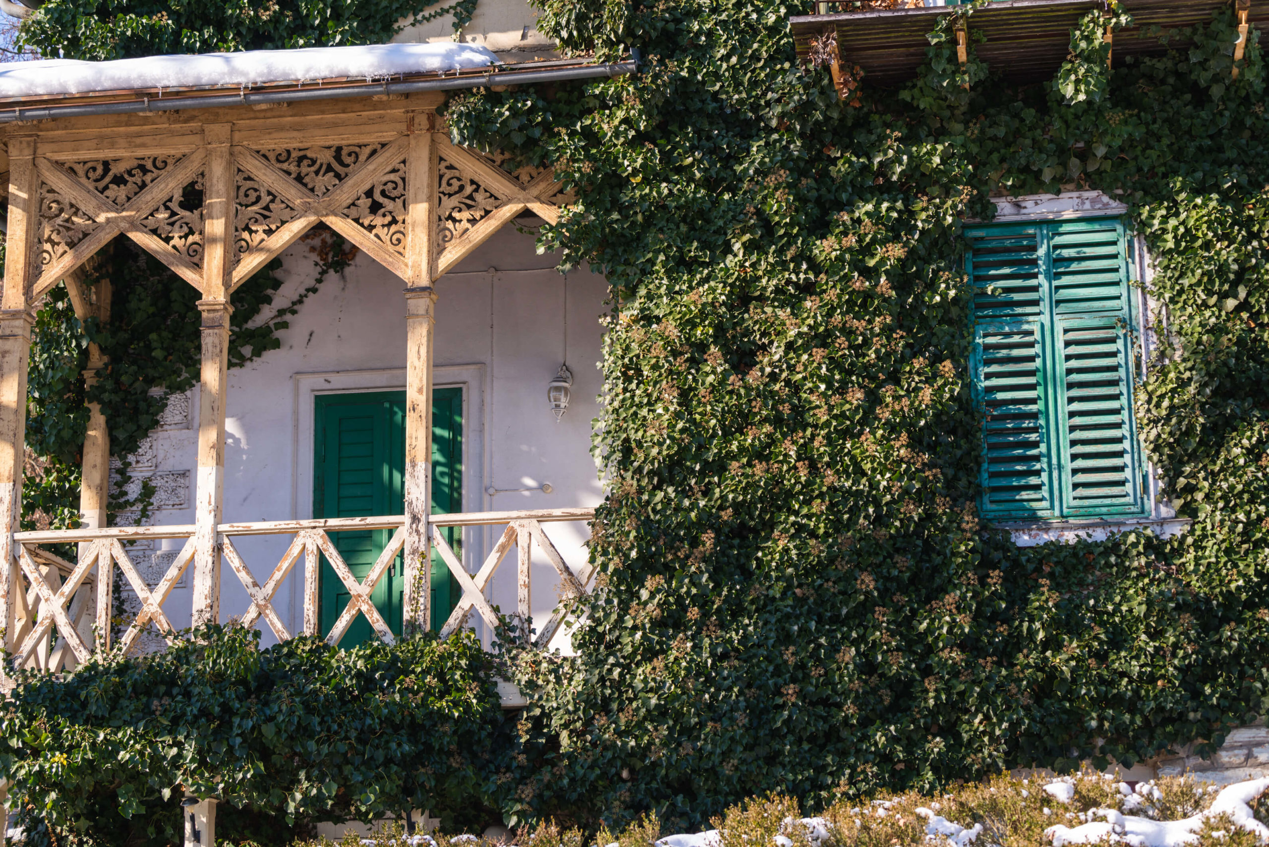
Starting from the car park head up the road towards the valley. After a little while you will turn off and pass a few cute houses covered in snow. The road will turn in to trail, it’s a little confusing here: go around the house to the right. The trail goes along the side of the mountain, just above the valley. It’s beautiful in the forest and a little precarious too! You are now on the Wittener Weg.
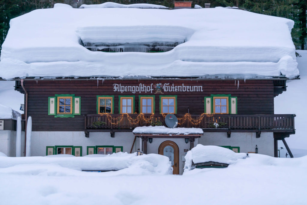
Stay on this trail and you will pass around the back of Alpengasthof Gutenbrunn. A little while later you will join the road again, and shortly after that you will arrive at Stockerhütte where you can grab refreshments.
Part two – Jamnigalm
This is where we start part two of the hike and basically we follow the Rodelbahn (sledge tack) all the way to the top! It’s about 300M up on a steady incline with lots of dangerous children shooting by! It’s heartwarming and the views are pretty. At the top, at Jamnigalm, you will find so much snow, you will be in heaven!
Jamnigalm is where we will turn around and descend, the same way, back to Stockerhütte. Next, we continue with the loop from part one of the hike. For this section we cross the road and follow the trail through the opposite side of the valley along the Tauernbach stream to the Mallnitz visitor centre. Finally, you are back where you started.
Part three – Seebachtal
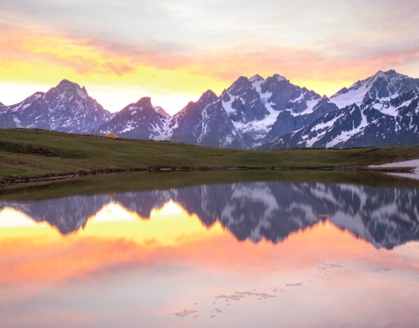
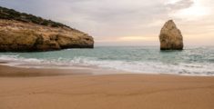
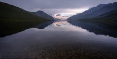
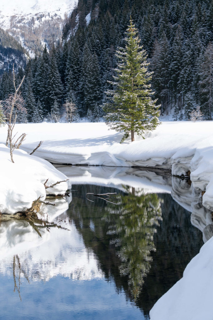
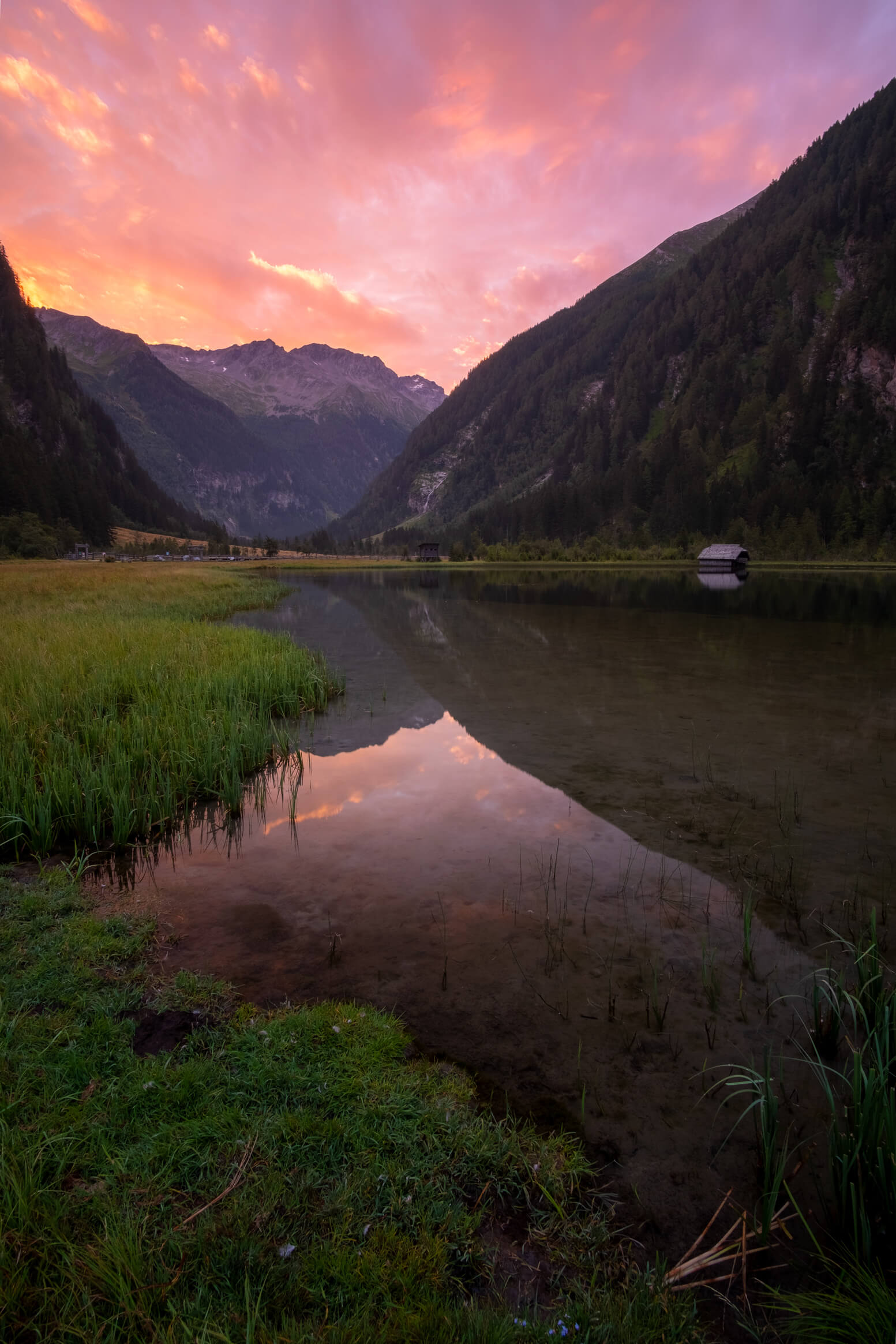
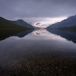
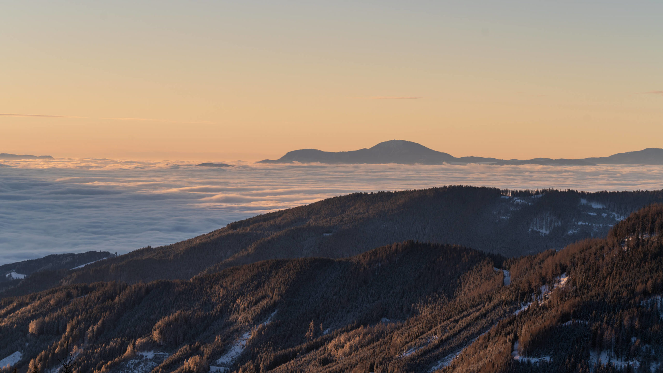
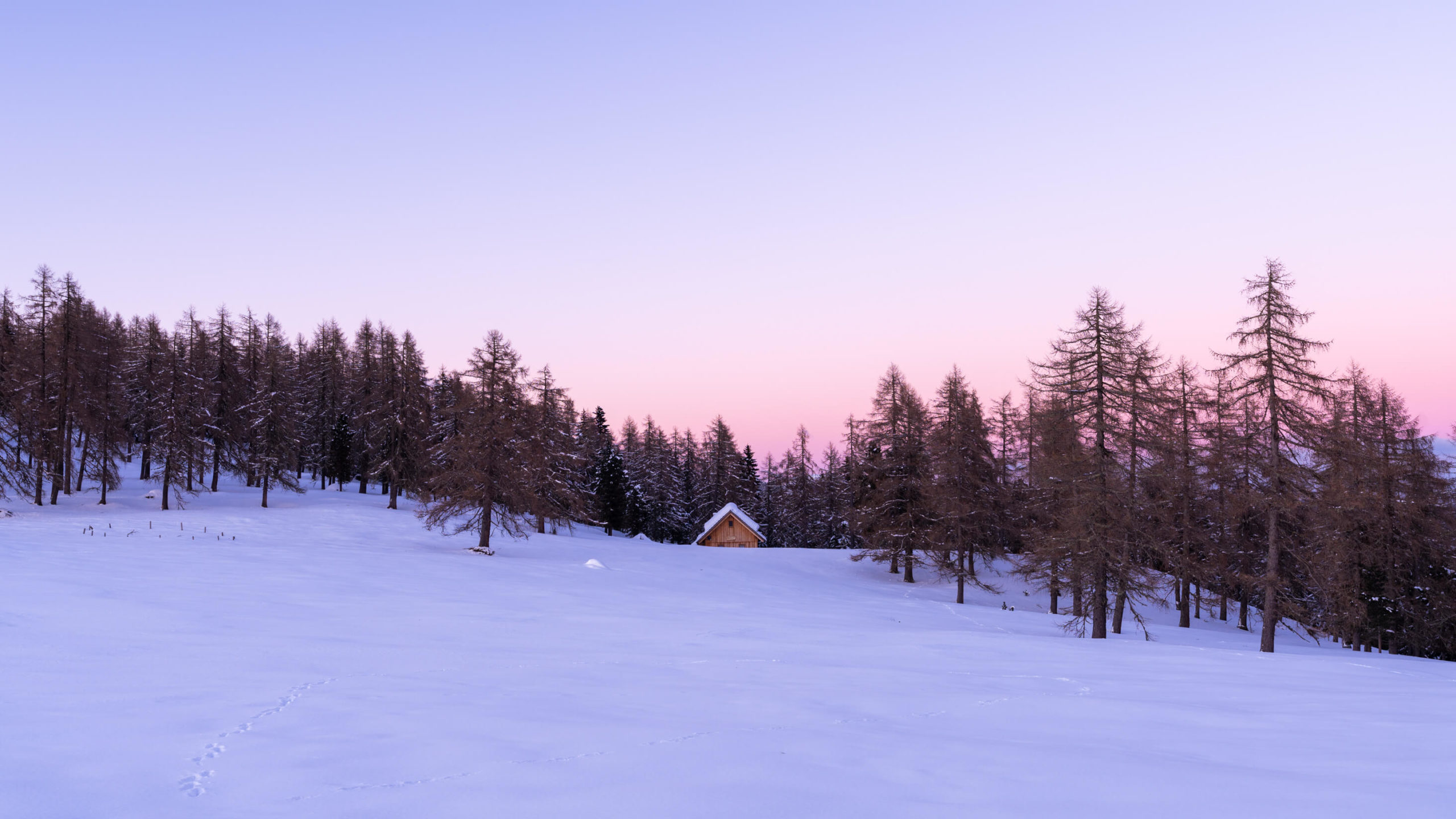
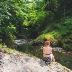
You can now attempt the third section if you have the time. We didn’t so we cannot provide a description, but we did drive to Ankogel car park and walk 2-3 kilometres around Seebachtal to just past Stappitzer See where the trail abruptly ends. This river is one of the most beautiful in Carinthia with its wild meanders and beaches. However, the lake is mostly frozen in the winter and unfortunately it was not so good to photograph so we added a picture from a beautiful summer sunrise we witnessed the year before!
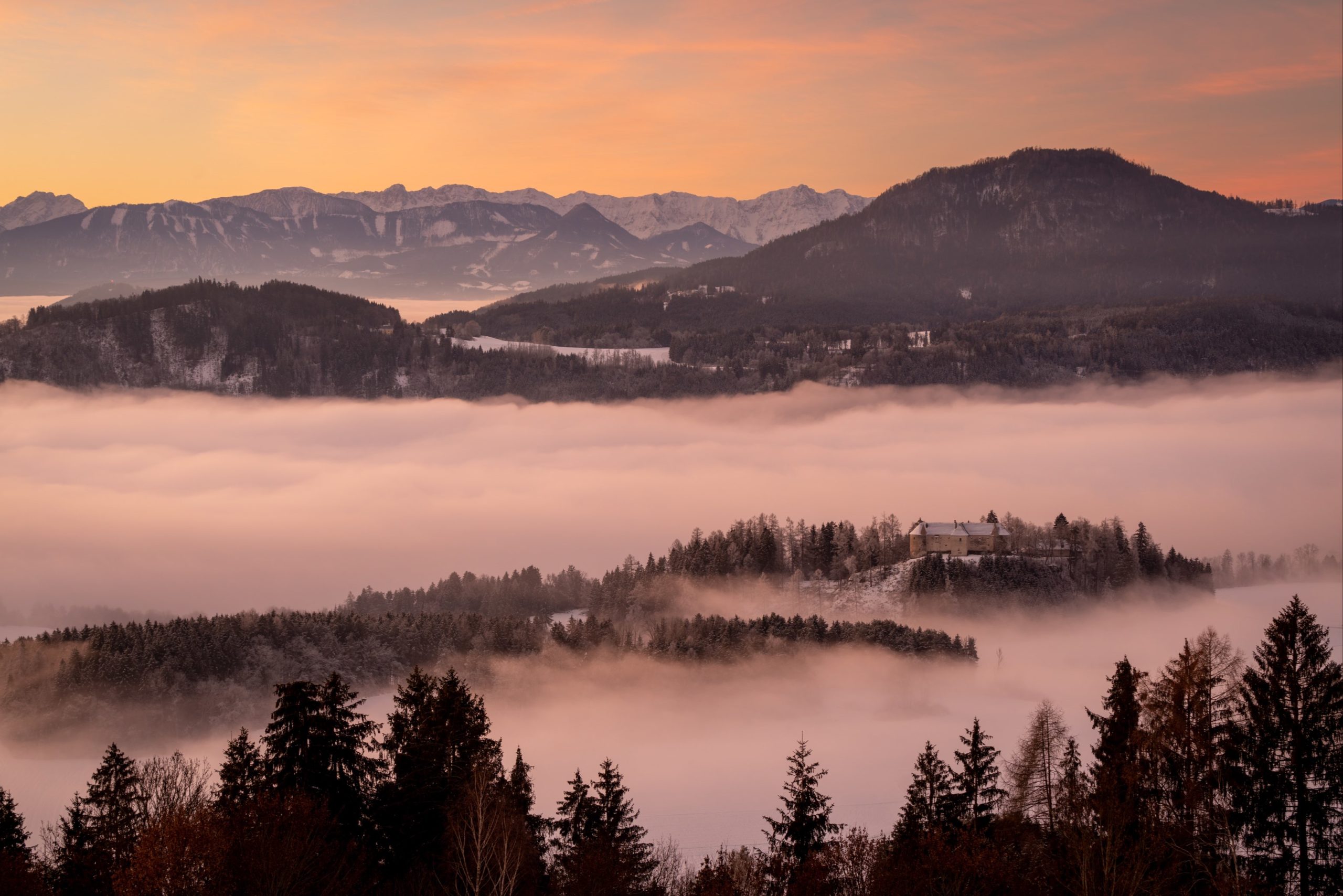
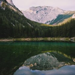
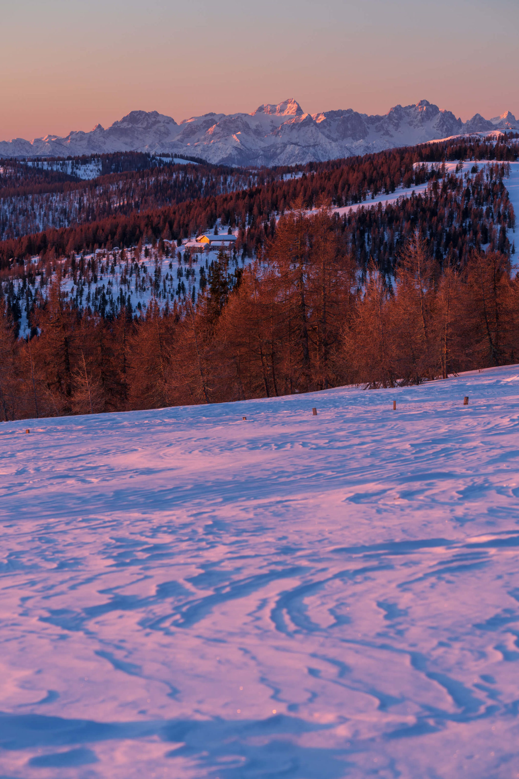
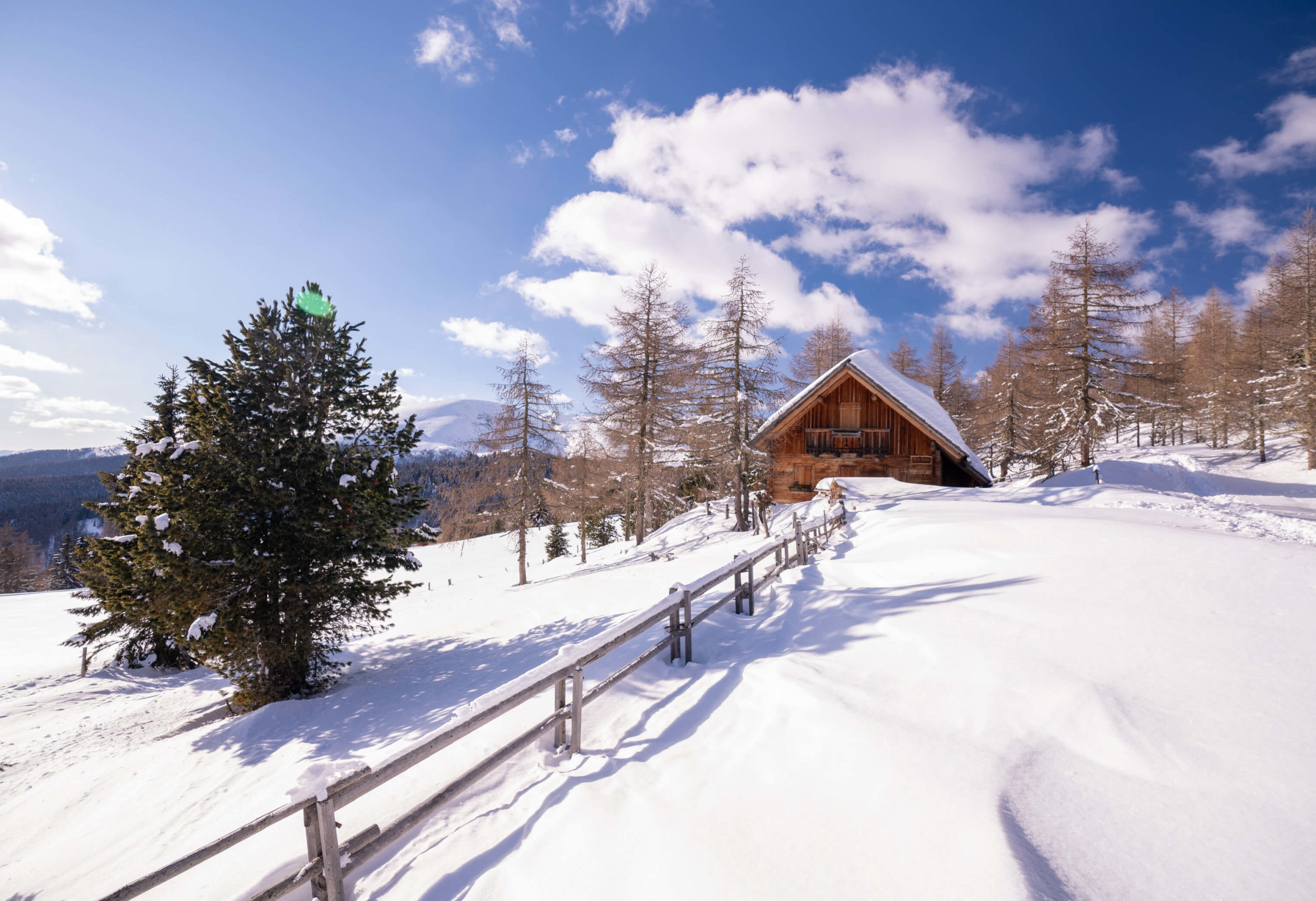
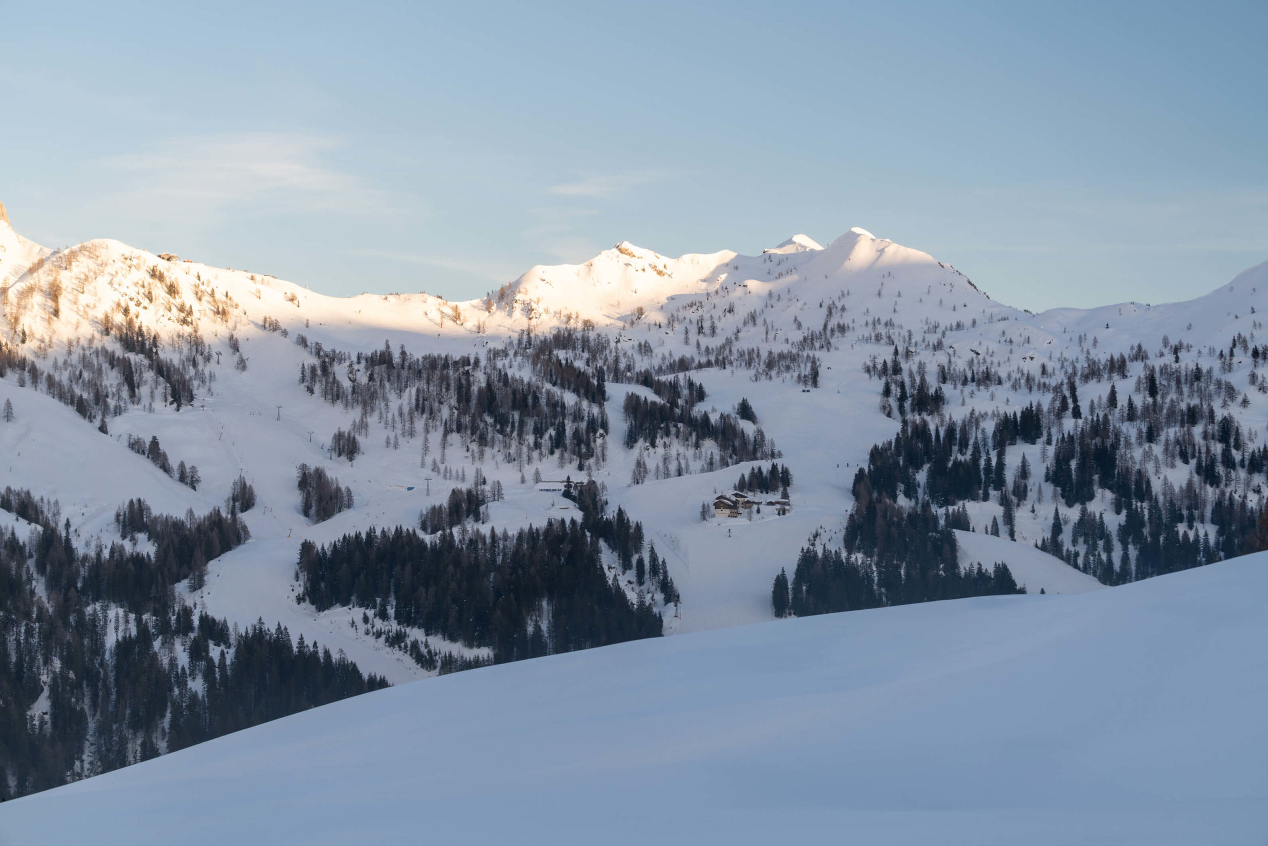
Beautiful alpine lakes
Wild and without a ride: Spiegelsee
It’s cold. It’s raining. Not only is there not a pub open in this god forsaken village, but there is also no traffic in it; understandably I guess. We’re leaving Tragöß and Grüner See for new adventures to Spiegelsee and the surroundings at Schladming. We wave our biker friends good bye as they screech past our […]
Wild and without beer at Grüner See
Grüner See (Green lake, I’ll let you guess why) is a karst lake in Styria, Austria. No one knew it even existed until Ashton Kutcher posted about it on Facebook a few years back. After that, the council had to impose a swimming and diving ban to protect the environment due to the tourist masses. […]
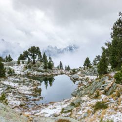
Wild and without warmth: Overnighting at lake Trullo
On a previous hike in the Aigüestortes i Estany of Saint Maurici national park we decided that we absolutely had to do another hike here and stay in a mountain refuge. We were quite happy to stay in the same one that we found on the last hike but the excitement of seeing some more […]
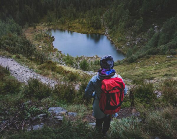
Black Rock Lake: 3 Day hike from Lagodekhi
Our time in Georgia is coming to an end and while we’re sad, we’ve got big plans for the summer. We are going to drive through Central Asia on the Silk Road with a final destination of Kyrgyzstan. A country not many people have ever heard of. When the summer is over we will head […]
3. Gießlhütte to Wolfsberger Hütte, Saualpe, Wolfsberg
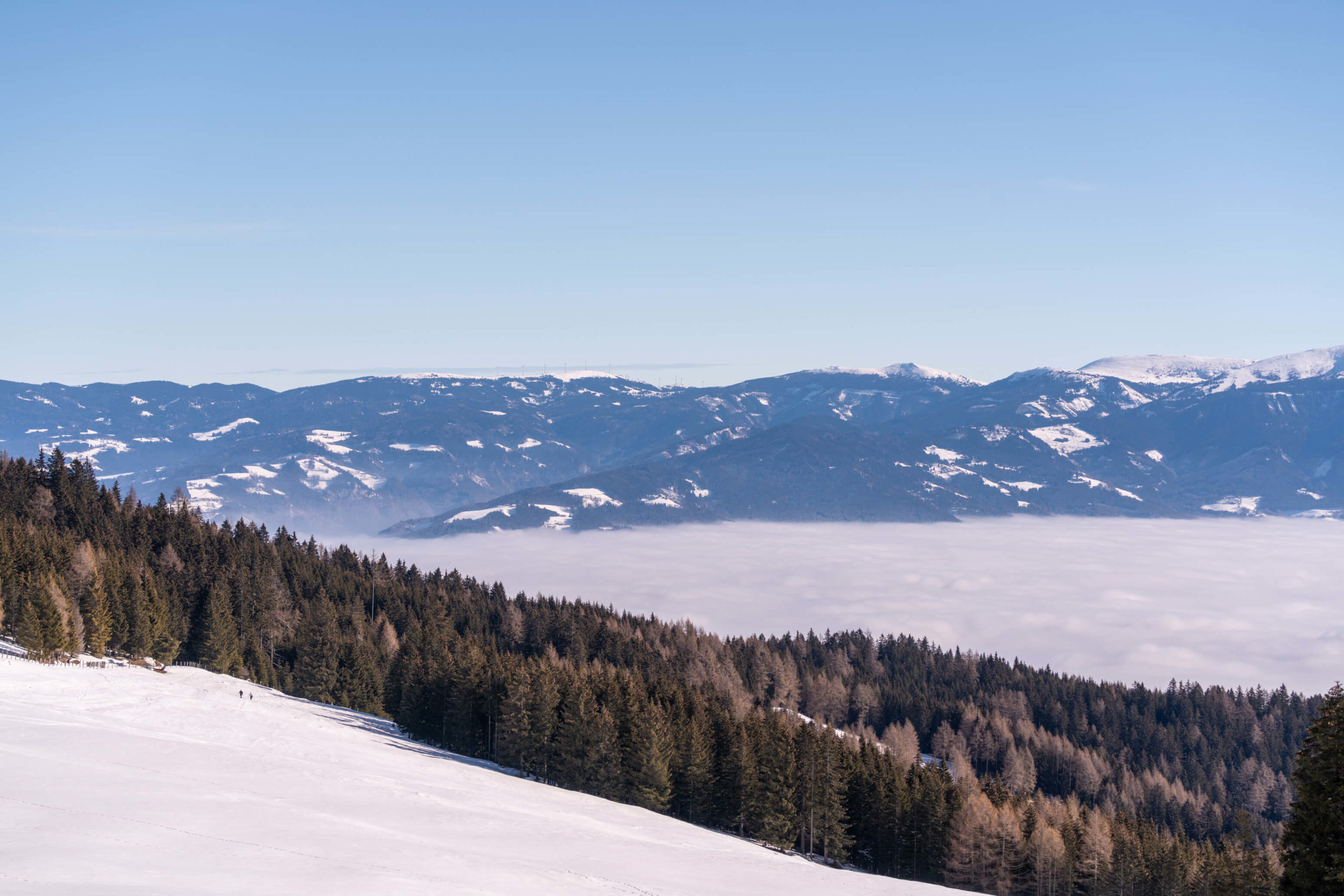
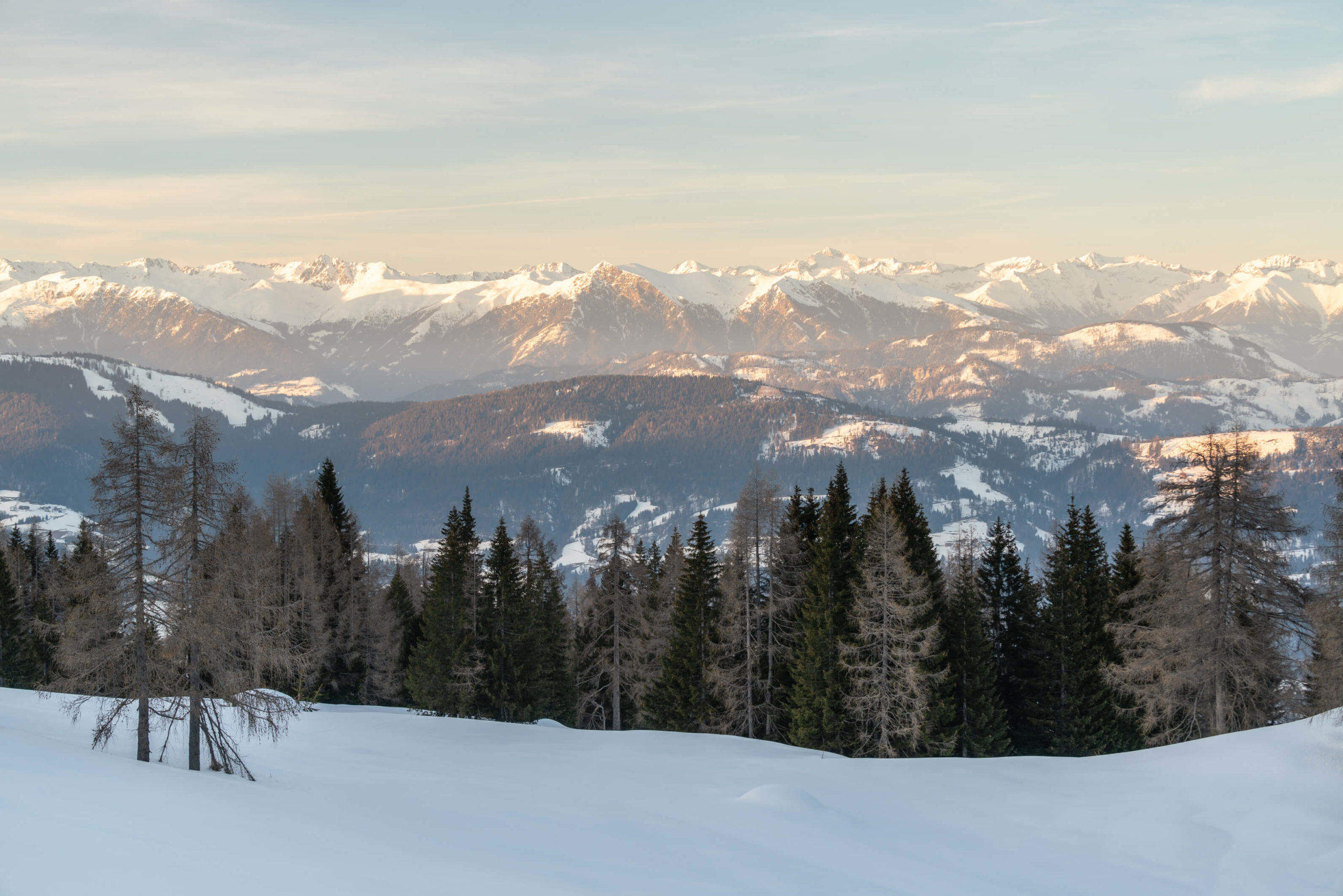
A straight forward hike with incredible panoramic views, well, as long as you can make it to the top. We didn’t have snow shoes and the snow was waist deep! From the top you can see into Slovenia, Italy and much of Carinthia – and finally the drive to the start is incredible!

Info
Hike description & GPX:
Difficulty: Medium
Time: 4 hours
How to get there: There is plenty of parking around Gießlhütte. There is no public transport up here. The only way is to drive, and it’s stunning. If coming from Sankt Veit way, we recommend driving over Klippitztörl Pass and then via Preims. See this Google Maps Route.
Kit: When there’s lots of snow around, you will absolutely need snow shoes. We didn’t have any due to the great snow shoe shortage of winter 2020/2021 and the last section of the hike was almost impossible, we were waist deep wading through snow. In the end, we gave up right in front of Wolfsberger Hütte, some 200 metres from the destination. We simply couldn’t push forward. Very frustrating!
Description
From Gießlhütte head up the road and into the forest. After, when the road takes a right turn, head on to the hiking trail up a little steep section through the woods. Shortly after you will cross the road.
It’s worth noting here that you can stay on the road all the way to the destination. Consequently, if there’s too much snow, or the trail is icy, or the visibility is low, it’s worth taking the road.
Take the 334 trail and after around 2.6 KM you will pass by Offnerhütte where you will head 500M up the mountain and then left across the mountain side to the destination of Wolfsberger Hütte. When you’re done, follow the forest road back to Gießlhütte via Zechhütte, which is open in winter.
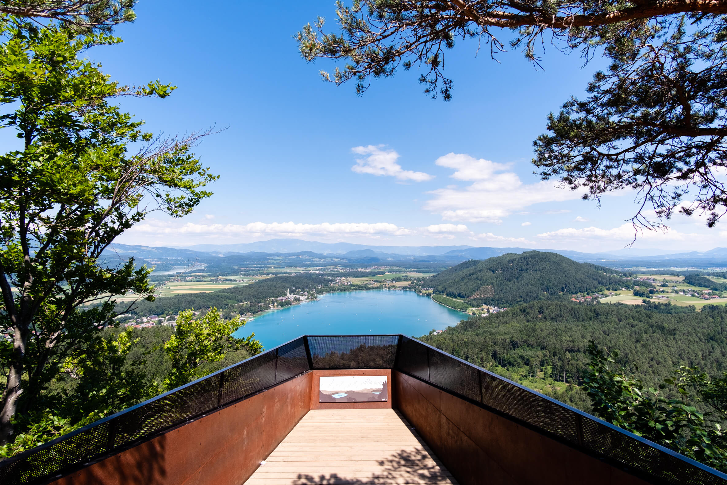
4. Kitzelberg slow trail, Klagenfurt
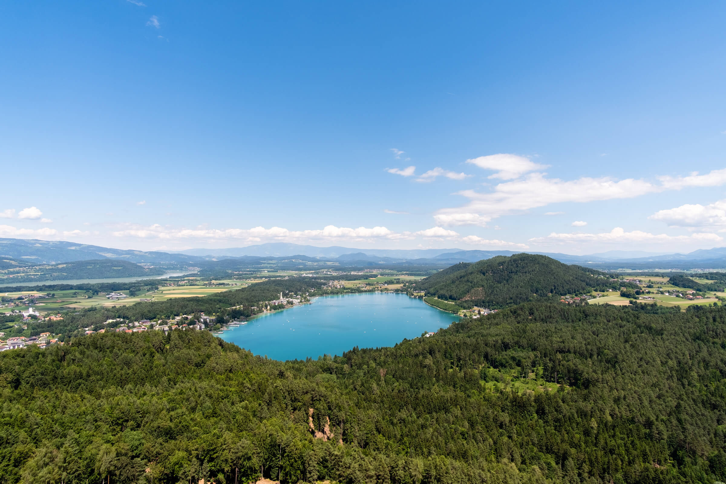
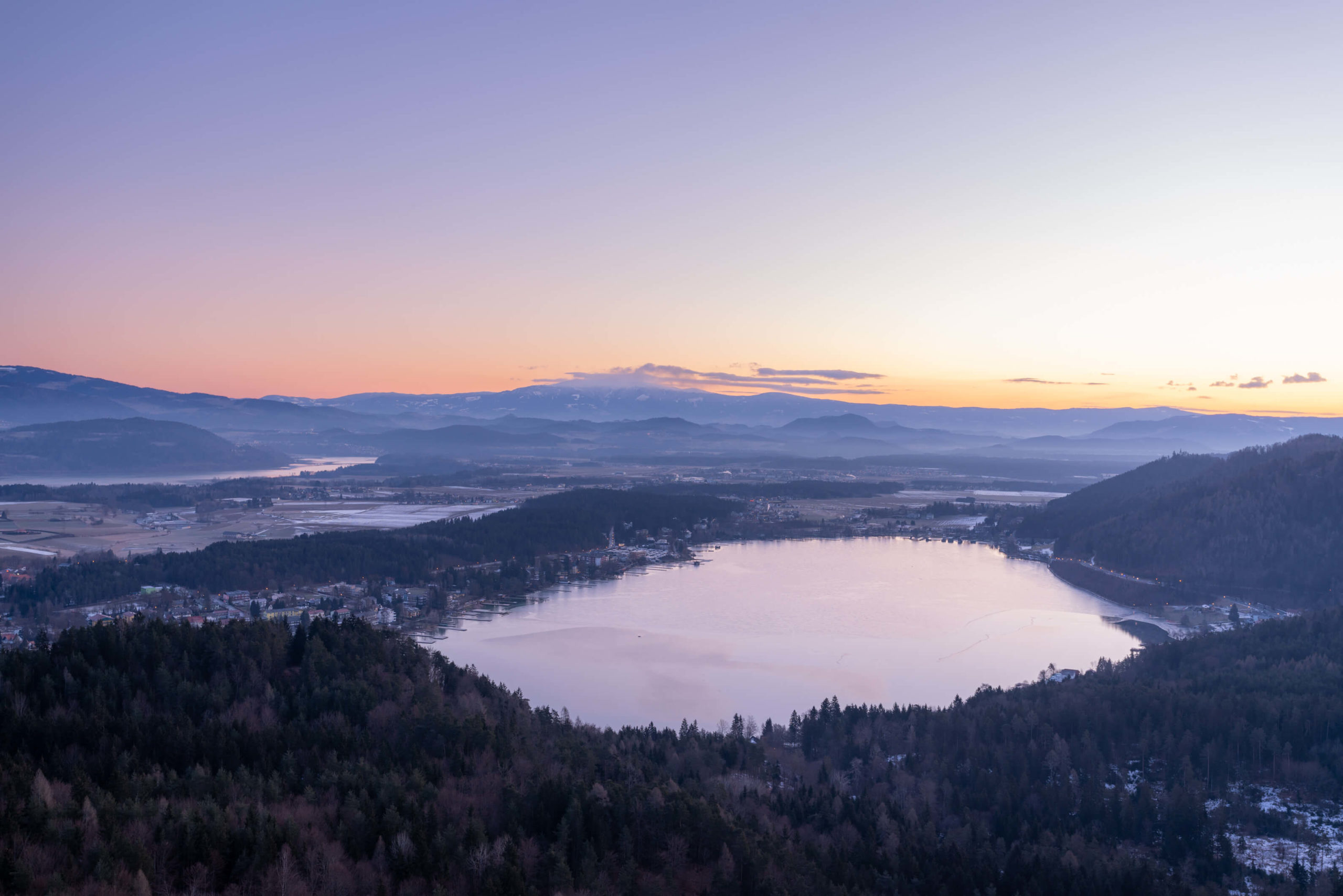
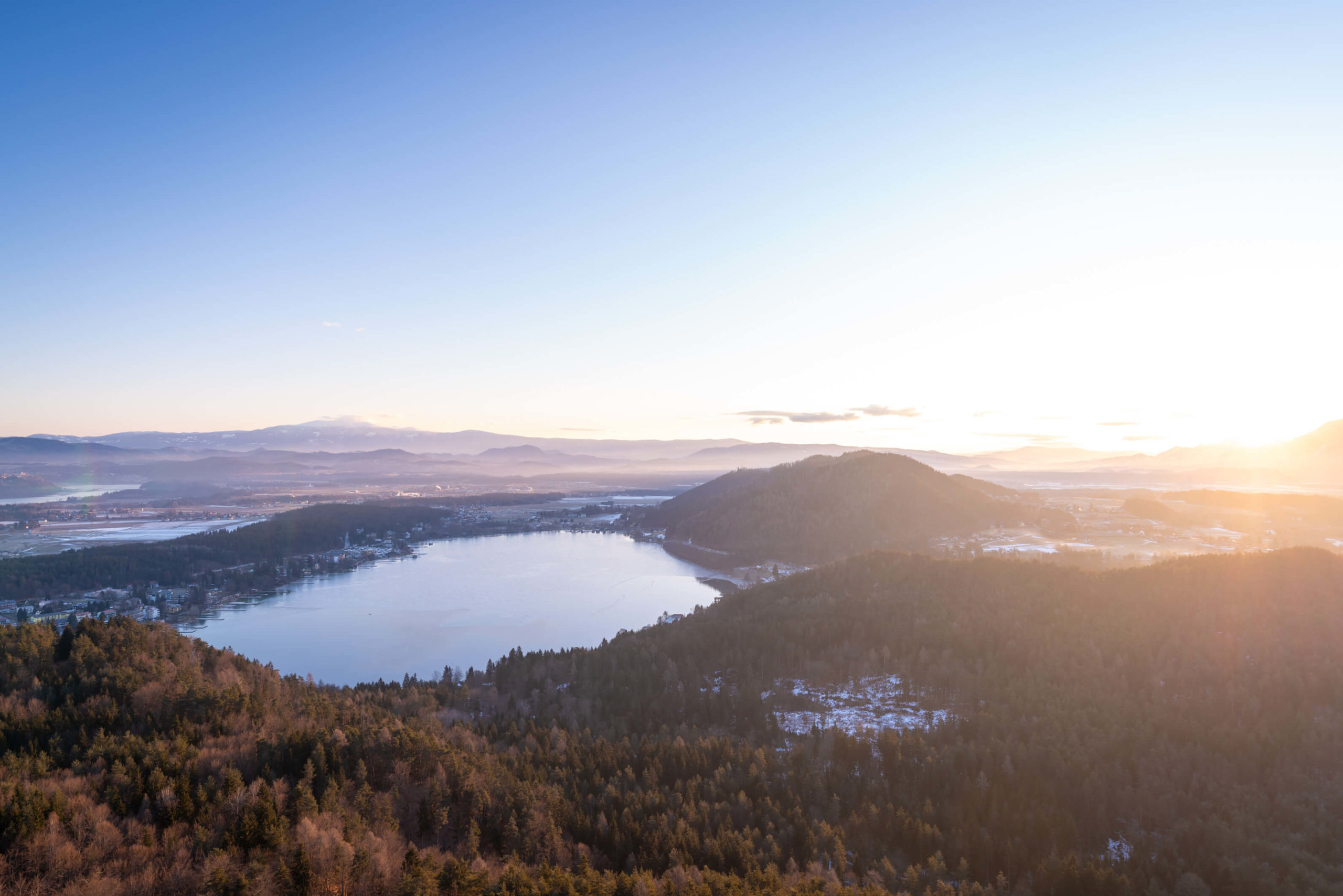
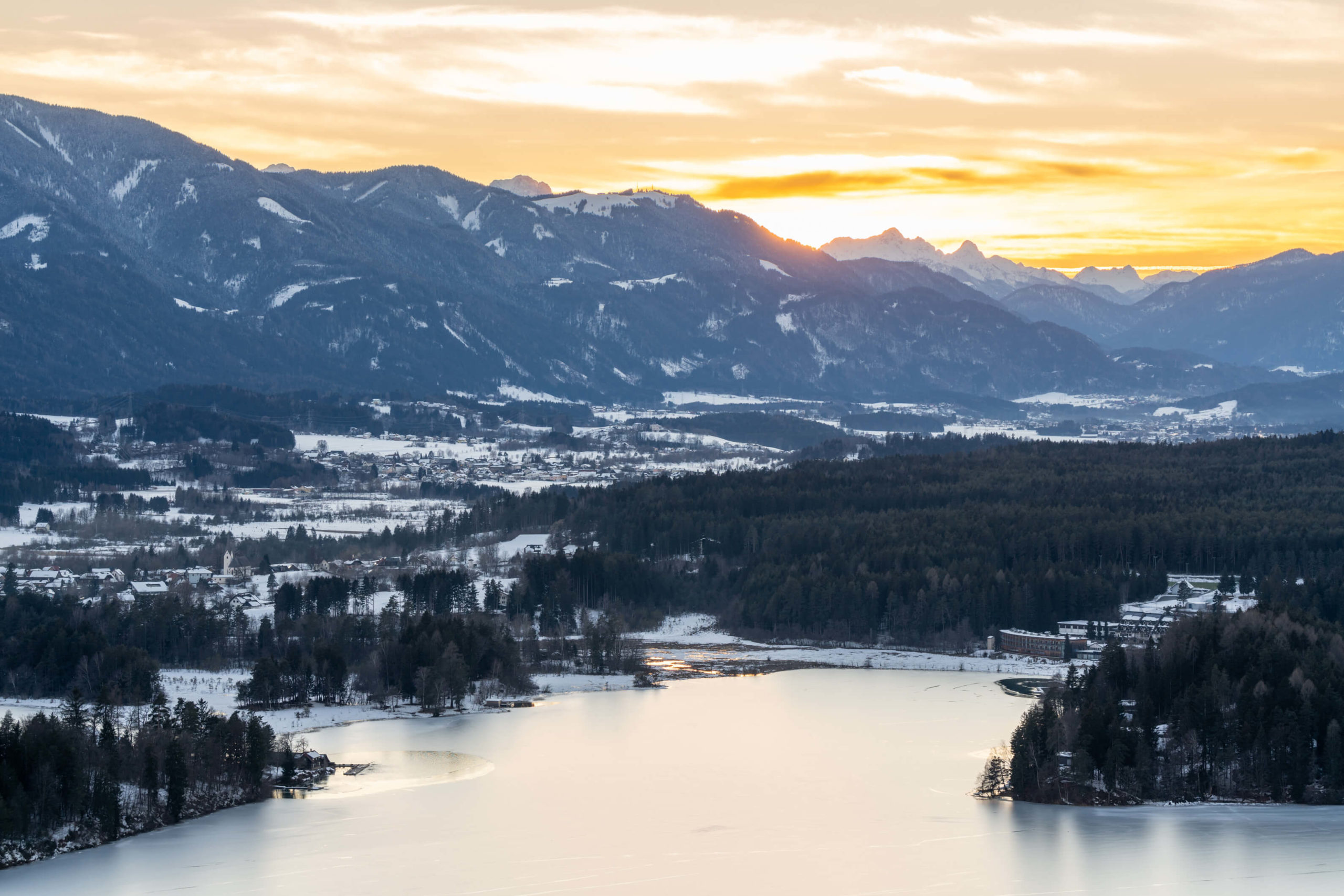
An easy hike to a beautiful lookout platform, a perfect location to watch the sun rise and slowly bring the landscape to life. Indeed, the view over Klopeiner See is perfect and different in every season and light.
Info
Hike description & GPX:
Difficulty: Easy
Time: 2 hours 40 minutes
How to get there: There is a little car park where the trail climbs up Kitzelberg. You can also start the hike in Klopeiner see and therefore catch the 5410 bus from Völkermarkt to Klopeiner see. Check ÖBB for details.
Kit: The trail was very icy and we slipped all over the place. We did do it in the dark as we wanted to watch the sunrise so no doubt it will be easier in daylight. Good shoes will be helpful and possibly shoe chains or crampons. However, you will manage without, the trail is more like a road.
Description
From the car park choose the road that is ascending the mountain. Next, follow the road all the way to the viewing platform. There’s not much else to describe! In the summer you will find beautiful lupins along the trail. It will take around 30-40 minutes to reach the viewing platform.
When you’ve finished enjoying the view, take the path that goes by the side of the radio/military looking building. The path slowly descends through the forest until it turns back on its self in to a meadow. Finally, past the meadow you join the road and follow that back to Klopeiner see.
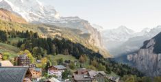
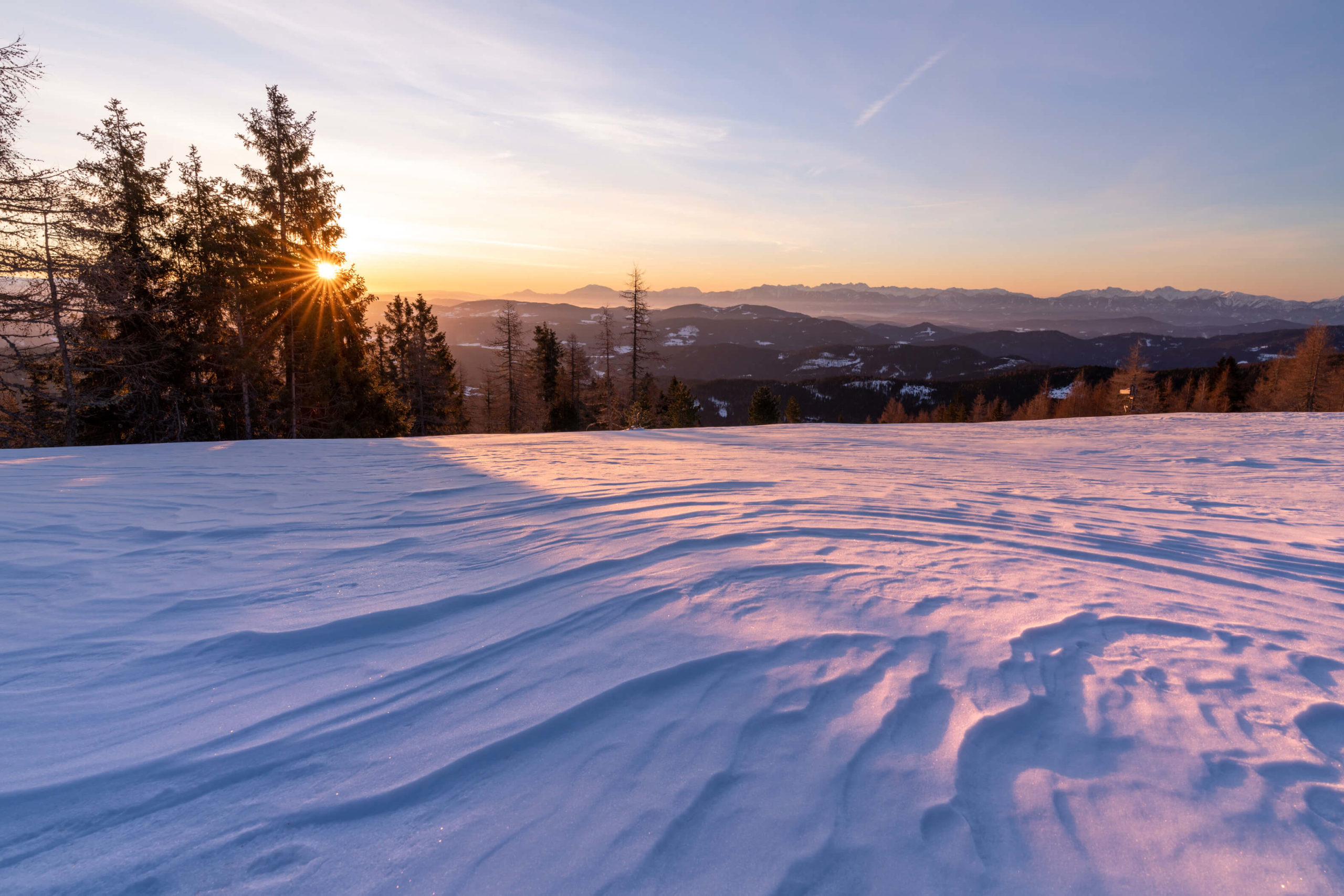
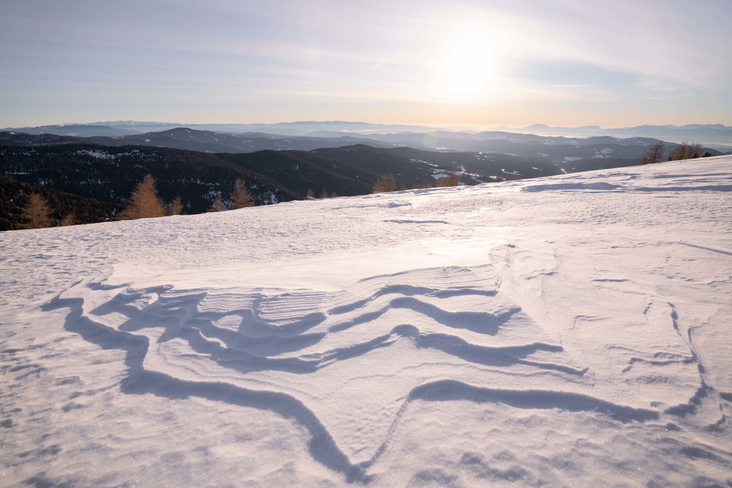
5. Hochrindl, Feldkirchen
Incredible landscapes, cute and cosy wooden huts, majestic forests and perfect snow. This was one of our favourite places during the winter for the gorgeous snow patterns. Of course, the views are stunning with perfect vistas of the Karawanken and Saualpe.
Info
Hike description & GPX:
https://www.bergfex.at/sommer/kaernten/touren/wanderung/687737,hochrindl-weises-kreuz/
This is the summer description but it is the same trail in winter.
Difficulty: Medium
Time: 3 ½ hours
How to get there: There is lots of parking spaces just off the main road, we parked in this car park.
Kit: The trail is cleared so you shouldn’t need any special kit. It was extremely cold up here when we visited with very strong winds so you might want to wrap up!
Description
Follow the signs for the Panoramawanderweg. The signs are very clear and will take you all the way to Weißes Kreuz (White Cross) where you will witness panoramic views of the Karawanken and Saualpe. In fact, watching the sunrise here is magnificent.
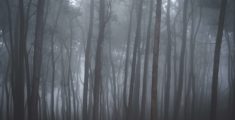
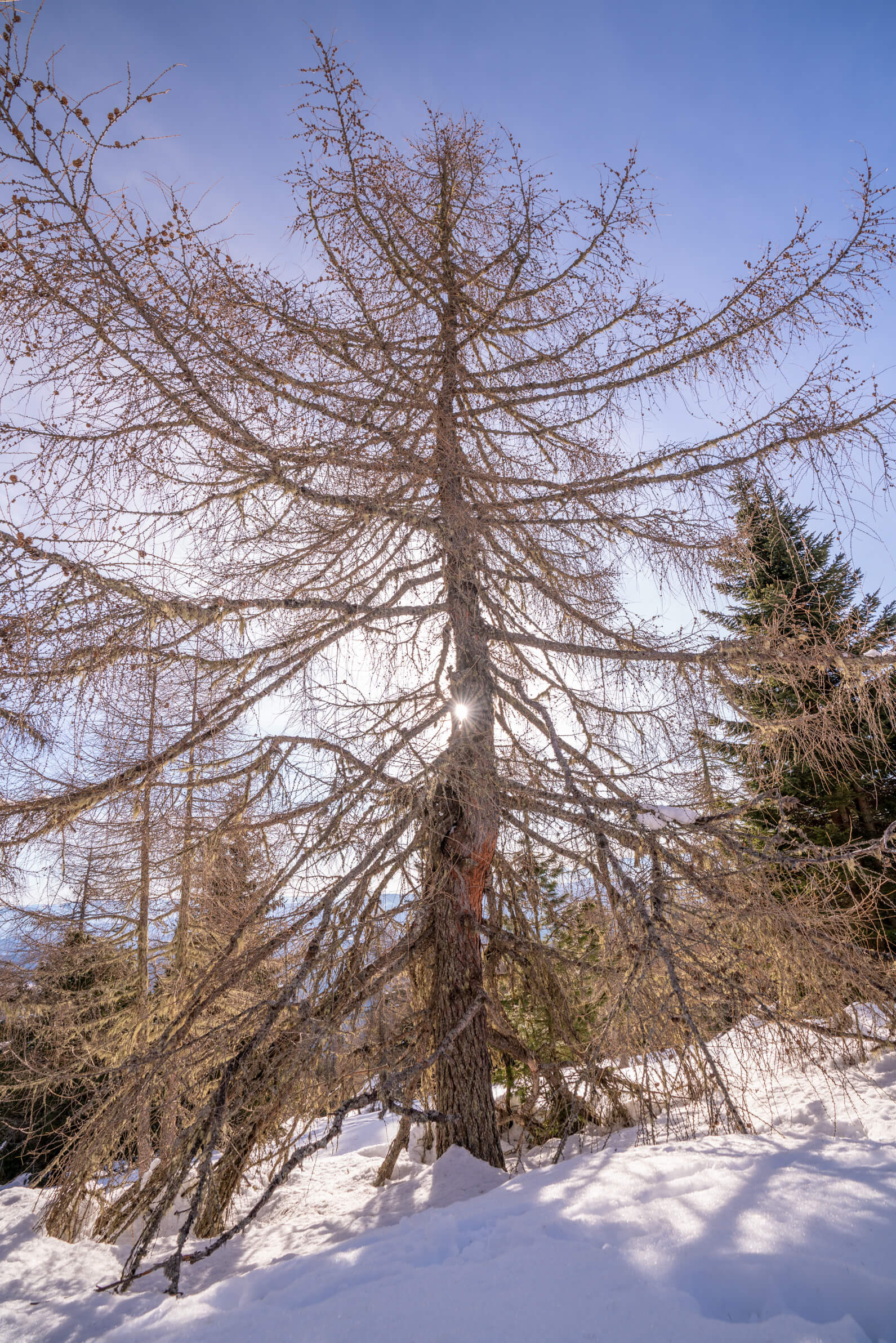
Along the way you will pass many cute wooden huts and through beautiful forests with bizarre creepy looking trees covered in moss. They almost appear to be petrified.
When we hiked the trail the loop was not possible, only the direct route from the car park to Weißes Kreuz, so you might also have to return the same way.
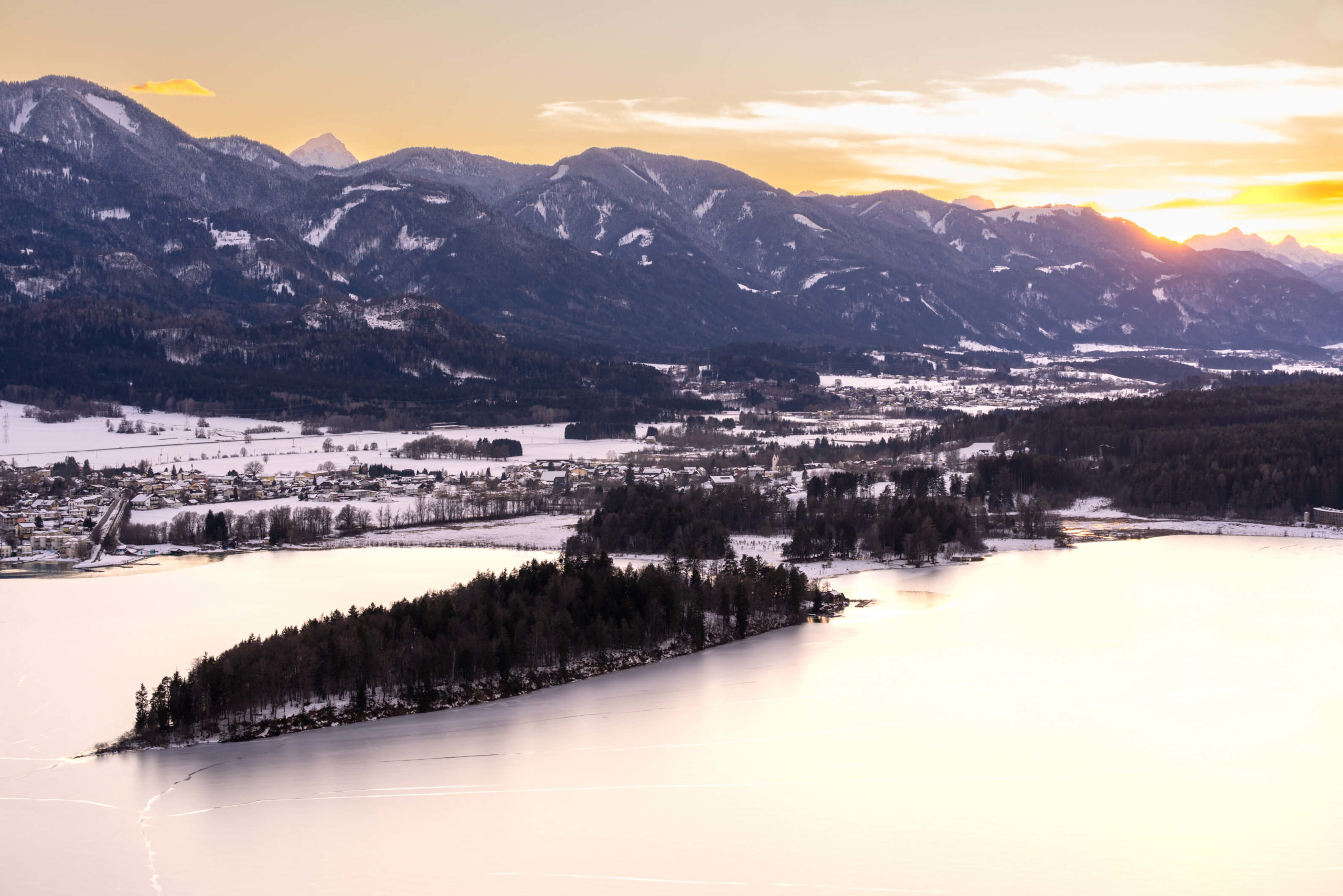
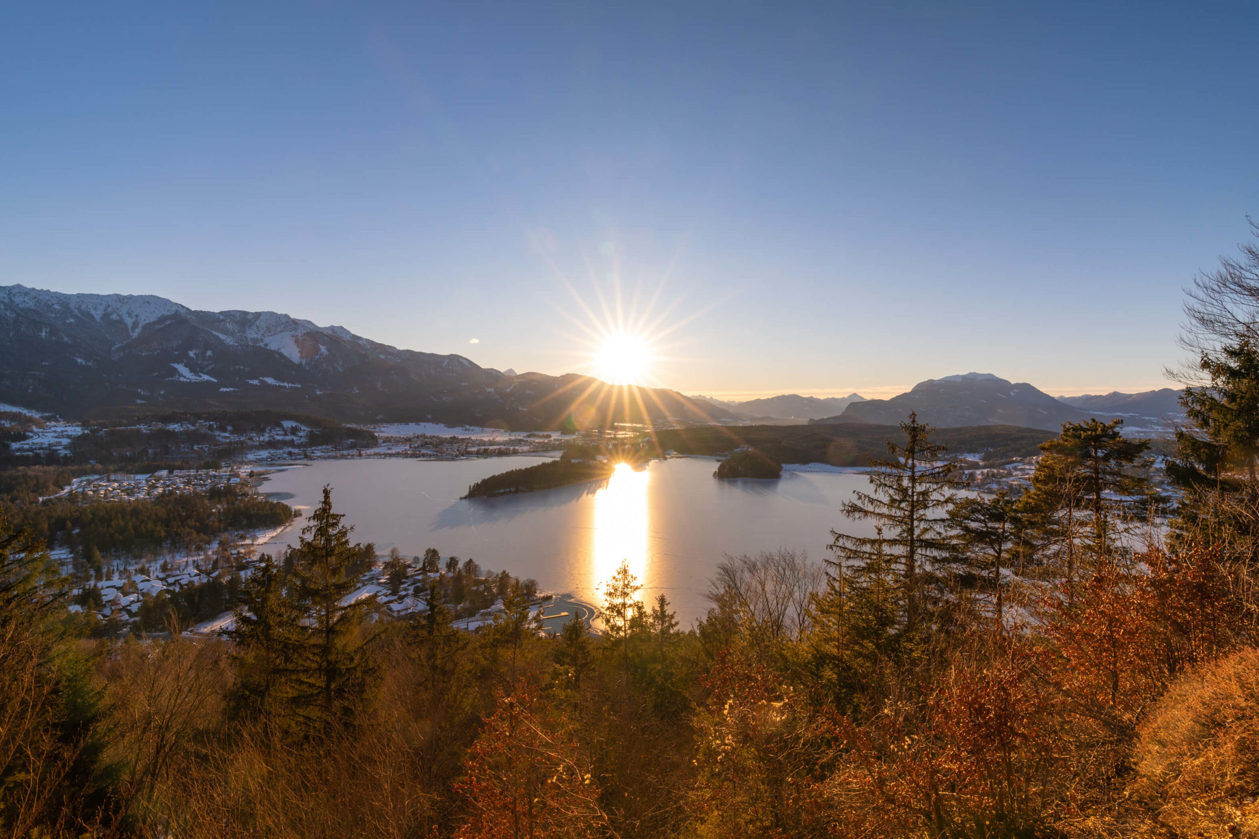
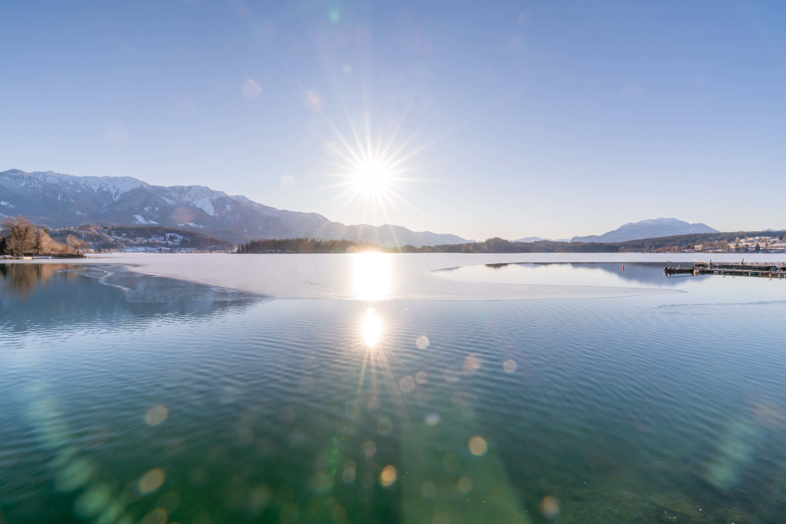
6. Faaker See Loop, Villach
Watch the sun set directly behind Faaker See from this wonderful view point. It’s busy, since you can drive up to the view point, but that just means there’s more positive energy and happy people. Leave your car at home and hike up the short trail, be careful though, some parts can get very icy!
Info
Hike description & GPX:
https://www.bergfex.at/sommer/kaernten/touren/wanderung/4191,aussichtsberg-tabor-725-m/
Difficulty: Easy
Time: 2 hours, factor in some more time for hanging around at the view point
How to get there: We parked in the Billa car park in Egg am Faaker See. That’s fine to do on Sundays. When the shop is open, the parking lot is for customers only.
Variation: Take a walk along the promenade too, it’s very pretty.
Kit: One of the trails was quite icy when we were there so sticks will help, but we descended via a different trail (there are many snaking through the forest) and that was much better.
Description
Starting from Egg am Faaker See head towards Tabor peak via the church on the hillside and walk on the road Taborweg. Next, take the left trail at the end, through the forest. When you come to the clearing, go straight over and then the path goes up with a slight incline for two hundred metres or so, this is the part that was icy for us. After a short while you will join the road which leads you to the lookout point.
From here you can continue the loop or alternatively return the same way as we did. Instead of taking the steep trail back we walked past it for another 200 metres on the road and then took the next left which led through the forest and down to the clearing on a much less steep trail.
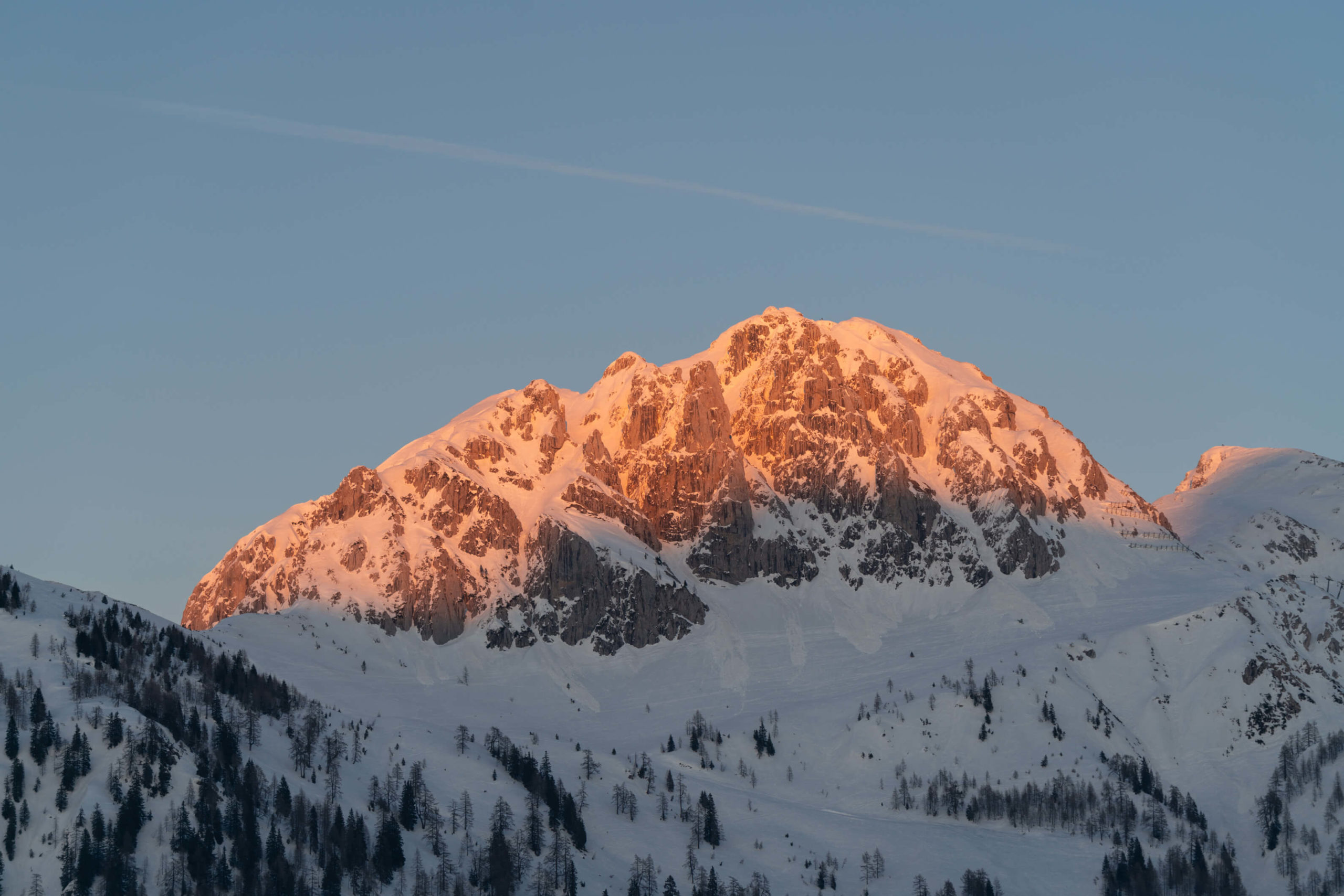
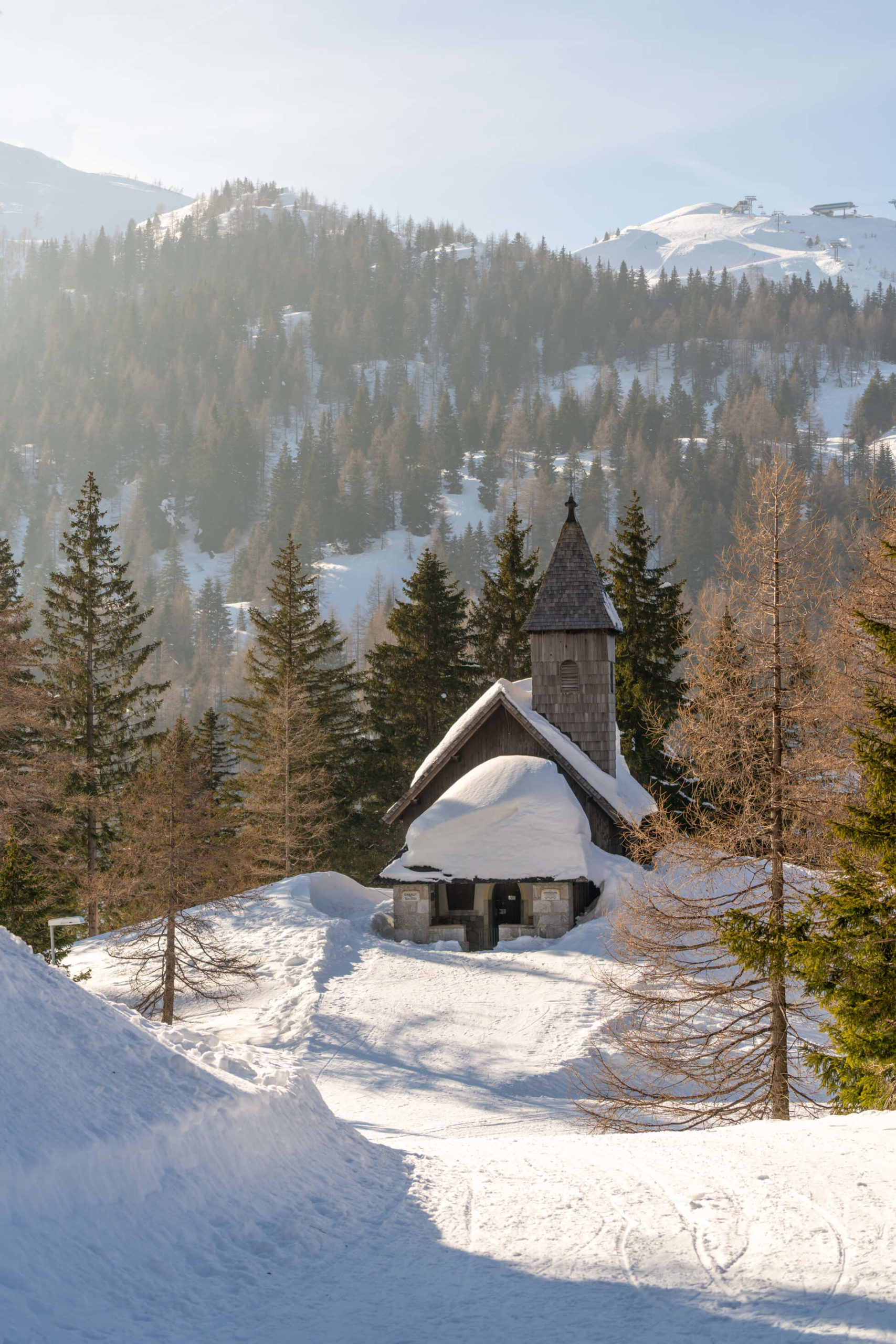
7. Nassfeld Loop, Hermagor
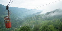
A great hike to get some serious elevation without the effort and cable cars. Bask in the majestic peaks of the surrounding mountains and walk across the border in to Italy – there are some pretty impressive snow shoe hikes just across the border.
Info
Hike description & GPX:
https://www.alpenadriahotel.at/de/tour/sonnenalpe-nassfeld-berghof-haus-kaernten-sonnenalpe-nassfeld
Difficulty: Easy
Time: 2 hours 40 minutes
How to get there: We parked in a little car park in front of the Alpenrose Nassfeld hotel.
Kit: No kit necessary, the trails are cleared, well, at least partially. Read the description for more.
Description
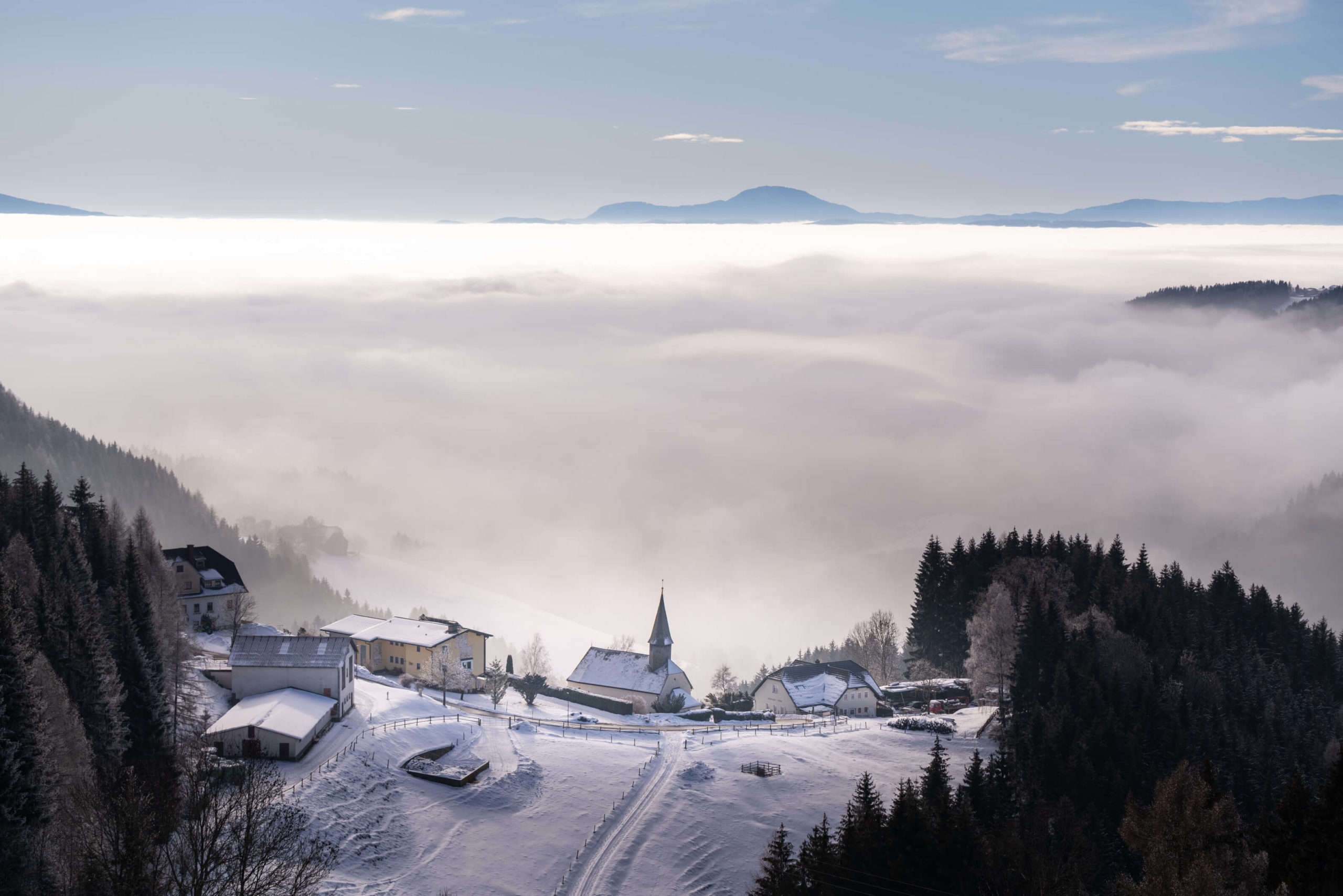
Take the main road and walk upwards. Take a left just after the Berghof restaurant onto the tail. You will pass the cute church pictured above. Around the corner the trail will split, take the lower of the two, the left one. You will cross the ski slope and then join a small road which will take you back to the main road.
Take a right on to the main road and then after 100 metres or so, turn off to the left. Go past the ski lift and follow the trail uphill, taking a left when the path forks. After a kilometre or so the trail brings you to a plateau with some bars and restaurants. The views of the valley and opposite mountains are very impressive here.
Unfortunately, when we visited, the trail ended here. We think it was maybe due to COVID-19 as it was the winter of 2020/21.
The trail should continue uphill and back around to the starting point, so, if you visit, let us know if you made it further than we did!
Incredible hikes in Europe
The most beautiful winter hiking trails in Carinthia: Part 1
We spent a whole winter in Carinthia during lockdown and what better way to alleviate the stresses of the pandemic and world in general than enjoying the beautiful outdoors? Carinthia has a great deal to offer when it comes to landscapes, hiking opportunities, skiing and in general all adventure sports including winter walking. Winter 2020 […]
The ultimate guide to canyons and swimming spots in Georgia
It seems you guys loved our guide to waterfalls in Georgia so we’re rolling out the next one to help you escape Sakartvelo’s summer heat! Canyon dig it?! Spending a summer in Georgia, we realised just how many beautiful canyons there are. And while Martvili and Okatse are undoubtedly beautiful, they frustrate you at the […]
Wild and without: Aigüestortes i Estany of Saint Maurici National Park
In the heart of the Pyrenees, we wake up from a cosy nights sleep in our tent, it was cold but not excruciatingly so. Wide awake, freshened and energetic to explore. We came to Espot to experience the mighty Pyrenees mountains. We decided randomly on the national park Aigüestortes i Estany of Saint Maurici. Well […]
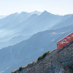
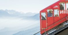
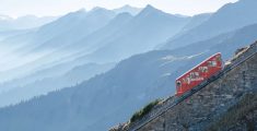
Wild and without a conscience: Interlaken & Niesenbahn
After a short morning explore of Lucerne, it’s time to leave. We’re heading to Interlaken, one of the most famous destinations in Switzerland. It’s nestled in the mountains between two huge gorgeous lakes and we are super excited! In particular we are looking forward to riding on the Niesenbahn funicular. This ride should be a […]
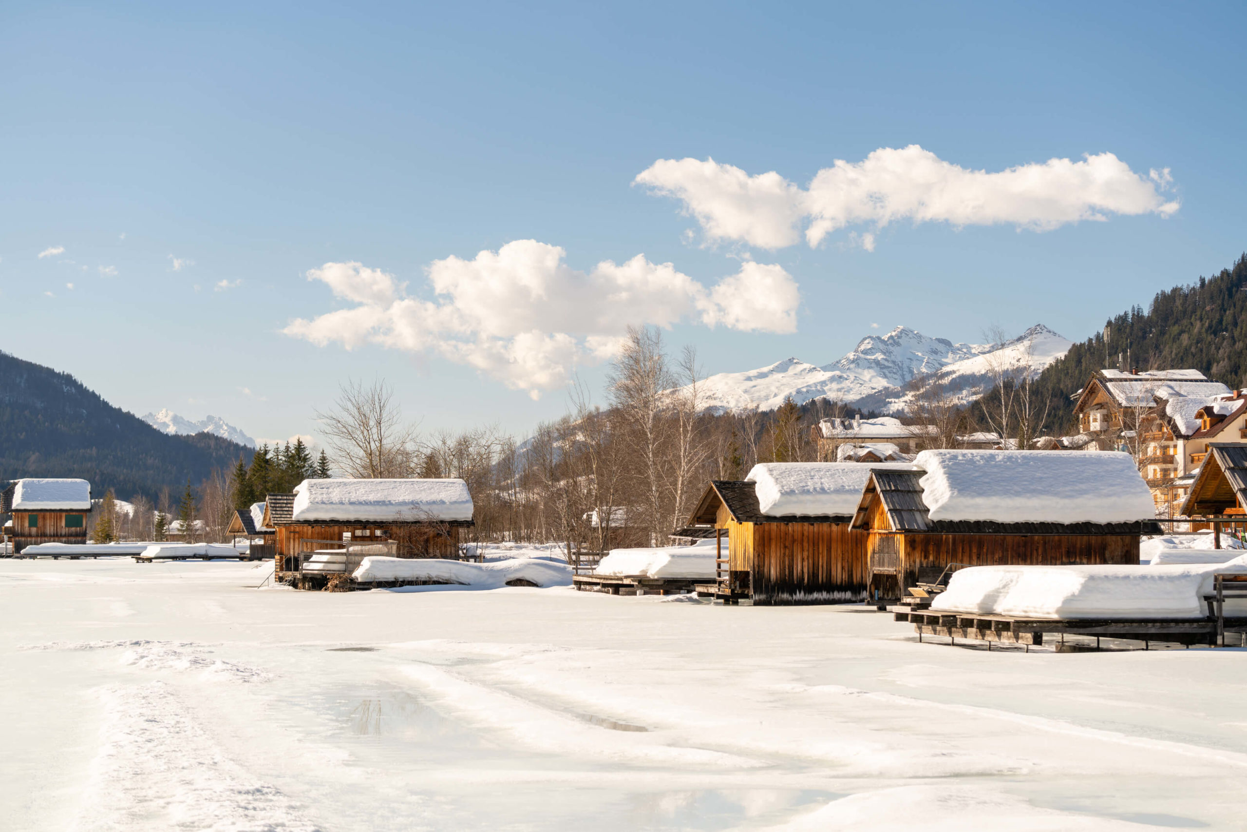
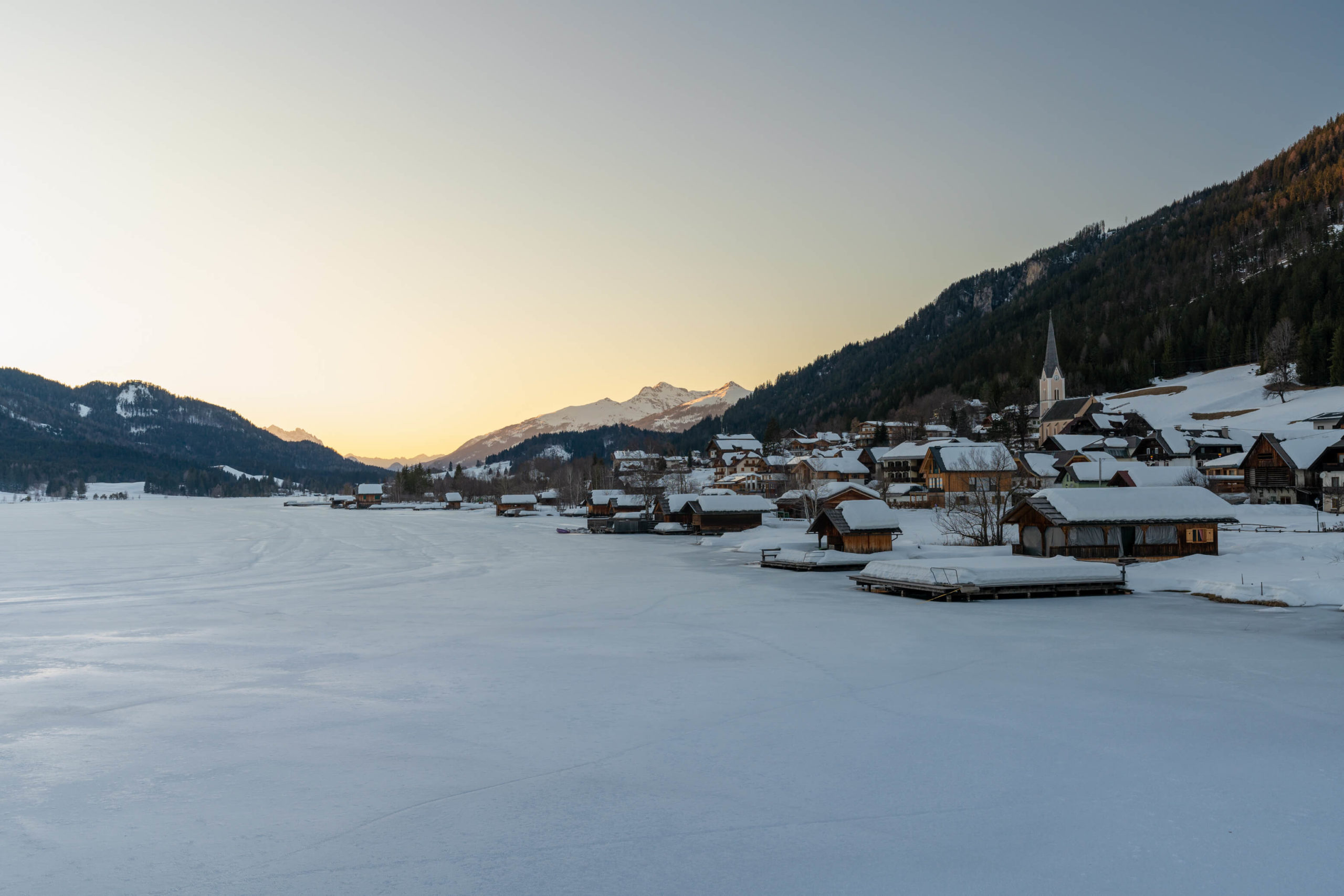
8. Weissensee loop & Alm Hinterm Brunn, Spittal an der Drau
One of the most beautiful lakes in Carinthia and probably Austria! It’s incredible during the summer and a winter paradise during the cold season. The lake completely freezes most winters and ice skating becomes the main attraction – but there is hiking too!
Info
Hike description & GPX: Weissensee Loop & To Hinterm Brunn Alm
Difficulty: Medium
Time: 4 hours
How to get there: There is a big car park at the edge of the lake. It costs a few euros to park. It’s not very easy to get to Weissensee on public transport. However, there are a few busses. They are not running often and some days there are none. Check ÖBB.
Variation: You could extend the loop and walk further down the north side of the lake. We have walked there in the summer and it’s very beautiful.
Kit: No kit necessary here – the trails are cleared. Nevertheless, hiking sticks might help as there were some icy sections on the south side of the lake.
Description
This hike is a combination of two. A loop of the west side of the lake and a little climb up to the Alm Hinterm Brunn. The ascent starts just after Techendorf, so you will be switching GPX tracks throughout the hike.
From the car park, head on to the cleared trail, it weaves through houses and boat houses along the shore of the lake. While it’s beautiful and there are some chances to walk to the lake side, just be careful, everything is private and forbidden!
When you reach Techendorf, switch GPX trails and head on to the road, going past the bridge (you will return and cross here later). A few hundred metres later, past many beautiful and expensive hotels you will take a left and start the ascent to Alm Hinterm Brunn.
Alm Hinterm Brunn
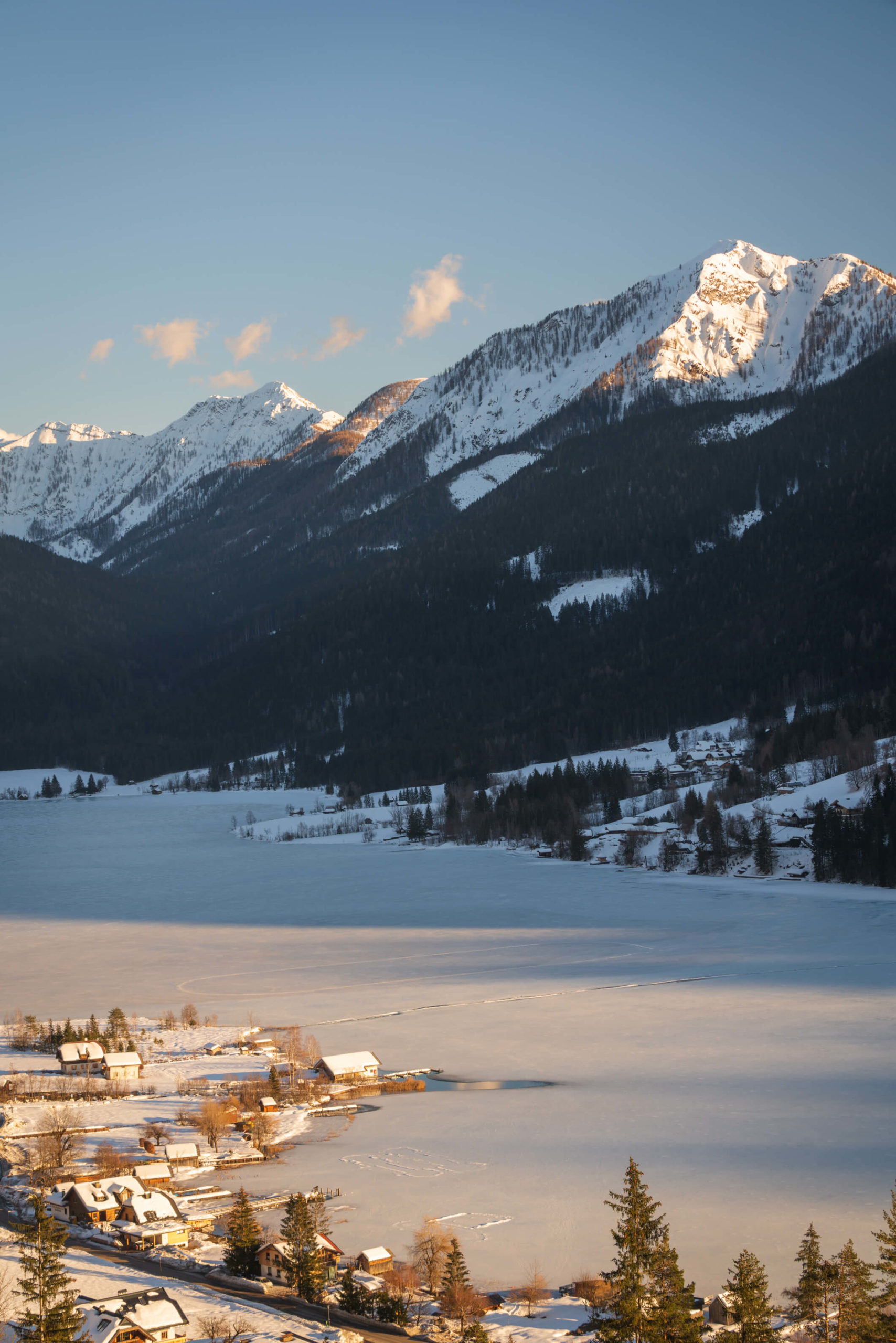
The ascent is fairly gradual since it doubles as a road to the hut. As you get higher, there are some breaks in the forest and the views open up. The east side of the lake and the surrounding mountains reveal themselves in all their glory.
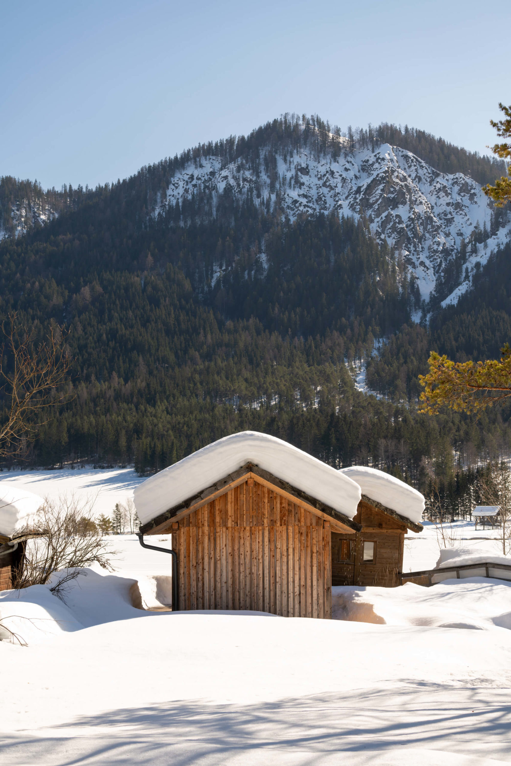
Shortly after, the trail turns into a small valley which leads to the Alm, the road follows a stream and navigates through the winter forests. After a few hundred metres the trail emerges from the forest and flattens out for the final stretch to the Alm. The Alm should be open so grab a hot drink and enjoy the view!
Weissensee south
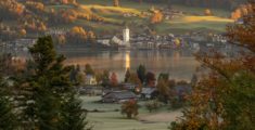
When you’re done, head back the way you came to Techendorf, and cross over the bridge. Take your time because the view is beautiful, Techendorf and its church are super pretty with the snowy peaks in the background.
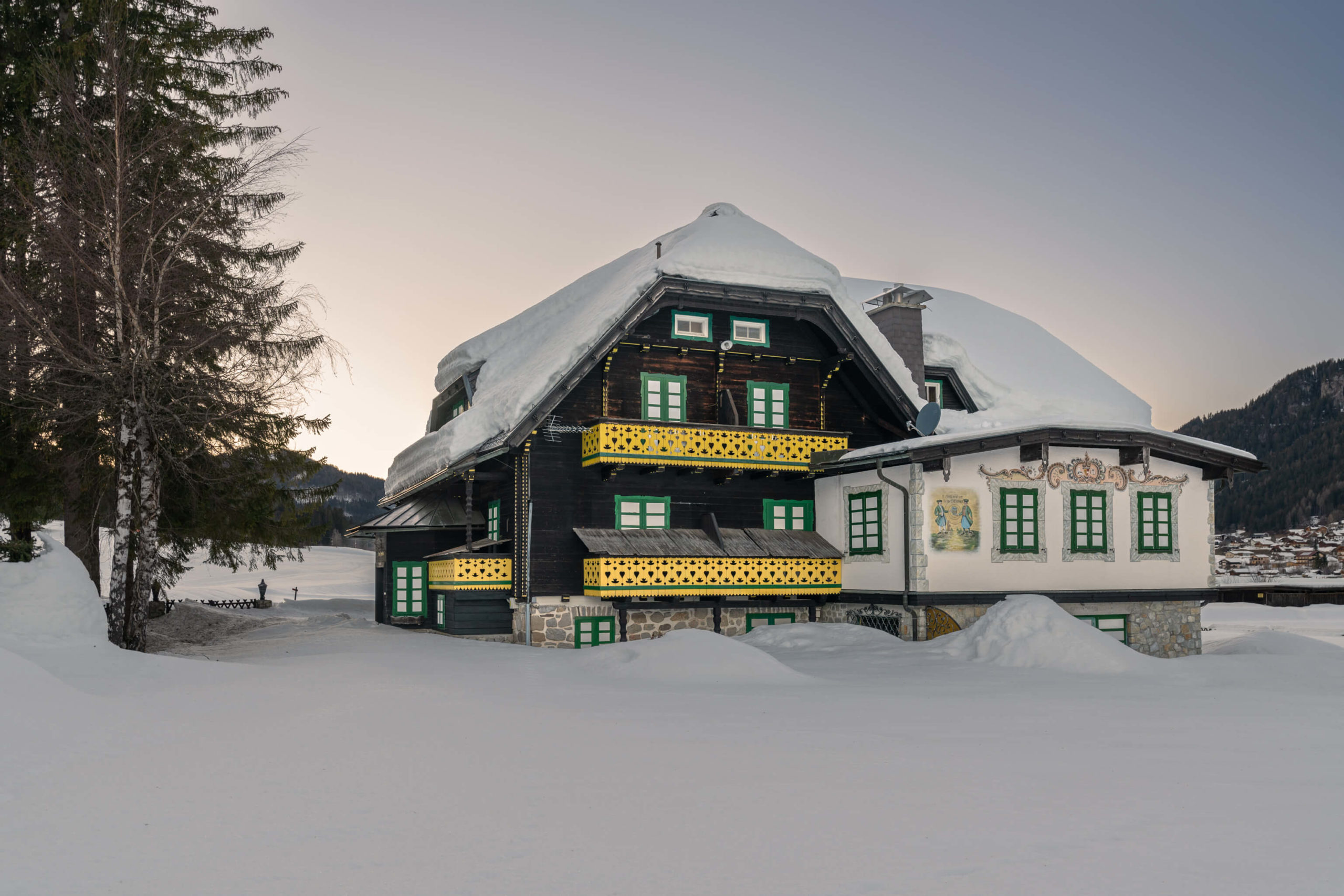
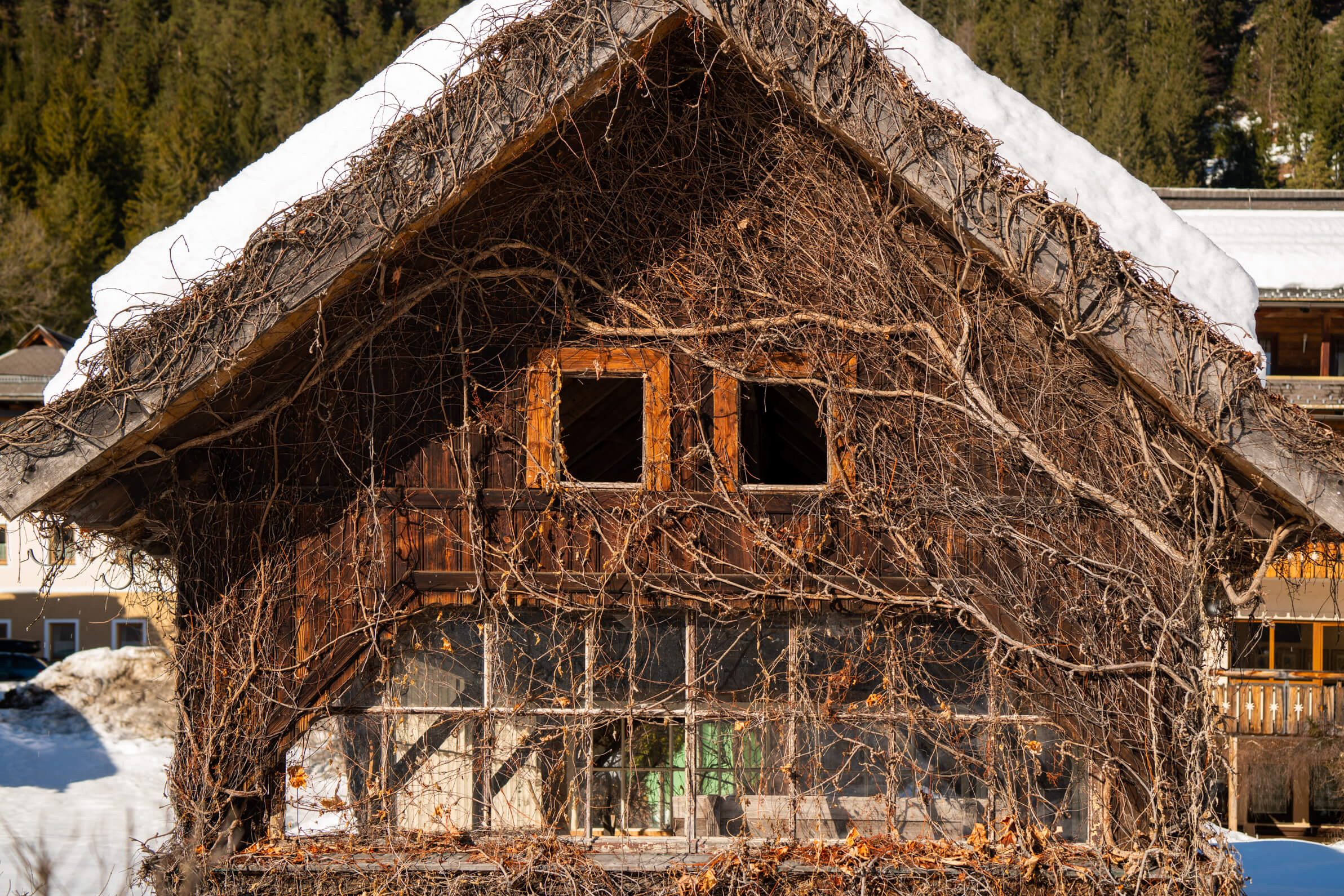
After crossing the lake, head past the buildings and take a right. The trail meanders around the lake back to the car park. It’s simple and relaxing with lots of beautiful views. In addition, look out for Hotel Harrida, pictured above, a stunning traditional Austrian countryside house converted into a hotel.
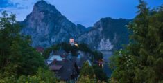
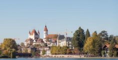
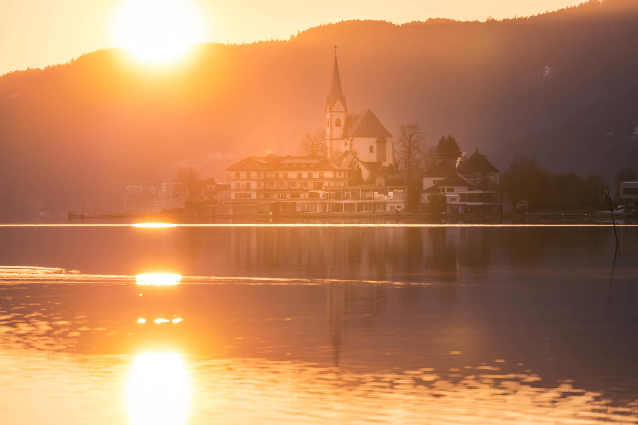
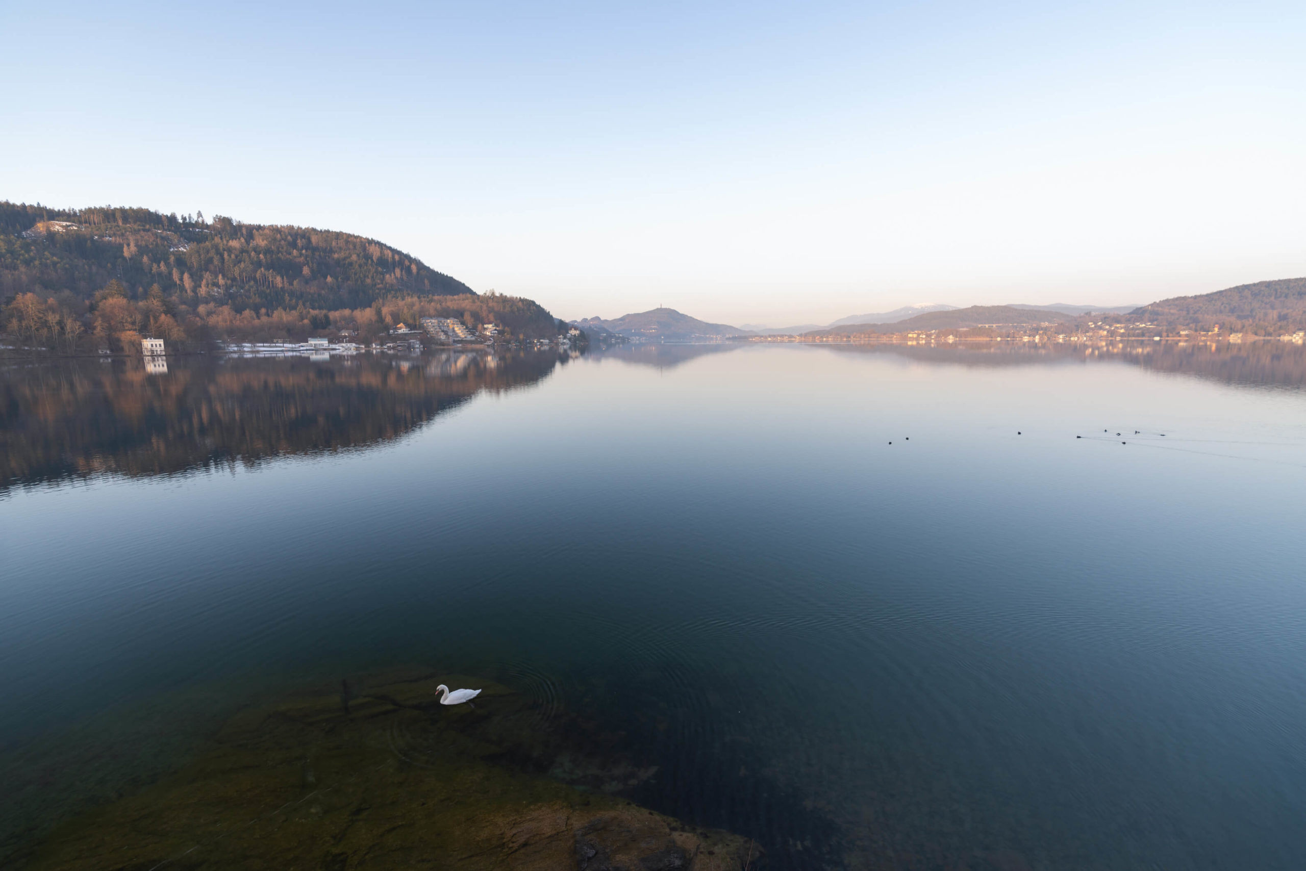
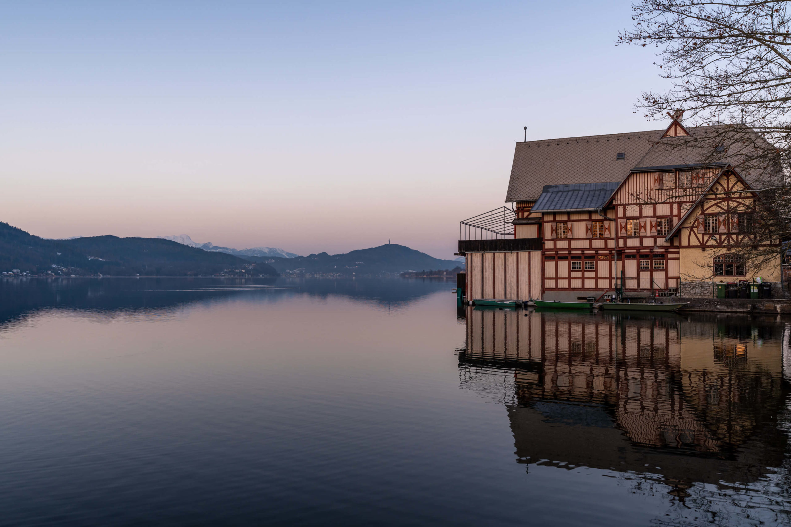
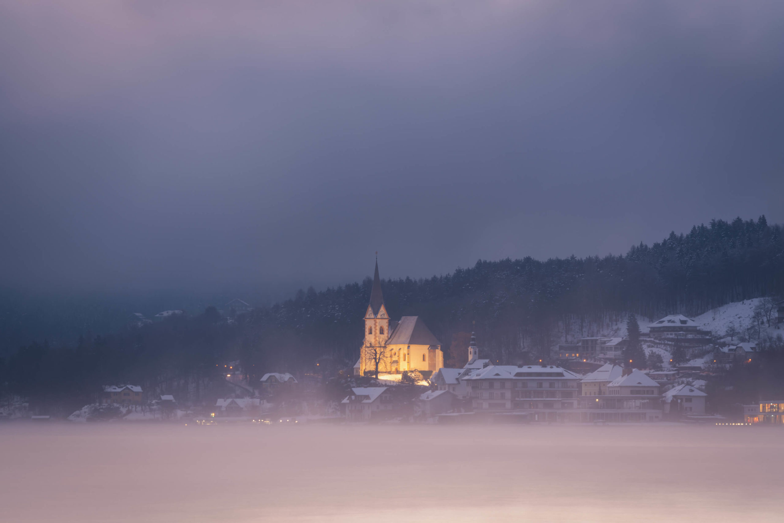
9. Maria Wörth, Klagenfurt
Gorgeous churches, boat houses and magnificent villas, Wörthersee is a stunning lake in Carinthia which attracts many tourists throughout the year. Take this charming trail and avoid the crowds of the north side of the lake!
Info
Hike description & GPX:
https://www.komoot.com/de-de/smarttour/21550435?ref=wsd
Difficulty: Easy
Time: 2 hours
How to get there: You can park in Maria Wörth. The bus 5310 from Klagenfurt stops at Maria Wörth, check ÖBB for timetables.
Variation: There are plenty of other hiking opportunities around Maria Wörth so have a google. For instance, up to the Pyramidenkogel viewing tower is an option, or maybe to castle ruins Reifnitz.
Kit: No kit necessary here!
Description
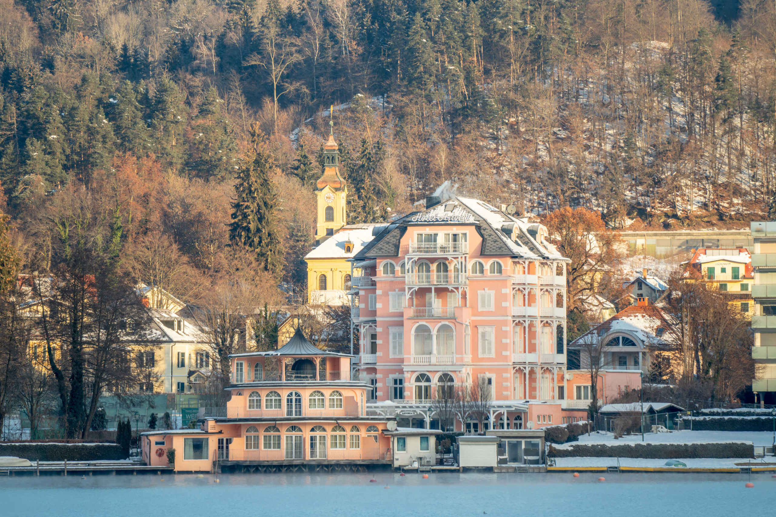
We picked this hike to have a little explore of Maria Wörth and the nearby boat houses, on the way to a more demanding hike on Dobratsch. We’re suckers for the beautiful architecture around Wörthersee and Maria Wörth is a real treat. It’s the Hallstatt of Carinthia – but for the above views you will need to head over to Pörtschach pavillion.
After exploring the pretty little peninsula head back towards the main road around Wörthersee and cross over, then walk up Sankt Anna Weg. You will climb up the hillside a little, through the forest before emerging in Sankt Anna, another pretty little village with nice views over Wörthersee.
Take a left and follow the path down through another forest to St. Margarethen and Reifnitz. Enjoy the beautiful architecture and boat houses and then take the road back to Maria Wörth.
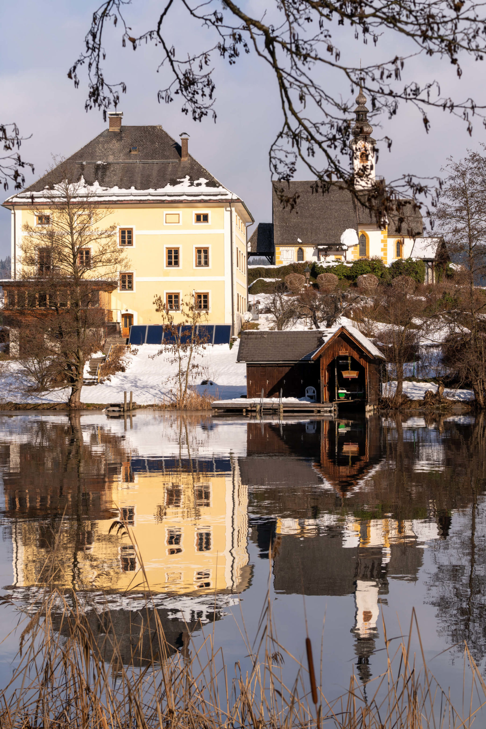
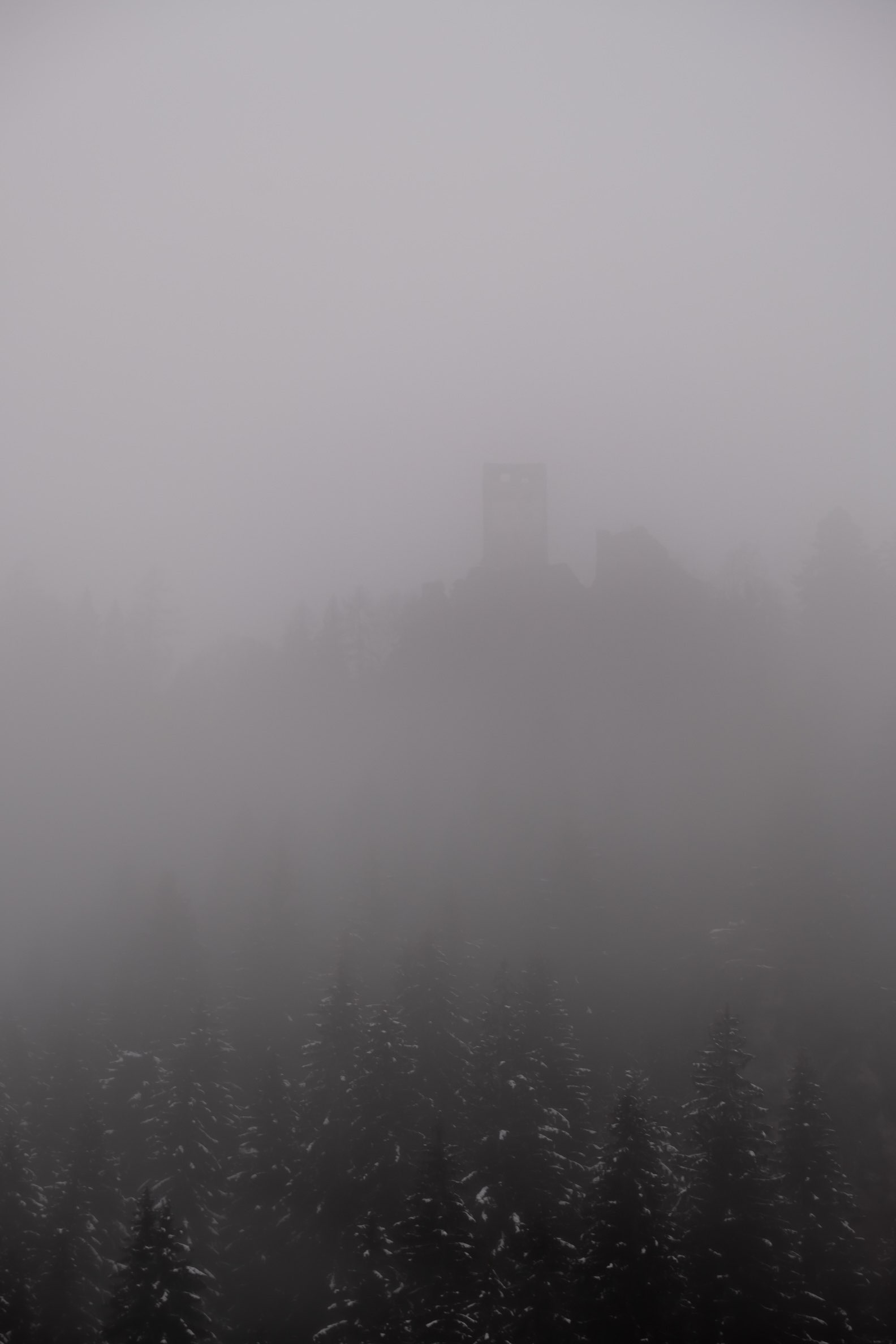
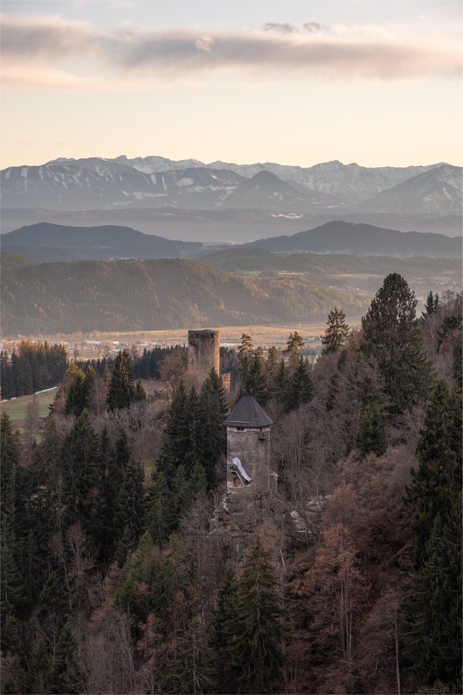
10. Frauenstein & Kraiger Schlösser Loop, Sankt Veit an der Glan
An easy walk around pretty lakes, marshes, castle ruins and chapels. There’s a lot of hidden gems packed into this romantic hike in middle Carinthia.
Info
Hike description & GPX:
https://www.bergfex.com/sommer/kaernten/touren/wanderung/63461,magdalensberg-rundwanderung/
Difficulty: Easy
Time: 2 hours
How to get there: There is a car park at Frauenstein castle.
Variation: You can take a detour up to the higher ruins and the refurbished tower that is now private.
Kit: After a fresh snow fall you might need snow shoes, especially for the higher ruins. For the rest of the time, good hiking boots will be fine.
Description
Start at Schloss Frauenstein, a beautiful Disney castle which unfortunately is private but opens a couple of times a year for events. Walk along the lakes through the forest until you see a path branching off to the left. From here it gets quite steep, taking you past Hochkraig and the Turmburg, the highest of the Kraiger towers. This is the detour.
If you decide to skip the detour, continue along the low path and you’ll see Niederkraig and the beautiful little St. Johan church on top of a steep hill. Walk through the aqueduct and follow the trail to Kraiger See lake. When you reach the lake, follow the trail around the back of a few farms and back in to the forest, where you find yourself at the lakes in the valley. After that, take a left and return the way you entered, towards Frauenstein.
Don’t forget to check our part one of our winter hiking guide for Carinthia!
Pin it!
You Might Also Like